


Details
- Sport
- Hike
- Rating
- Difficulty
- Tourist
- Duration
- 04:30 hrs
- Length
- 13.6 km
- Vertigo
- A little
- Min. elevation
- 720 m
- Max. elevation
- 1792 m
- Elevation gain
- 1080 m
- Elevation loss
- 1080 m
- Car park
- View on Gmaps
Terrain
- 80%
- 10%
- 10%
- Forest
- Grass
- Urban
Seasons
- Jan
- Feb
- Mar
- Apr
- May
- Jun
- Jul
- Aug
- Sep
- Oct
- Nov
- Dec
Signposts
Description
The ascent from the village of Pieve (Fiera di Primiero) up to the summit of Mount Bedolé is a very classic route that, before the Vaia storm of October 2018 permanently altered the eastern slopes of the mountain, reached the summit by ascending the historic trail of the Signpost No. 356, fully immersed in the forest. It took years of hard cleanup work on a slope with particularly unstable soil to restore such a trail, which now runs parallely (and in places overlapping) to the historic trail and – in many places – crosses roads used to remove the fallen trees. The main feature of this climb of about 1,000 m, also covered by the vertical kilometer race “Da la Boteghina a la Zima,” is that – compared to the opposite Mount Padella – it is all on “sunny” slopes, thus making it easy to possibly fit to all seasons, even during winter.
In this itinerary, an “alternative” return is proposed, if compared to the classic return on the same way of ascent; the descent proposed leads to the bottom of the valley passing by Nolésca, along another historic mid-altitude trail: the Signpost No. 355.
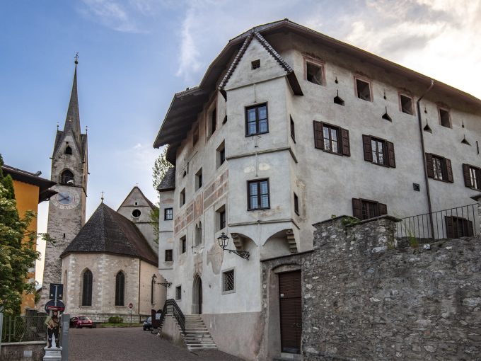
The route starts from Pieve, near the bar “La Boteghina”. It initially climbs Via Bedolé (Signpost No. 356) towards Tassoni / Cima Bedolé; after an initial stretch on rough asphalt, the road becomes a wide path that climbs into the woods and leads, in just under 1 km, near the location of Tassonét, to the asphalt road leading from Pieve to the Colaór chapel. The route then continues uphill on the road to the hairpin bend / junction at the location of Tassoni (906 m asl), where it is possible to see a section of the old path to the summit. From Tassoni, the trail continues slightly uphill, always following the paved road to the NE; after a few hundred meters, on the left, the road “Via dell’Impero” begins, which you take uphill towards the SO. After about 300 m, having passed on the right another entrance to the old path that is now impassable, turn right, walking uphill through the woods on a section of a wide path, almost fit for cars, that leads to rejoin, further uphill, with the “Via dell’Impero”, near Baita Zeni. Two hairpin bends on the paved road in quick succession will make it possible to reach the hut of Baita Zeni, where there is also a chance to drink from the water pipe. The itinerary passes Baita Zeni and continues for another 150 m along the main road to then take, on the right, the path that leads to the drinking water intake “Acqua del Faoro” (1,129 m asl), which the trail passes reaching the junction / hairpin bend with the gravel road “Dismoni”, which you take to the left and follow for a few meters to then take the path again (on the right) that climbs in a short stretch along an obvious nose of the terrain until you reach the next dirt road, just above. Continuing for about 100 meters on the dirt road you then take – on the left (red and white markers) – the path that climbs steeply cutting across the road, which reaches near a large plateau – used for timber storage -, visible on the right. From the plateau, the trail continues steeply uphill keeping the direction, passing alongside a wooden hut located a few meters before reaching another gravel road (“Bedolé”). From here, the itinerary continues following the gravel road “Bedolé” slightly downhill towards the SO for about 250 m until it reaches the location of Masiera Menuda (1,470 m asl), where it leaves the road to face perhaps the most challenging section of the itinerary on the track of the Signpost No. 356 (towards Cima Bedolé).
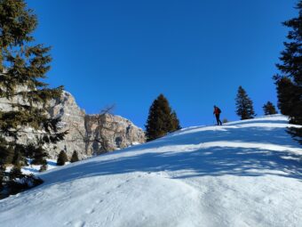
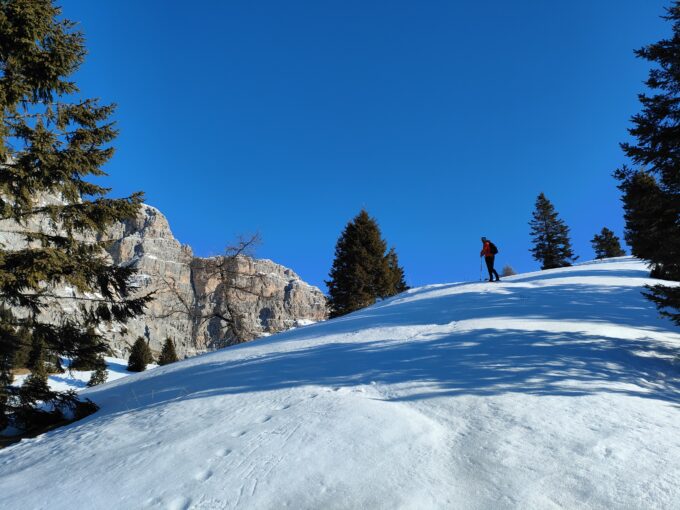
The steep track is visible and cuts the coast to the S with respect to the summit, allowing, among other things, to be able to begin to admire, at a glance, the entire dolomite mountain range of Vette Feltrine; the forest becomes sparse, but it is still advisable to pay attention to the low vegetation that can sometimes hide the path. When approaching the summit, it will be enough to look up on the right to catch sight of the cross; the trail becomes wider and reaches a last gravel road that you follow until the hairpin bend – just below the cross – and then climb the path that leads to the summit of Cima Bedolé.
Just before reaching the summit cross, a grassy saddle also opens the view to the W, to the Lagorai peaks of Fólga and Costón, as well as to the Lòzen Valley.
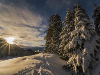
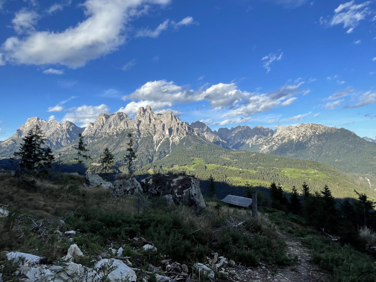
In spite of the altitude, the view from the cross is magnificent and allows one to discover an almost 360° panorama, covered only to the O; the gaze sweeps over the entire Primiero Valley, from Passo Rolle to the Vette Feltrine peaks.
The descent follows the path of the ascent up to the junction / hairpin bend with the gravel road “Dismoni”, just before Acqua del Faoro; instead of returning to Pieve (Fiera di Primiero) following the route of the ascent, the itinerary descends from Val Serena. Given the cobbled soil of this variant, think twice about taking it in case the ground is particularly wet.
From the junction / hairpin bend at Acqua del Faoro, follow the forest road toward N, in the direction of Dismoni / San Martino di Castrozza, for a little less than 1 km, on a flat section that offers interesting views of the summits of the Pala Group. Once you reach the junction with the trail of the Signpost No. 355, take it to the right toward Nolésca / Sirór, beginning the pleasant descent along the historic paved trail that enters the thick, damp forest of Val Serena. Arriving at the paved road in the locality of Guastaia, proceed to the left following the signs for Nolésca / Sirór, resuming shortly afterwards the mule track that, after crossing the SS50 main road comes directly in front of the old brewery of Nolésca, a small and pretty hamlet (770 m asl – called “Little Paris” by the residents). Crossing Nolésca along the cobblestone main street with its typical fountain, you soon reach the bridge over the Cismón torrent, under which you take the bicycle path to the right of the torrent that takes you directly back, in about 2 km, to Fiera di Primiero.
Paths
- From the village of Pieve (Fiera di Primiero), follow the Signpost No. 356 towards Cima Bedolé, passing by the locations of Tassoni (906 m asl), Acqua del Faoro (1,129 m) and Masiera Menuda (1,470 m asl), up to the summit [2h 45],
- From the summit of Cima Bedolé (1,792 m asl), turn back to the hairpin bend / road junction by Acqua del Faoro [3h 15],
- From the fork, follow the gravel road “Dismoni” toward Dismoni / San Martino di Castrozza for just under 1 km, then descend on the trail of the Signpost No. 355 toward Nolésca / Sirór [4h 00],
- From Nolésca (770 m asl), follow the bicycle path to the right of the Cismón torrent, leading directly to Fiera di Primiero [4h 30]. ✓
Waypoints


Suggested hikes

- Demanding
Forks at Treviso
Canali Valley,Mis Valley,Pala Group
- Duration: 03:45 hrs
- Length: 6.2 km
- Elev. gain: 1080 m

- Demanding
Val de Stua
Lower Primiero,Vette Feltrine Range
- Duration: 05:30 hrs
- Length: 12.1 km
- Elev. gain: 1080 m


- Demanding
- Best choice
Leslie Stephen
Canali Valley,Pala Group,Upper Primiero
- Duration: 12:00 hrs
- Length: 29.5 km
- Elev. gain: 1080 m