Tour of Venegia
Malga Venégia / Venìa - Forcela Venégia - Laghetto di Caladora - Passo Venegiòta - Malga Venegiòta / Veniòta
gian • 29/06/2024


Details
- Sport
- Hike
- Rating
- Difficulty
- Tourist
- Duration
- 03:30 hrs
- Length
- 10.0 km
- Vertigo
- A little
- Min. elevation
- 1742 m
- Max. elevation
- 2303 m
- Elevation gain
- 600 m
- Elevation loss
- 600 m
- Car park
- View on Gmaps
Terrain
- 30%
- 70%
- Forest
- Grass
Seasons
- Jan
- Feb
- Mar
- Apr
- May
- Jun
- Jul
- Aug
- Sep
- Oct
- Nov
- Dec
Signposts
Description
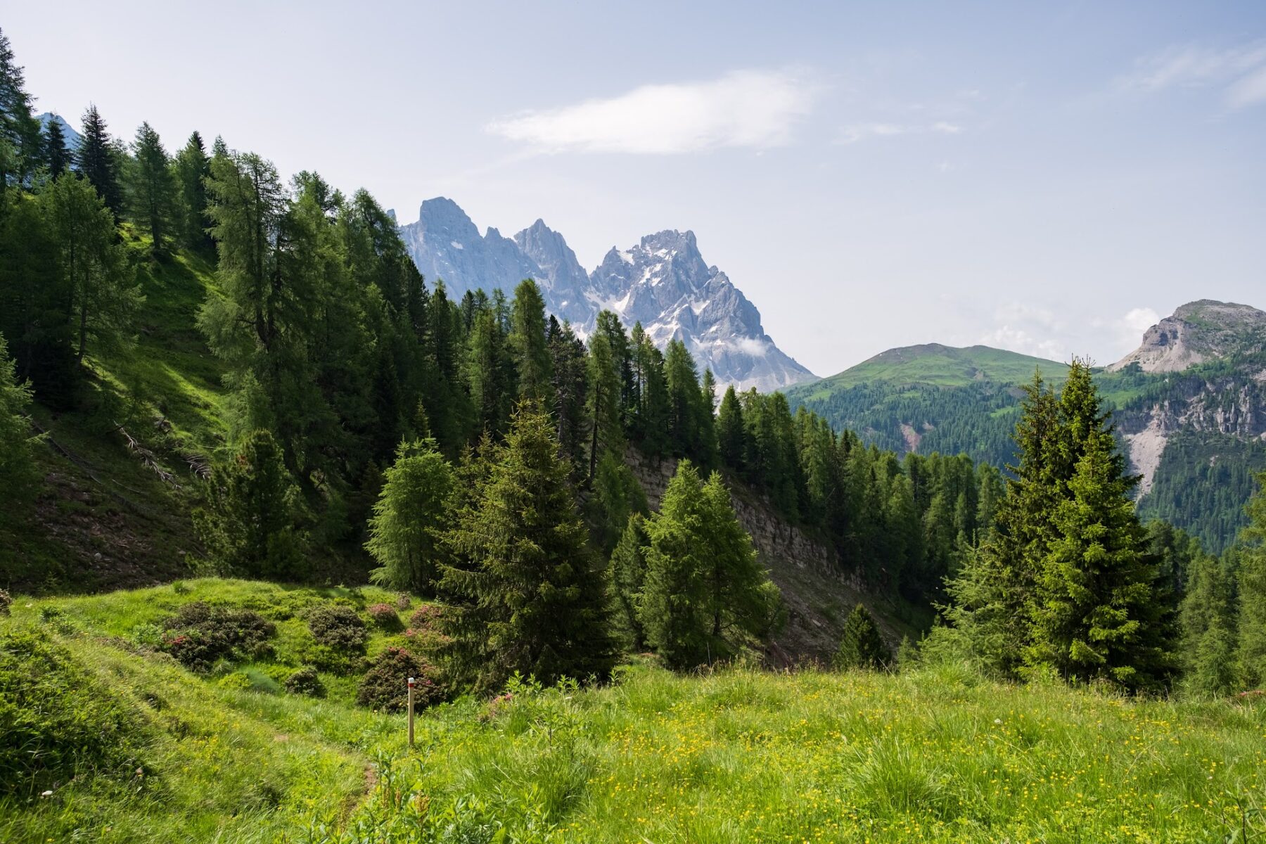
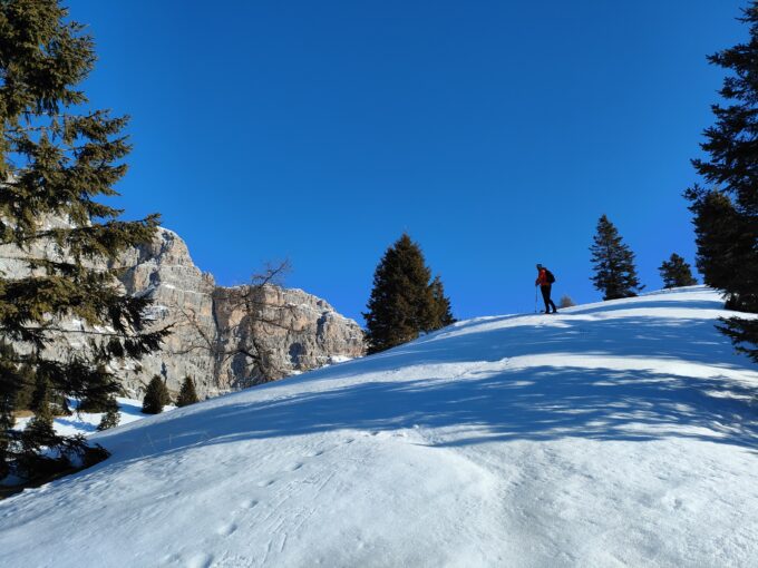
This awesome loop, suitable for everyone with a minimum of physical preparation, leads to the discovery of the grassy ridge that, from the northern shoulder of Mount Mulaz, descends toward the gap of Passo Valles (with its unique panorama of the Pale di San Martino and the Val Venegia seen from above) and then returns on the tourist road that follows the watercourse of Travignòlo. Despite the valley floor being often overcrowded (especially on summer weekends), this route is surprisingly seldomly traveled, except by hikers who, at the highest part of the route, take the main trekking path of “Alta Via delle Dolomiti No. 2” and its variants. The advice is to approach this route with the afternoon light, weather permitting, because the direct light on the walls of the Pale di San Martino peaks offers simply extraordinary reflections…
The itinerary starts from the parking lot of Malga Venégia / Venìa, which can be easily reached from the road from Paneveggio to Passo Valles, turning at the locality of Pian dei Casoni. It is also possible to start directly from Pian dei Casoni, thus lengthening the route by about a couple of km back-and-forth.
From the parking lot, go directly up to the hut of Malga Venegia (1,778 m asl), passing to the right of the building to then continue along the track that climbs on the left edge of a gentle depression present in the middle of the pasture. The track continues to climb into the woods, always to the left (W side) of the depression that becomes progressively more and more pronounced. After passing a small wooden bridge, the track gradually leaves the forest to plunge into the sparse environment of medium-high altitude; after a series of hairpin bends, it reaches the vicinity of the wooden cottage “Baita El Costón”, visible ahead, and then continues on a steep stretch in the grassy slope that leads to the junction with the trail of the Signpost No. 749 / AV2 / SI.
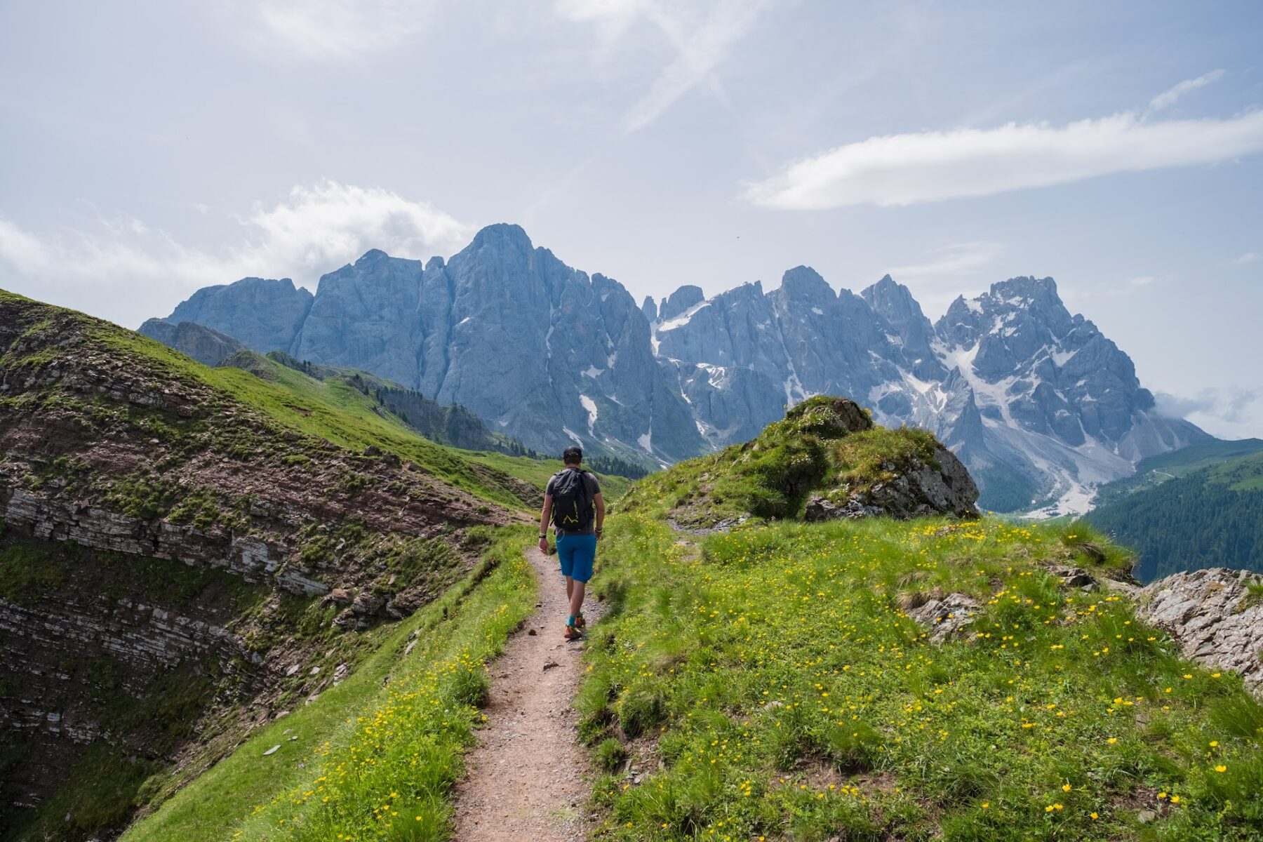
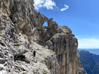
From the junction, the itinerary proceeds uphill to the left, following the Signpost No. 749 toward Passo Valles / Forcella Venegia until it gets to the saddle of Forcella Venegia. From the saddle (2,217 m asl) the itinerary continues on the beautiful trail that follows the grassy ridge, never exposed or dangerous, of the Signpost No. 751 toward Passo della Venegiòta / Passo del Fochét / Rifugio Mulaz. From this point on, the view improves the closer the route gets to the gap of Passo della Venegiòta / Forcella Venegiòta; the half-hour walk separating the two saddles is perhaps one of the most exciting “not demanding” traverses you can find on the Pale di San Martino / Pala Group. After passing, on a pretty grassy basin, the lake named Laghetto di Caladora (2,270 m asl), S of the summit of Cima del Lago, the trail proceeds on the southern slope of Cima Venegiòta, with continuous panoramic windows that allow you to admire, just in front of you, the imposing peaks of the northern chain of the Pale di San Martino.
Once at the gap of Passo Venegiòta (2,303 m asl), the route proceeds right, downhill, on the path of the “Alta Via delle Dolomiti No. 2” / AV2 towards Malga Venegiòta / Passo Rolle; the path, never too steep, descends over wide grassy terraces with pretty pools of water until it reaches the pastures near the hut of Malga Venegiòta / Veniòta, where it continues into the woods on the path of the Signpost No. 749 / SI (“Sentiero Italia”), shortly leading to the junction with the main road “Strada Forestale Val Venegia”, which the itinerary takes to the right until reaching the hut of Malga Venegiòta (1,824 m asl).
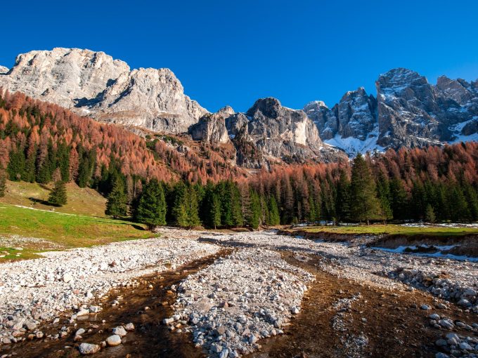
From Malga Venegiòta, the route returns to Malga Venégia by simply following the gravel road, gently descending following the course of the stream of Travignolo, which in less than two kilometers leads back to the parking lot of Malga Venégia.
Paths
- From the parking lot of Malga Venégia, climb to the hut (1,778 m asl), then continue along the trail that climbs to the right of the building on the left edge of a gentle depression [1h 00],
- From the wooden cottage “Baita El Costón”, continue uphill to the junction with the Signpost No. 749 / AV2 / SI, then proceed on the Signpost No. 749 toward Forcella Venégia / Passo Valles [1h 15],
- From the saddle of Forcella Venégia (2,217 m asl), follow the Signpost No. 751 toward Passo della Venegiòta / Passo del Fochét / Rifugio Mulaz [2h 00],
- From the gap of Passo Venegiòta (2,303 m asl), descend to the right on AV2 path, then Signpost No. 749, toward Malga Venegiòta / Passo Rolle [3h 00],
- From the hut of Malga Venegiòta (1,824 m asl), return to Malga Venégia along the gravel road [3h 30]. ✓
Waypoints
Best choices


Suggested hikes

- Demanding
Forks at Treviso
Canali Valley,Mis Valley,Pala Group
- Duration: 03:45 hrs
- Length: 6.2 km
- Elev. gain: 1000 m

- Demanding
Val de Stua
Lower Primiero,Vette Feltrine Range
- Duration: 05:30 hrs
- Length: 12.1 km
- Elev. gain: 1065 m


- Demanding
- Best choice
Leslie Stephen
Canali Valley,Pala Group,Upper Primiero
- Duration: 12:00 hrs
- Length: 29.5 km
- Elev. gain: 2400 m