Valles Pass – Mulaz
Passo Valles - Passo Venegòta - Monte Mulaz - Forcella Venégia
hz • 04/07/2020
Details
- Sport
- Hike
- Rating
- Difficulty
- Intermediate
- Duration
- 06:30 hrs
- Length
- 15.9 km
- Vertigo
- A little
- Min. elevation
- 1400 m
- Max. elevation
- 2906 m
- Elevation gain
- 1400 m
- Elevation loss
- 1400 m
- Car park
- View on Gmaps
Terrain
- 10%
- 30%
- 60%
- Forest
- Grass
- Rock
Seasons
- Jan
- Feb
- Mar
- Apr
- May
- Jun
- Jul
- Aug
- Sep
- Oct
- Nov
- Dec
Signposts
Description
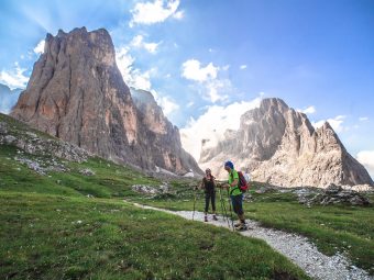
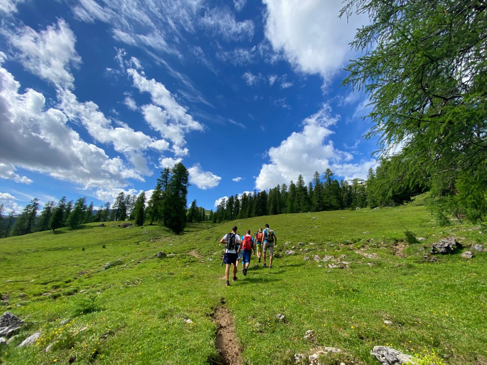
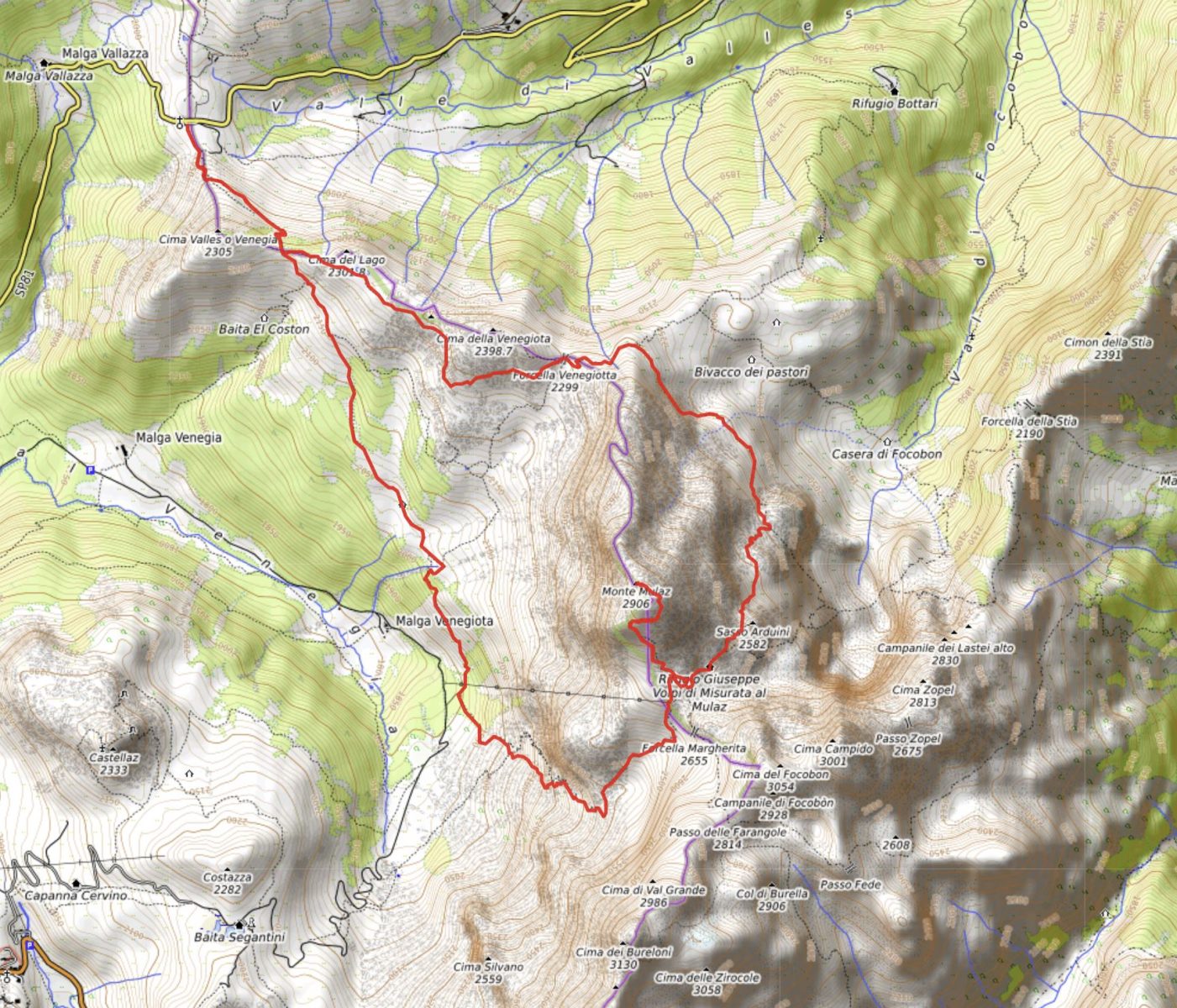
This spectacular itinerary, perhaps one of the most beautiful – landscape wise – single-day trail that can be done on the Pale di San Martino (aka Pala Group), develops in the extreme western corner of the Pala Group, starting and arriving at Valles Pass, “step brother” of the more suggestive Rolle Pass. The route crosses green pastures and rocky stretches to reach the hut of Rifugio Mulaz: first it crosses the unpopular gap of Passo Venegiòta, then it continues with the ascent to the summit Monte Mulaz, for then plunging into the beautiful Val Venegia, just before getting back towards Valles Pass. Although it is also possible to follow the itinerary in an anti-clockwise direction, we suggest the clockwise direction, as described here, which allows you to stay lower in altitude during the final part of the route.
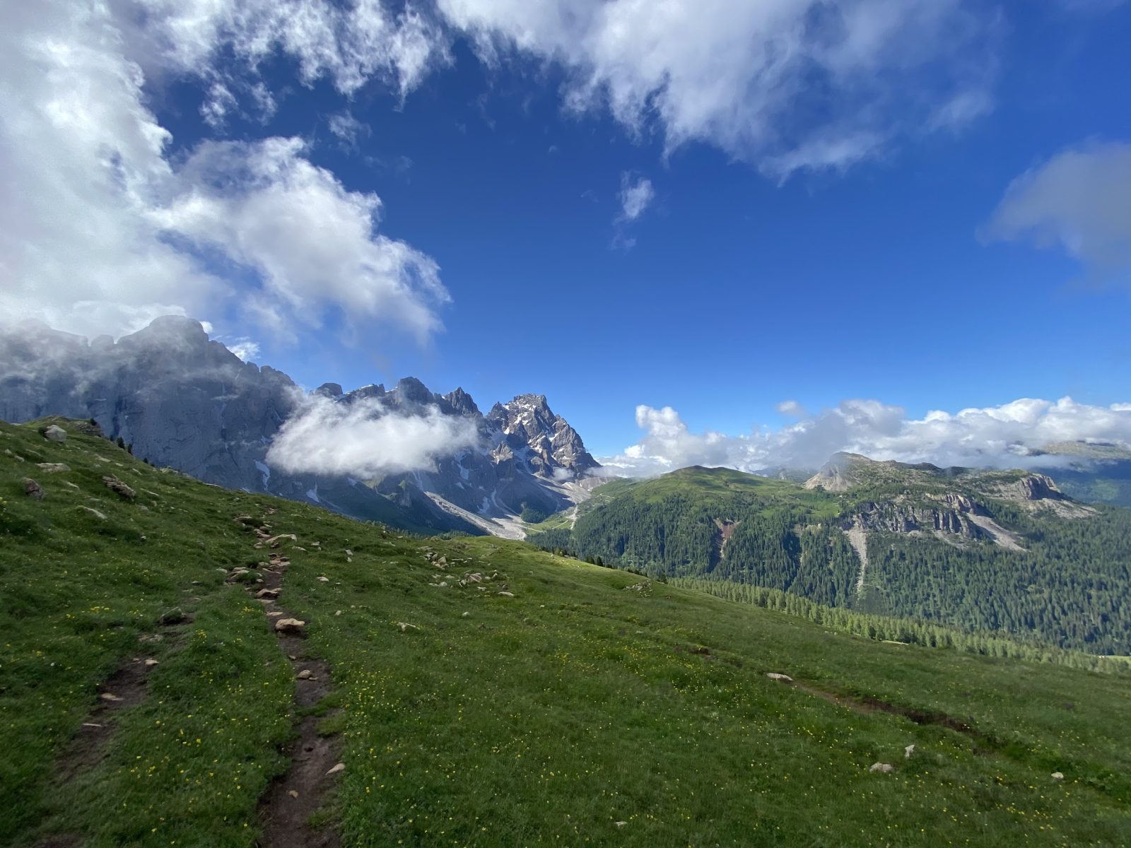
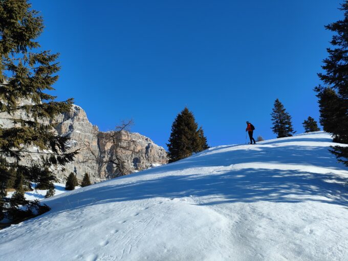
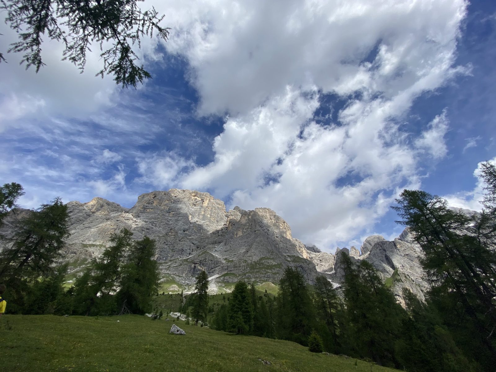
The hike begins at Valles Pass (Passo Valles – 2,032 m asl), located between the Pala Group and the porphyritic mountain range of Cima Bocche, shaping the watershed between the valleys of Biois and Travignolo, formerly called Pas de le Stèle. The initial section of the route climbs along the Signpost No. 751 which runs along the pyramidal Cima Valles towards the south, leading directly to the panoramic gap of Forcella Venégia (2,215 m asl), where the view unexpectedly widens over the northern sub range of the Dolomites of Pale di San Martino (among all, on the peaks of Focobòn, Burelóni, Mulaz and Cimon della Pala) and on the underlying Val Venégia.
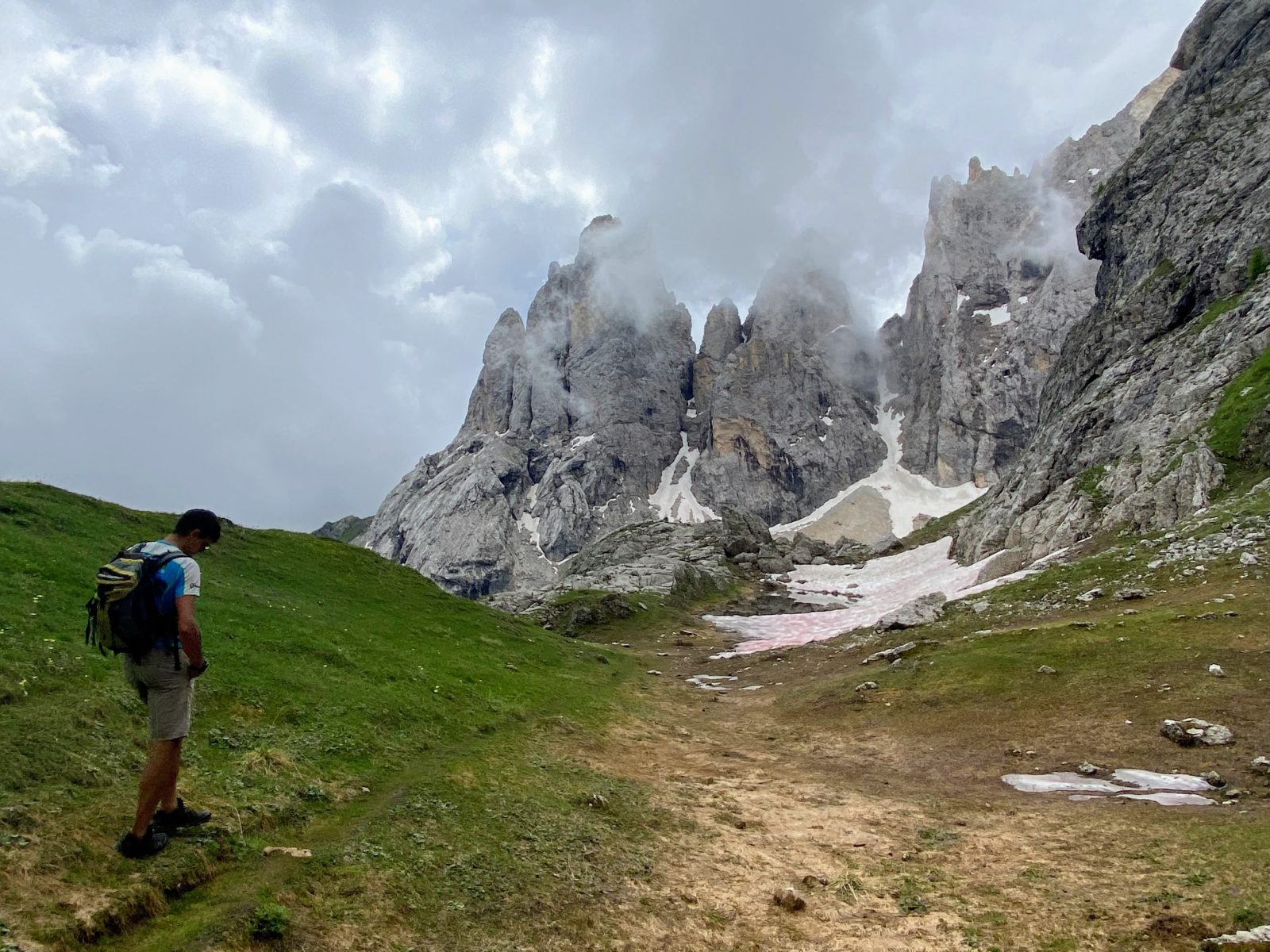
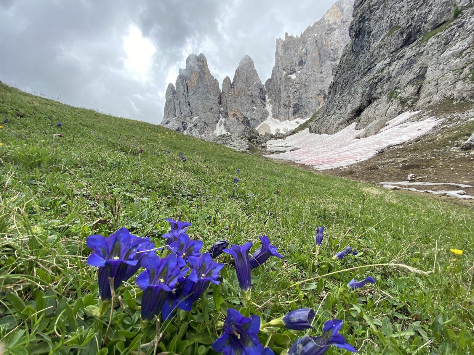
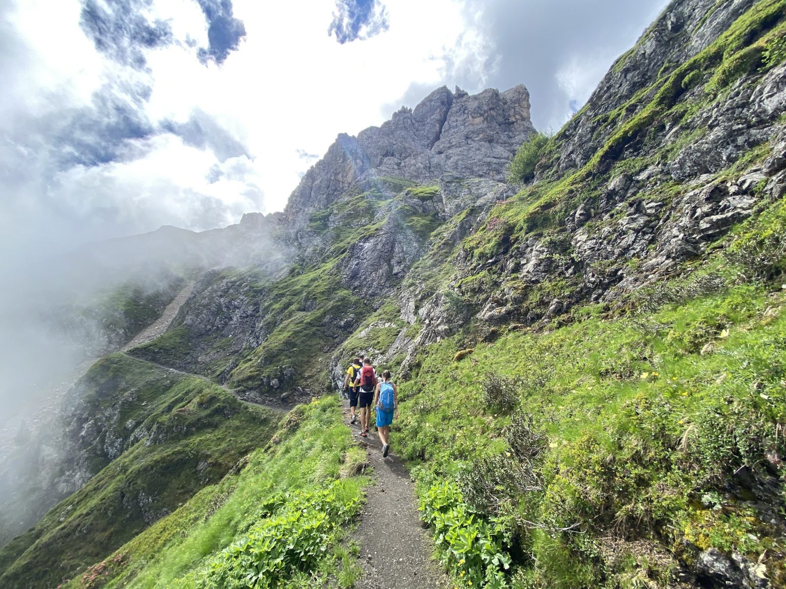
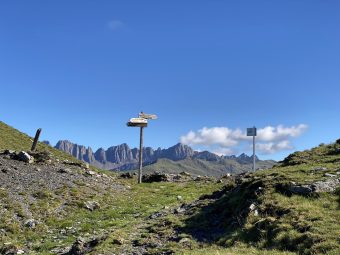
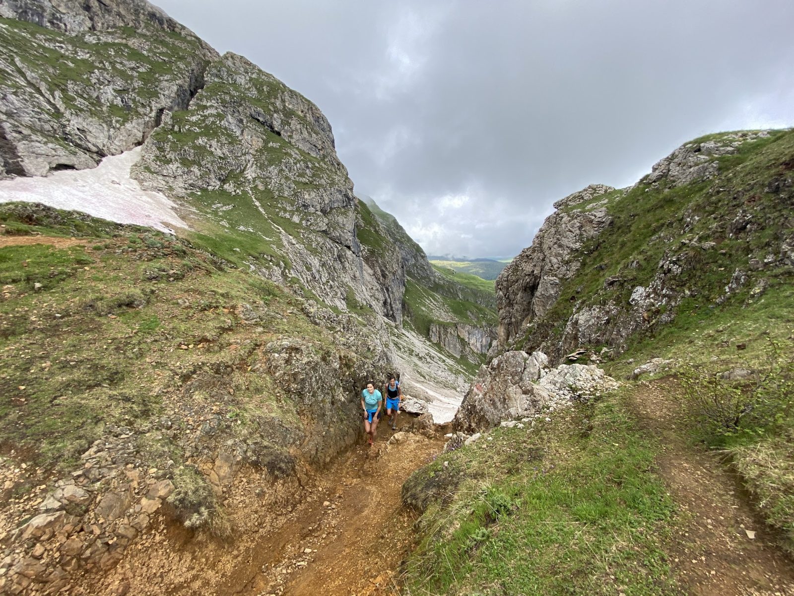
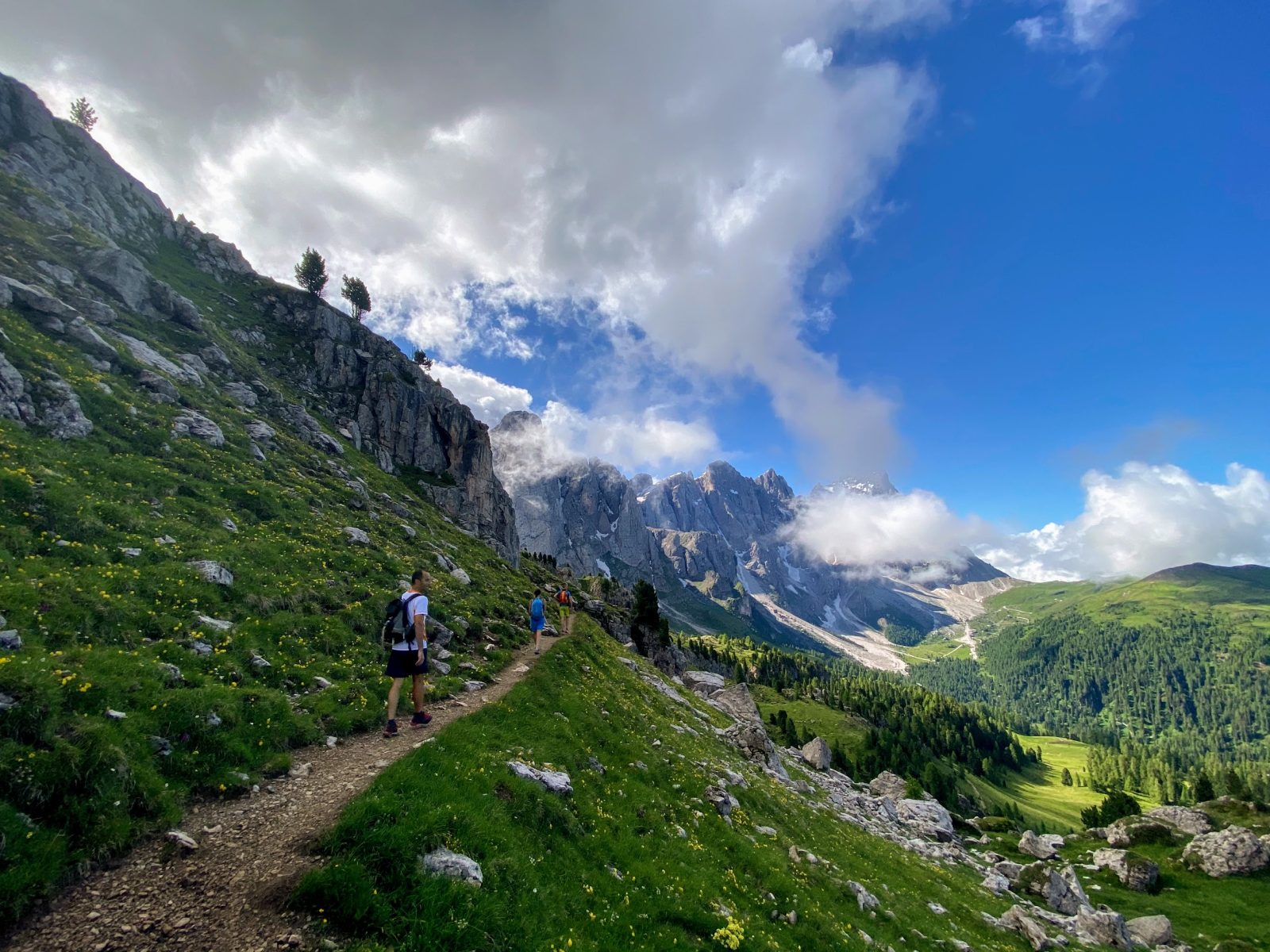
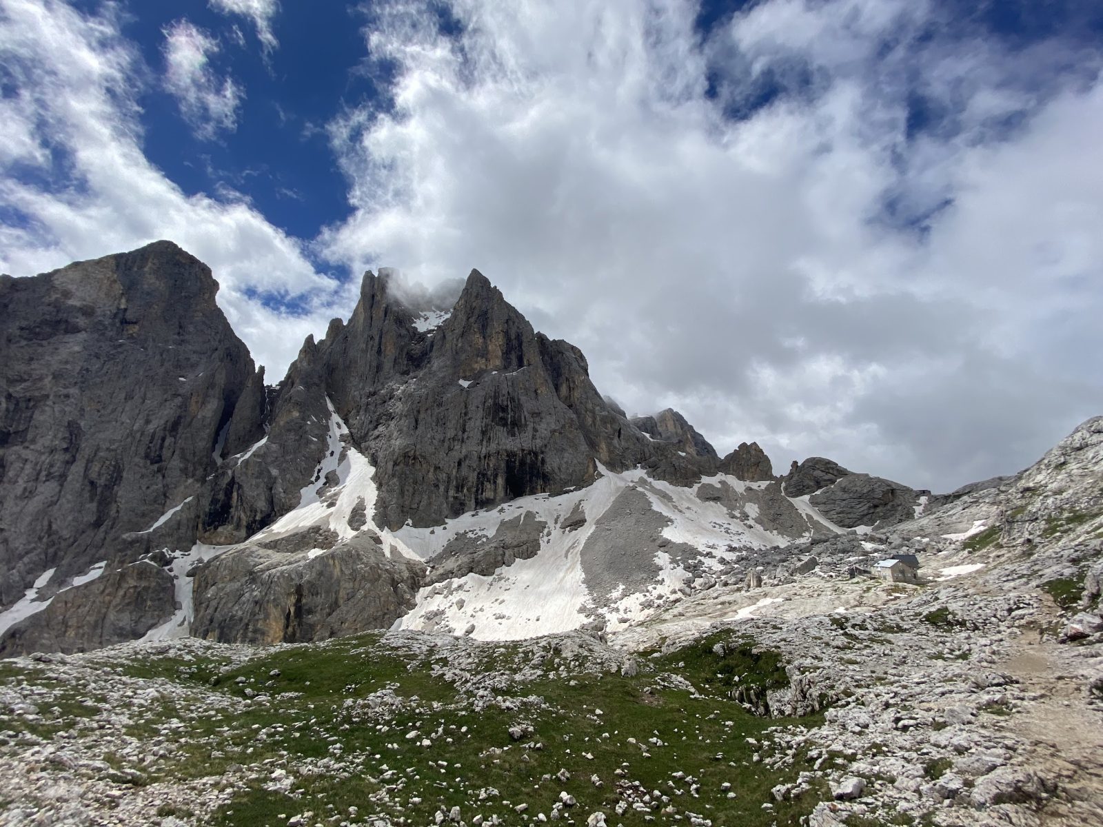
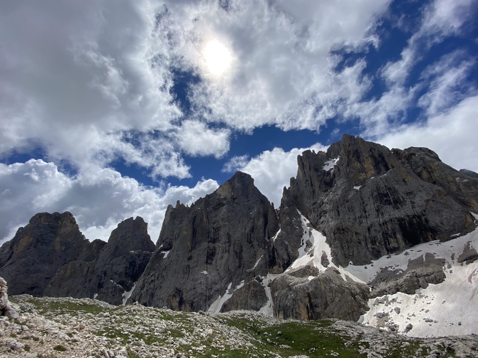
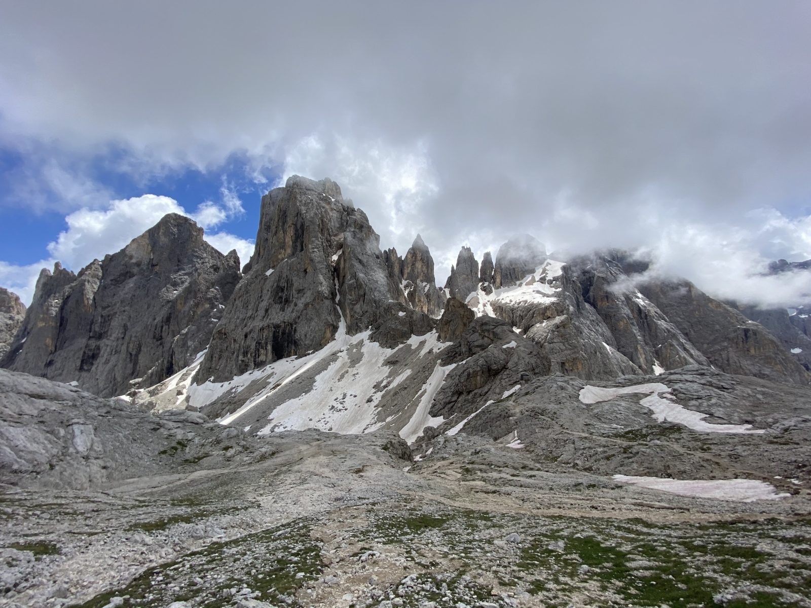
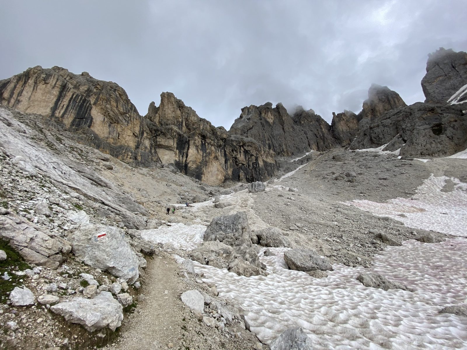
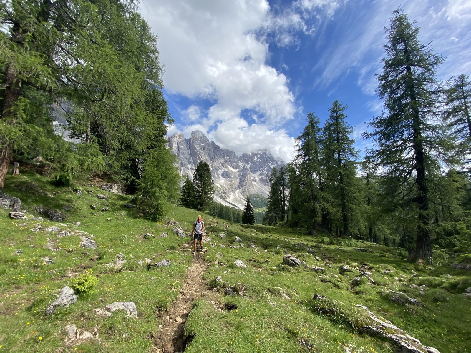
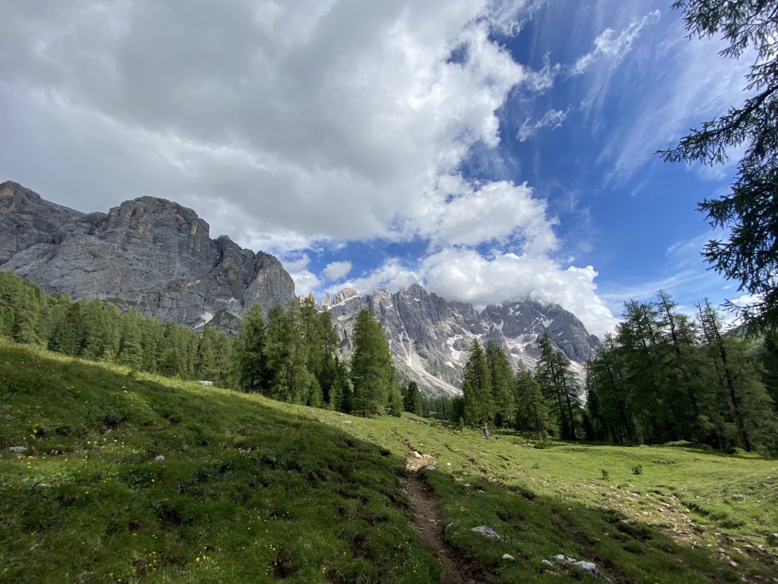
From Forcella Venégia, the trail continues high in altitude towards the gap of Passo Venegiòta, on the ridge that defines the border between the regions of Trentino Alto Adige and Veneto. After a short stretch through the pastures overlooking Val Venégia, you pass by the small lake of Coladora – next to the peak of Cima Coladora (2,313 m asl) -; then you continue on the southern slopes of Cima Venegiòta while approaching the gap. From Passo Venegiòta (2,303 m asl), where the surrounding environment begins to turn into the typical high altitude Dolomite environment, you walk through a relatively comfortable initial stretch of descent along the Signpost No. 751, on the north-eastern walls of Monte Mulaz. After the short descent, the path begins to climb towards the hut of Rifugio Mulaz. A remarkable feature of this uphill stretch is the conformation of the landscape behind you, which resembles, with a little bit of imagination, the famous snapshot of the Peruvian town of Machu Picchu.
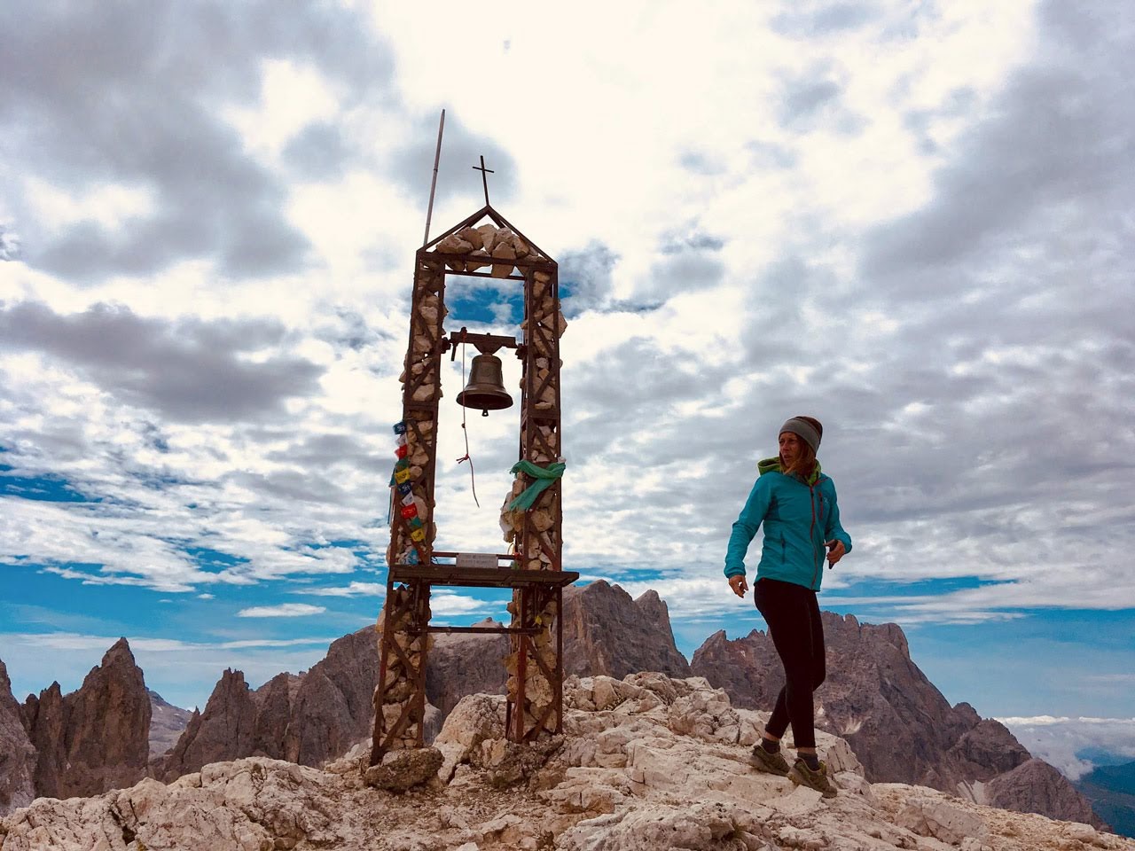
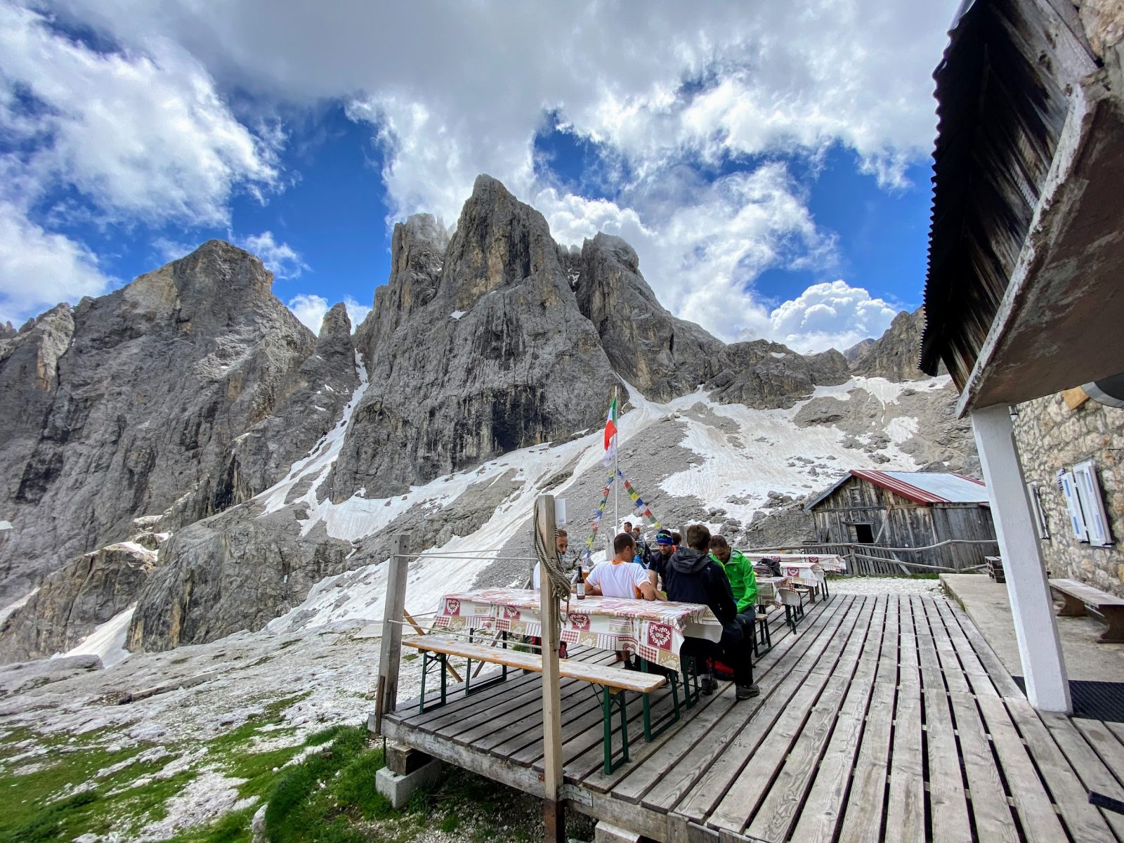
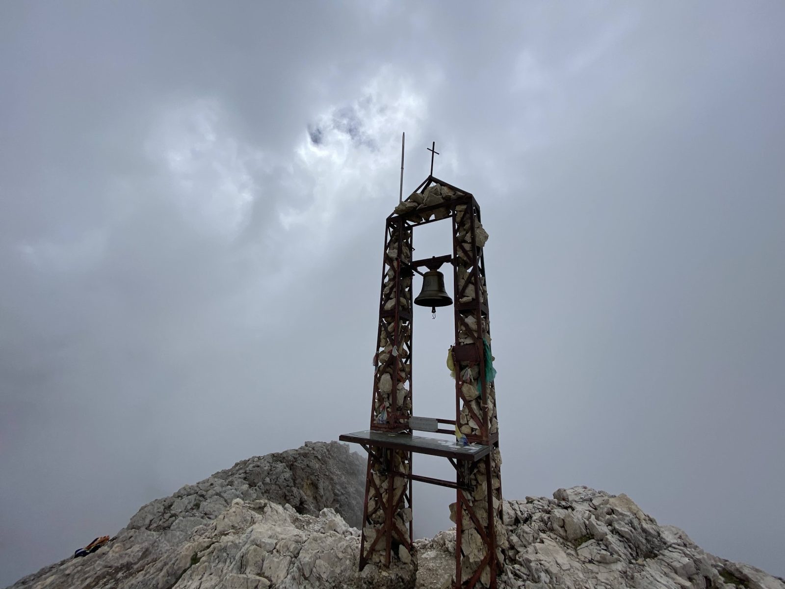
Once reached Rifugio Mulaz (2,571 m asl), the route offers a variant, basically mandatory, which allows you to reach the top of the majestic and “pachydermic”, especially if compared to the surrounding peaks, Monte Mulaz (2,906 m asl). After the steep climb between the stones, from the summit you can enjoy one of the most classic all-round sights of the Pala Group and, in particular, over the nearby Focobòn group with all its spectacular peaks. As soon as you get to the top of Monte Mulaz, don’t forget to ring the bell set in the metal structure, with a pinch of enthusiasm!
The way back from the summit follows the path of the ascent, taking at the end along the Signpost No. 710 towards the gap of Passo Mulaz (2,619 m asl).
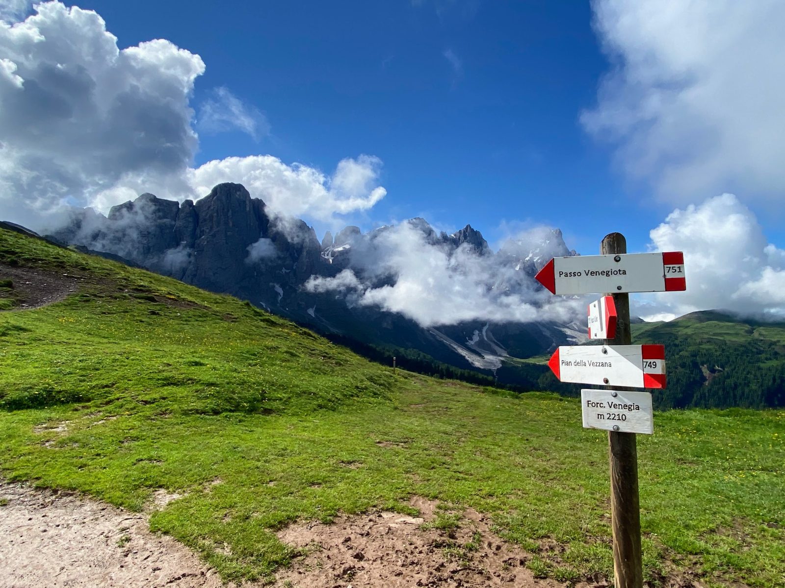
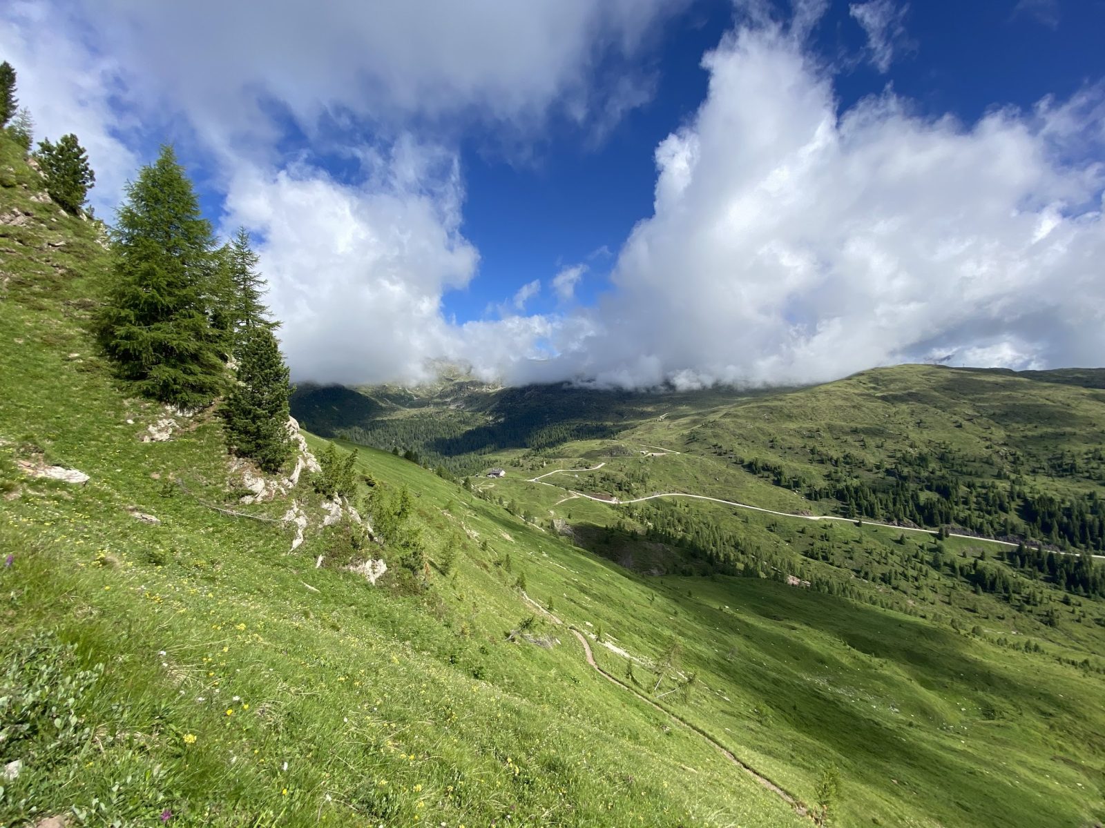
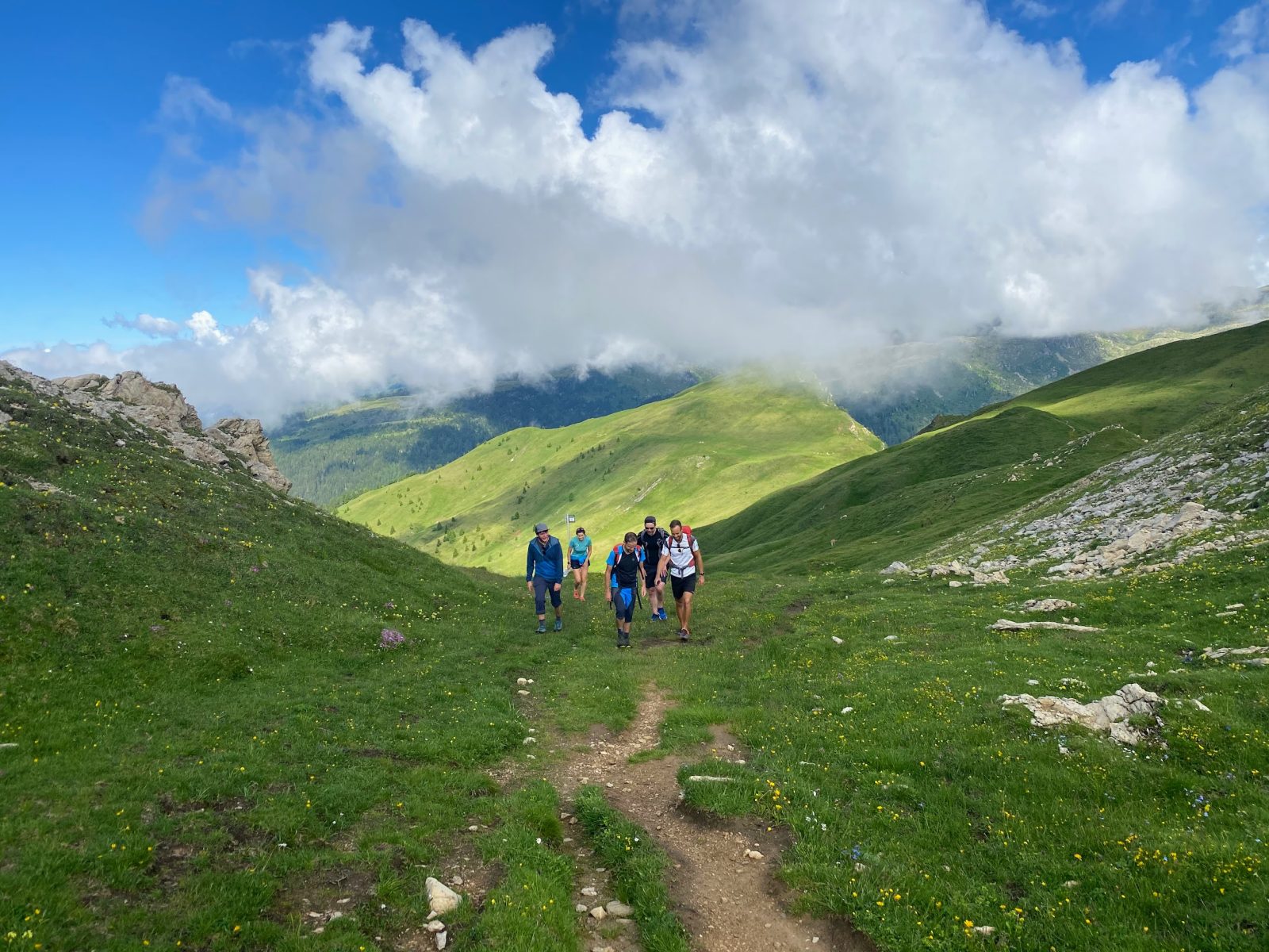
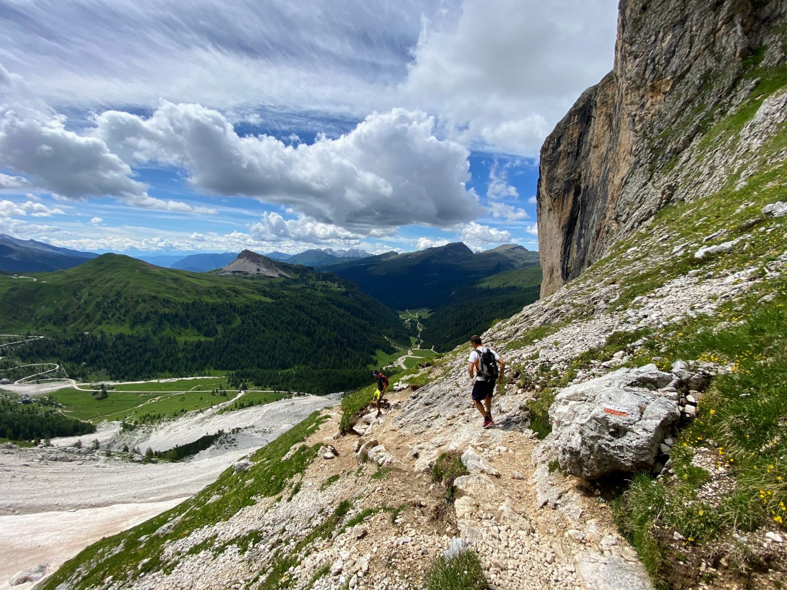
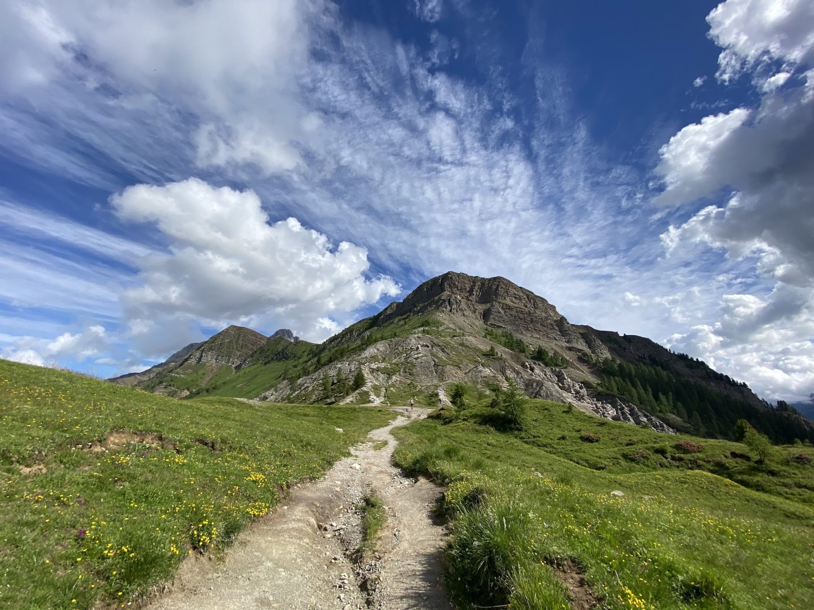
From Passo Mulaz you begin a long descent (Signpost No. 710), sometimes slippery, towards Val Venégia and Malga Venegióta. Just before arriving at the hut of Malga Venegióta, almost on the bottom of the Venégia valley, you begin the last uphill stretch on the Signpost No. 749 towards Passo Valles, which will let you avoid jumping straight into the heart of the tourist valley.
The ascent along the path of the Signpost No. 749 is simply beautiful, and gradually ascends the sunny right orographic side of the Val Venégia, passing through the alpine pastures of the Busa dei Làibi, at the base of the massive western wall of Monte Mulaz. The path leads directly to the gap of Forcella Venégia, where it resumes the initial section of the trail, along the Signpost No. 751, heading directly to Passo Valles.
Paths
- From Valles Pass (2,032 m asl), follow the Signpost No. 751 towards Passo Venegiòta / Rifugio Mulaz, passing by the first gap of Forcella Venégia (2,215 m asl) and the second one of Passo Venegiòta (2,303 m asl) [2h 45],
- From the hut of Rifugio Mulaz (2,571 m asl), proceed along the Signpost No. 710 towards Passo Mulaz / Val Venégia [2h 50],
- [VARIANT] Before reaching the gap of Passo Mulaz, reach the summit of Monte Mulaz (2,906 m asl) [4h 15],
- From the gap of Passo Mulaz (2,619 m asl), descend along the Signpost No. 710 towards Val Venégia / Malga Venegiòta [5h 00],
- Shortly before reaching the hut of Malga Venegiòta, at the crossroads, take the Signpost No. 749 towards Passo Valles,
- Arrive at Valles Pass, passing by the gap of Forcella Venégia [6h 30]. ✓
Waypoints

Best choices


Suggested hikes

- Demanding
Forks at Treviso
Canali Valley,Mis Valley,Pala Group
- Duration: 03:45 hrs
- Length: 6.2 km
- Elev. gain: 1400 m

- Demanding
Val de Stua
Lower Primiero,Vette Feltrine Range
- Duration: 05:30 hrs
- Length: 12.1 km
- Elev. gain: 1400 m


- Demanding
- Best choice
Leslie Stephen
Canali Valley,Pala Group,Upper Primiero
- Duration: 12:00 hrs
- Length: 29.5 km
- Elev. gain: 1400 m