Climb of the Baron
Colverde - Val di Ròda - Col dei Béchi - Col delle Féde - Cima Rosetta - Rifugio Colverde
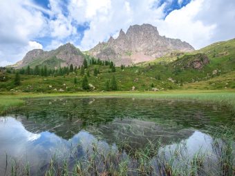
Pala Group,San Martino di Castrozza
gian • 24/08/2019


Details
- Sport
- Hike
- Rating
- Difficulty
- Intermediate
- Duration
- 06:00 hrs
- Length
- 15.0 km
- Vertigo
- Medium
- Min. elevation
- 1530 m
- Max. elevation
- 2742 m
- Elevation gain
- 1615 m
- Elevation loss
- 1615 m
- Car park
- View on Gmaps
Terrain
- 30%
- 5%
- 65%
- Forest
- Grass
- Rock
Seasons
- Jan
- Feb
- Mar
- Apr
- May
- Jun
- Jul
- Aug
- Sep
- Oct
- Nov
- Dec
Signposts
Description
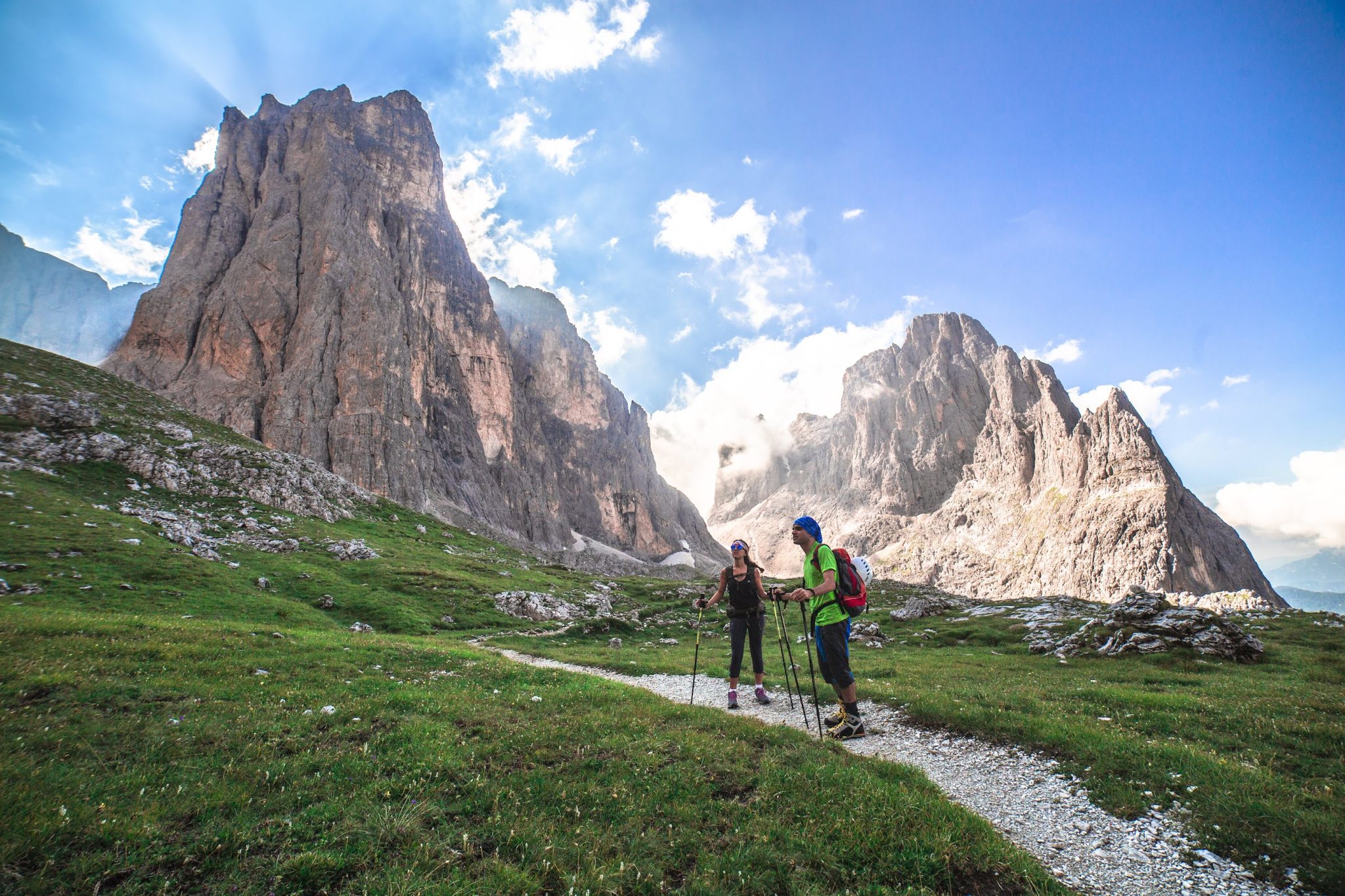
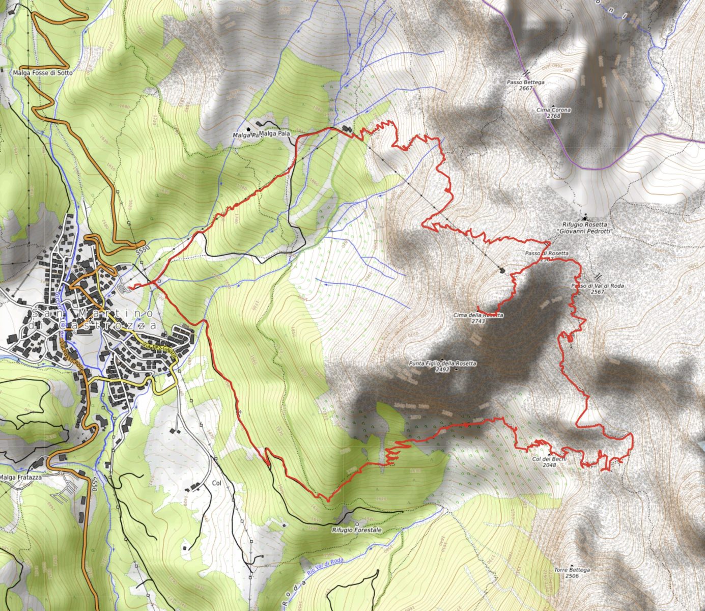
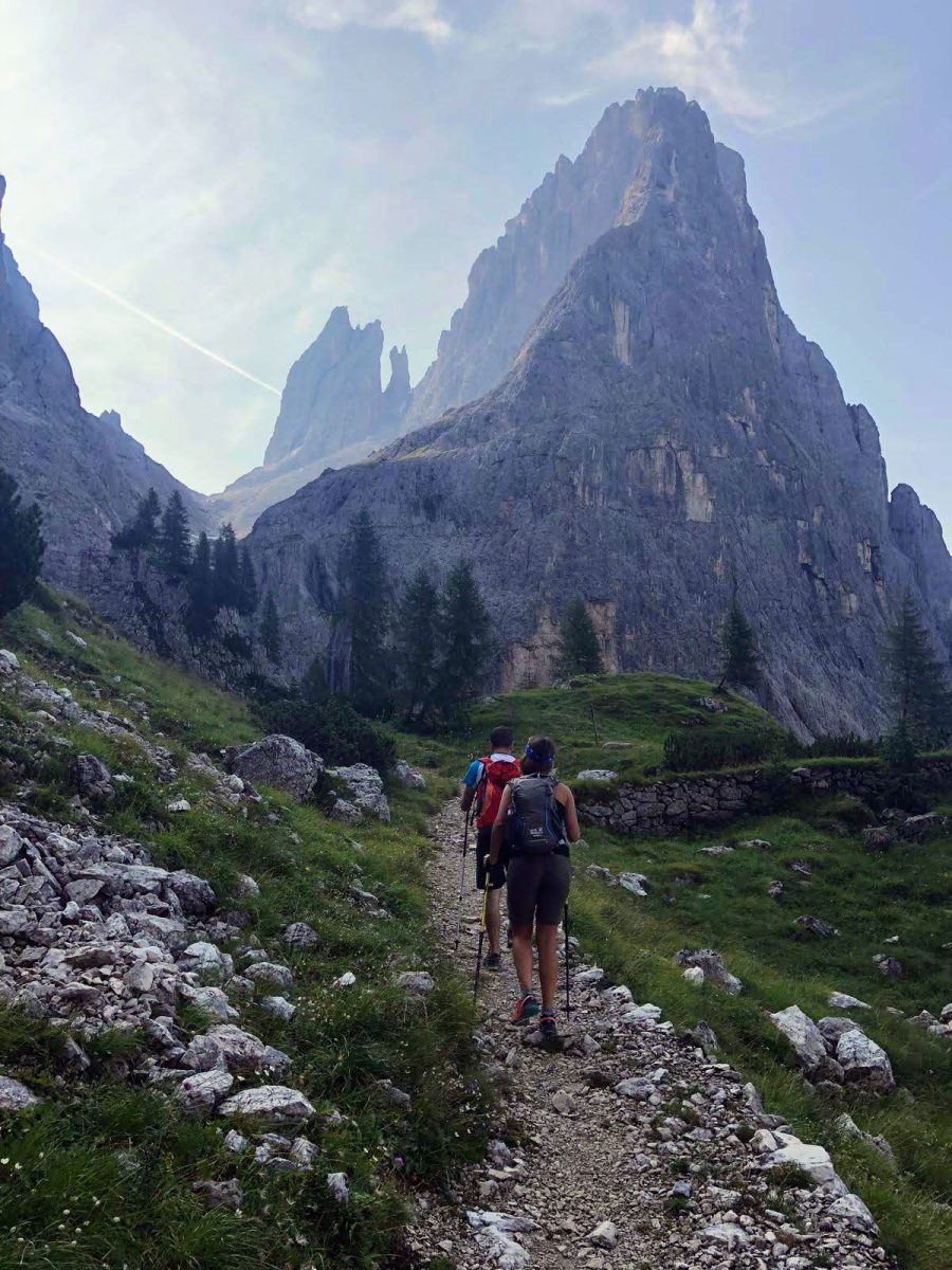
This itinerary starts from the base of the Colverde gondola and allows you to reach the Pala Group Plateau and the summit of Cima Rosetta via the most scenic and panoramic access possible: the one of Val di Ròda.
From the base of the gondola, located to the N of the village of San Martino di Castrozza, beside the SS50 road that climbs from San Martino to Passo Rolle, the hike begins by following the trail of the Signpost No. 702, which begins about a hundred meters upstream from the station on a pleasant gravel road, closed by a bar that prevents cars from passing, The first 1.5 km retraces one of the classic access routes to the hut of Rifugio Velo della Madonna; at the first crossroads the route continues following the Signpost No. 702, turning left onto the gravel road “Val di Roda”. Before the road becomes a path, the trail comes to a subsequent junction – well signposted – with the path of the Signpost No. 725 “Cacciatore di Malga Pala”, which, to the left, would lead back to the start; the route proceeds to the right, still along the Signpost No. 702, taking the famous “Baron von Lesser Trail” / “Von Lesser Weg”.
Baron Ladislaus Leon Freiherr von Lesser (1856 ✝ 1925), after whom this section of the Signpost No. 702 is named, was a Prussian nobleman and professor in Leipzig who, between 1905 and 1914, entrusted – under lavish reward for the time (5850 crowns) – the work of building a path climbing the scenic Val di Ròda to the surveyor Giovanni Secco. Given the trail’s low gradient and its numerous hairpin bends, it is believed that the path was built to allow the Baron to arrive on the Plateau on horseback or by walking without any extra effort; it is also speculated that Secco studied a route that was as long as possible, in order to justify the reward.
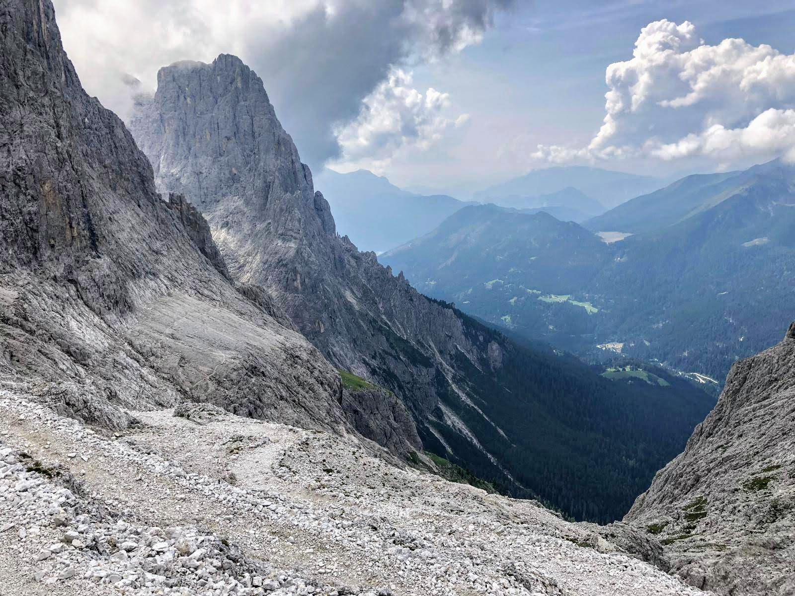
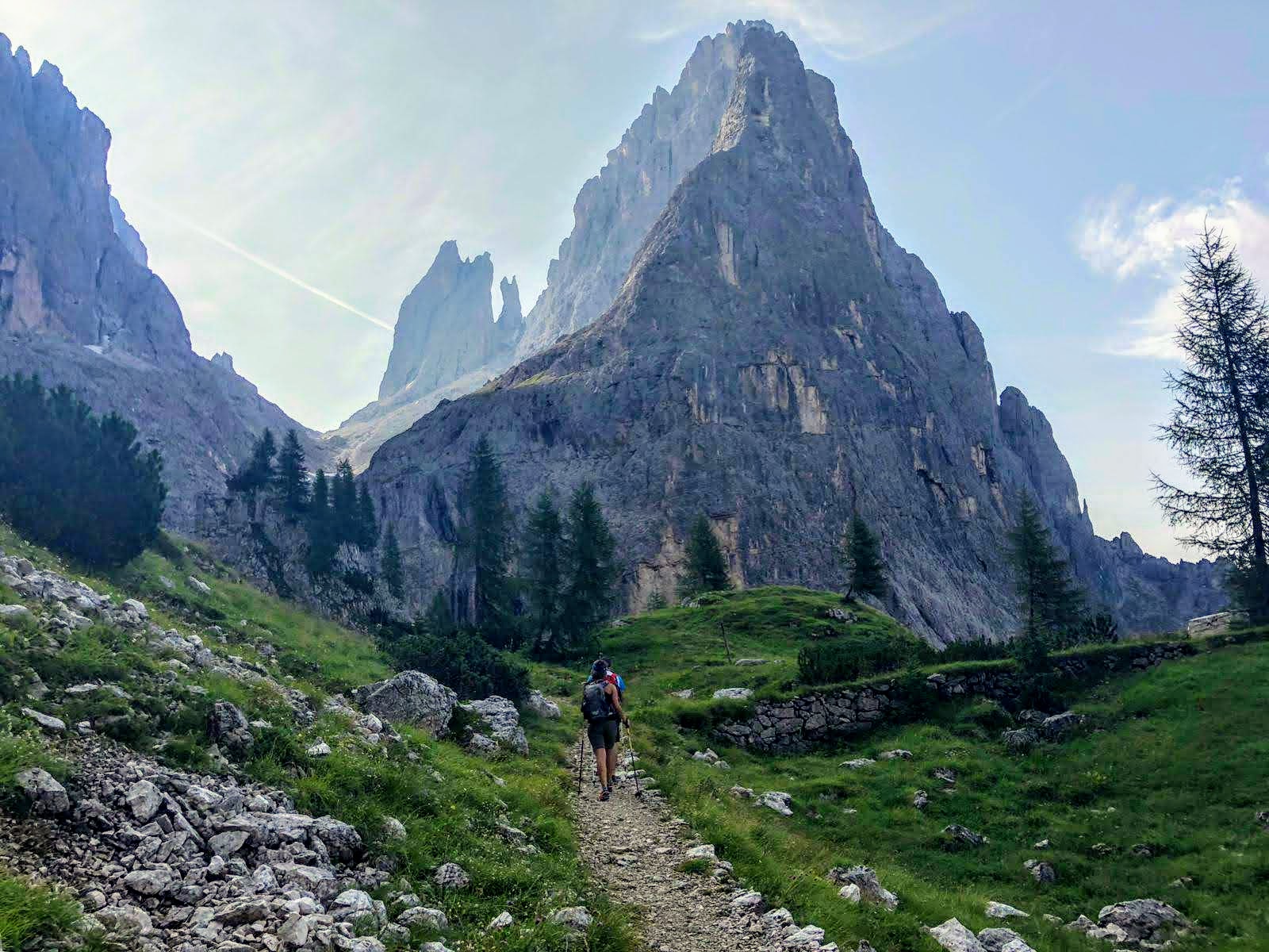
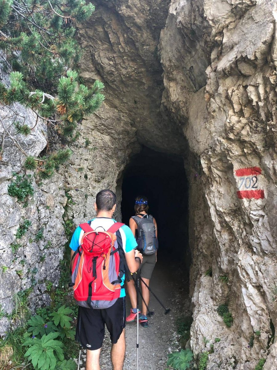
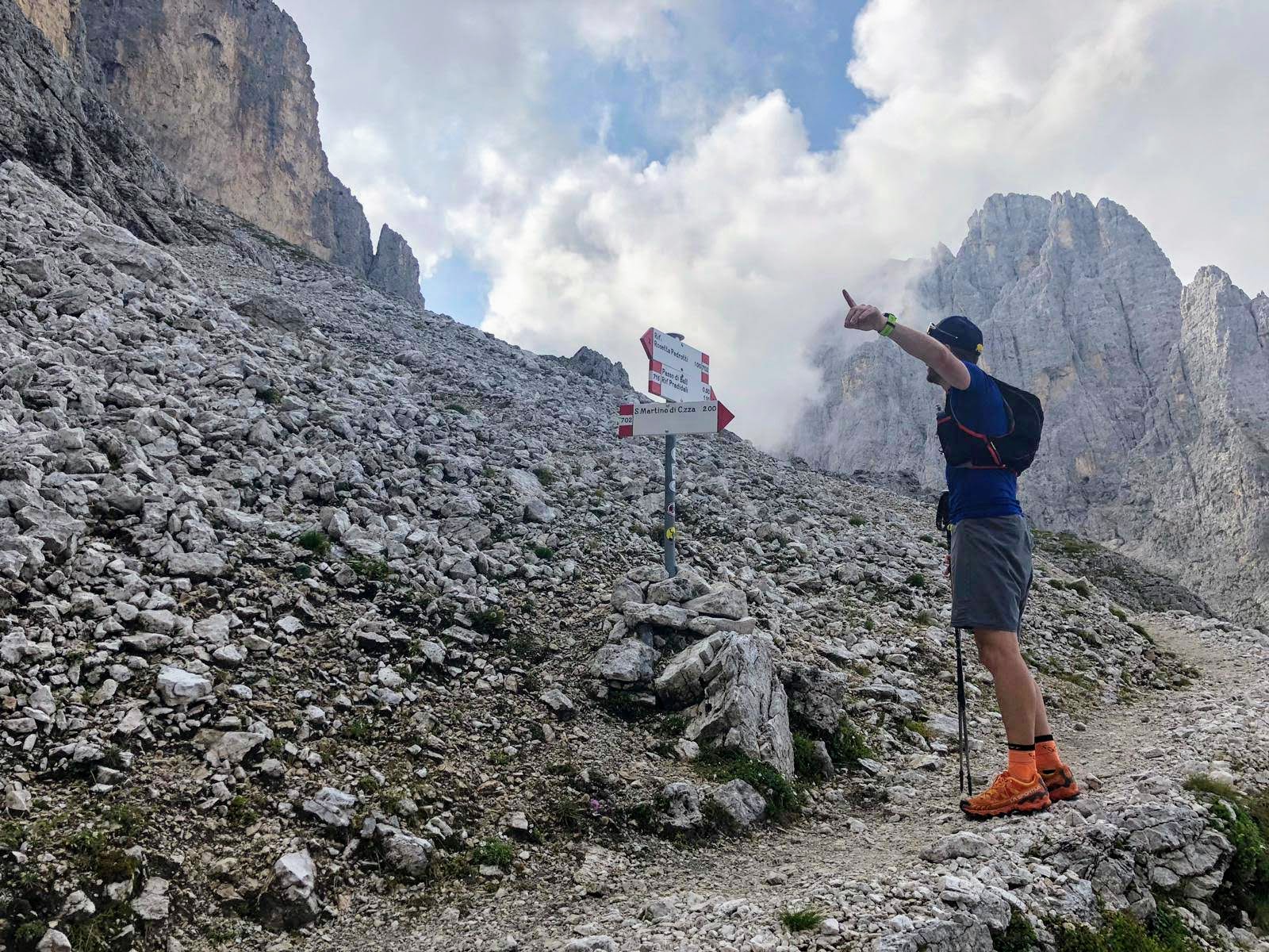
With the majestic peak of Pala di San Martino in front, to the SE, Cima Rosetta on the left and Cima Val di Ròda on the right, the trail climbs with its characteristic (and endless: 240!) hairpin bends, passing first through the small clearing of Col dei Béchi (2,048 m asl) and then, after passing the junction with the path of the Signpost No. 715 coming from the gap of Passo di Ball, through the wider clearing of Col delle Féde (2,278 m asl). A special feature of this ascent is the striking rock-cut tunnel that you pass through, for which a flashlight is not necessary.
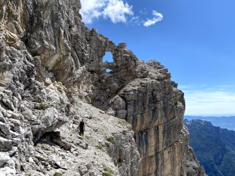
From Col delle Féde (tr. sheeps hill), the most challenging part of the entire hike begins (shared with the itinerary of the “Alta Via delle Dolomiti No. 2 – AV2”); the section is steep and at times exposed, as it climbs the head of Val di Ròda towards the gap of Passo di Val di Ròda.
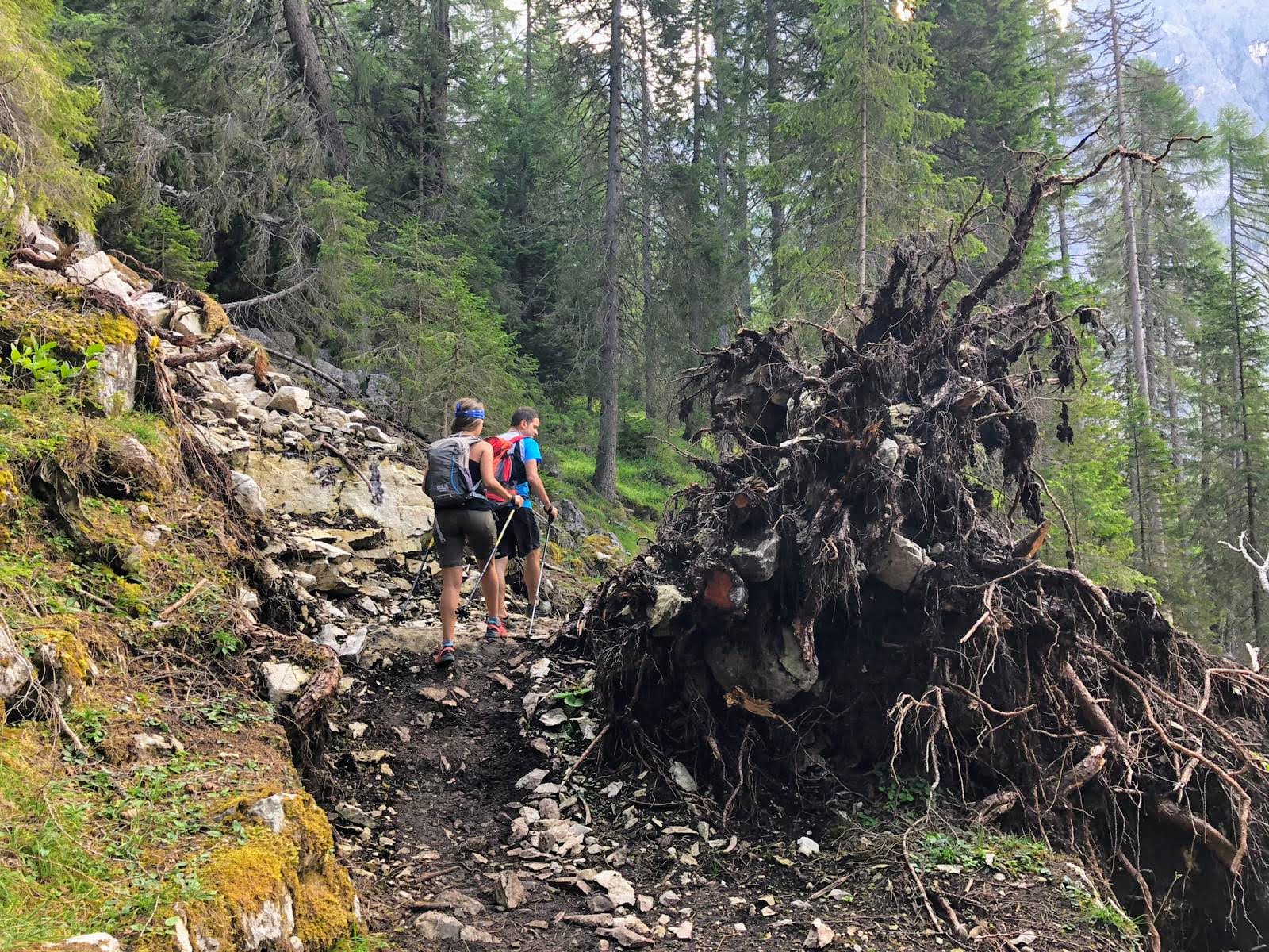
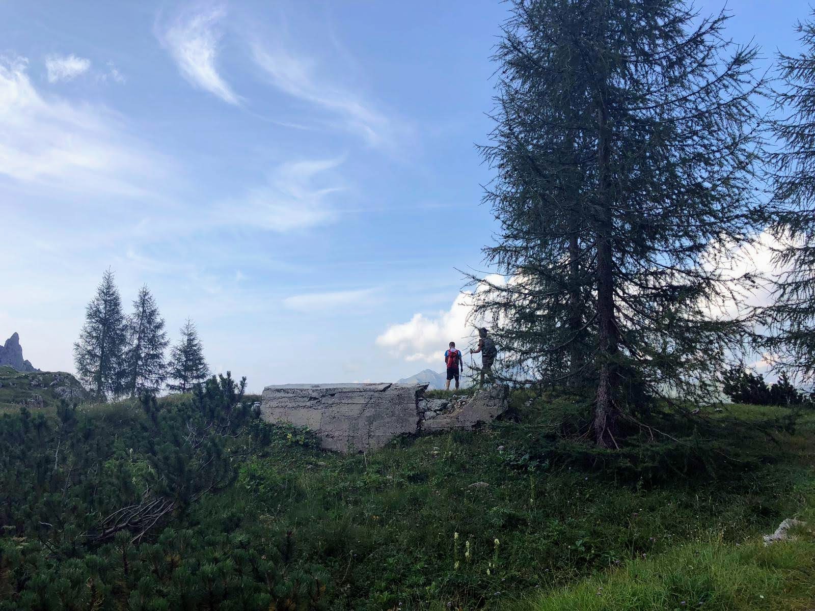
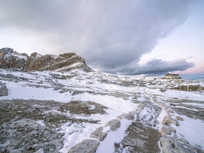
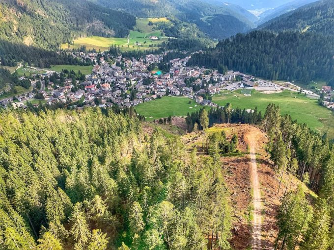
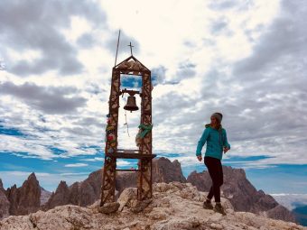
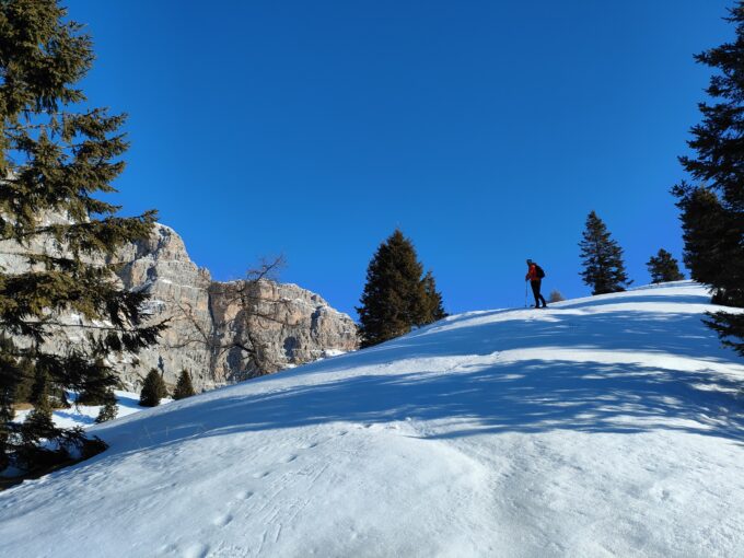
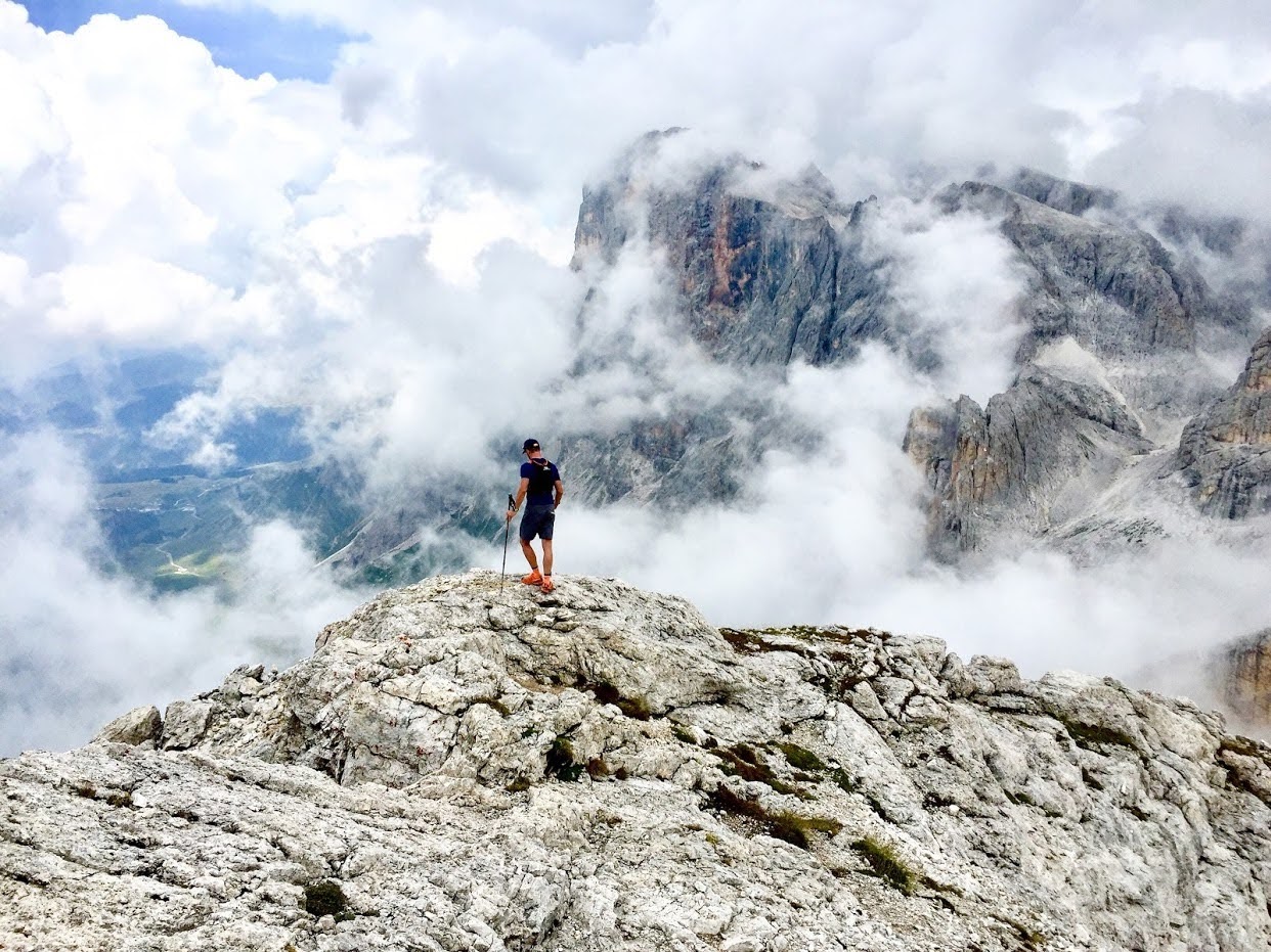
Just before arriving on the gap (which is just about 15′ from Rifugio Rosetta), the route optionally deviates to the left, to walk on the edge of the plateau and join the Signpost No. 701A toward the summit of Cima Rosetta (clearly visible to the W). Once on the summit (2,746 m asl), with its spectacular view both over the village of San Martino di Castrozza and on the Pala Group summits, the way down a matter of choosing one of the many tracks running parallel to the Signpost No. 701A, getting down to the gap of Passo di Rosetta (2,567 m asl), located near the hut of Rifugio Rosetta “Giovanni Pedrotti”. From Passo di Rosetta the itinerary proceeds downhill, initially steep and with some more technical but never dangerous sections, along the Signpost No. 701, which quickly drops in elevation towards Rifugio Colverde / San Martino di Castrozza. Once past the hut of Rifugio Colverde (arrival of the Colverde gondola lift – 1,965 m asl) and in the proximity of the hut of Malga Pala, the last part of the descent on path plunges into the woods towards San Martino di Castrozza; a bit boring and not very scenic compared to the rest of the itinerary, the path leads directly back to the starting point of the hike, at the departure of the Colverde gondola.
Paths
- From the base of the Colverde gondola, follow the trail of the Signpsot No. 702 toward Rifugio Velo della Madonna up to the first crossroads [0h 30],
- At the first and second crossroads continue following the Signpsot No. 702 towards Rifugio Rosetta / Passo Val di Ròda, taking the “Baron von Lesser Trail” [0h 40],
- Keep following the path of the Signpost No. 702 to Passo Val di Ròda, passing at the locations of Col dei Béchi (2,048 m asl) and Col delle Féde (2,278 m asl) [3h 30],
- [VARIANT] From the gap of Passo Val di Ròda (2,567 m asl), walk left, heading W, and join the path of the Signpost No. 701A toward Cima Rosetta; from the summit, follow the Signpost No. 701A to Passo Rosetta [4h 15],
- From the gap of Passo Rosetta (2,567 m asl), descend along the path of the Signpost No. 701 toward San Martino di Castrozza, leading back to the starting point [6h 00]. ✓
Waypoints
Best choices


Suggested hikes

- Demanding
Forks at Treviso
Canali Valley,Mis Valley,Pala Group
- Duration: 03:45 hrs
- Length: 6.2 km
- Elev. gain: 1615 m

- Demanding
Val de Stua
Lower Primiero,Vette Feltrine Range
- Duration: 05:30 hrs
- Length: 12.1 km
- Elev. gain: 1615 m


- Demanding
- Best choice
Leslie Stephen
Canali Valley,Pala Group,Upper Primiero
- Duration: 12:00 hrs
- Length: 29.5 km
- Elev. gain: 1615 m