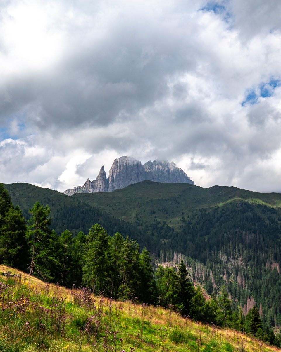
Cima di Cece from Caoria
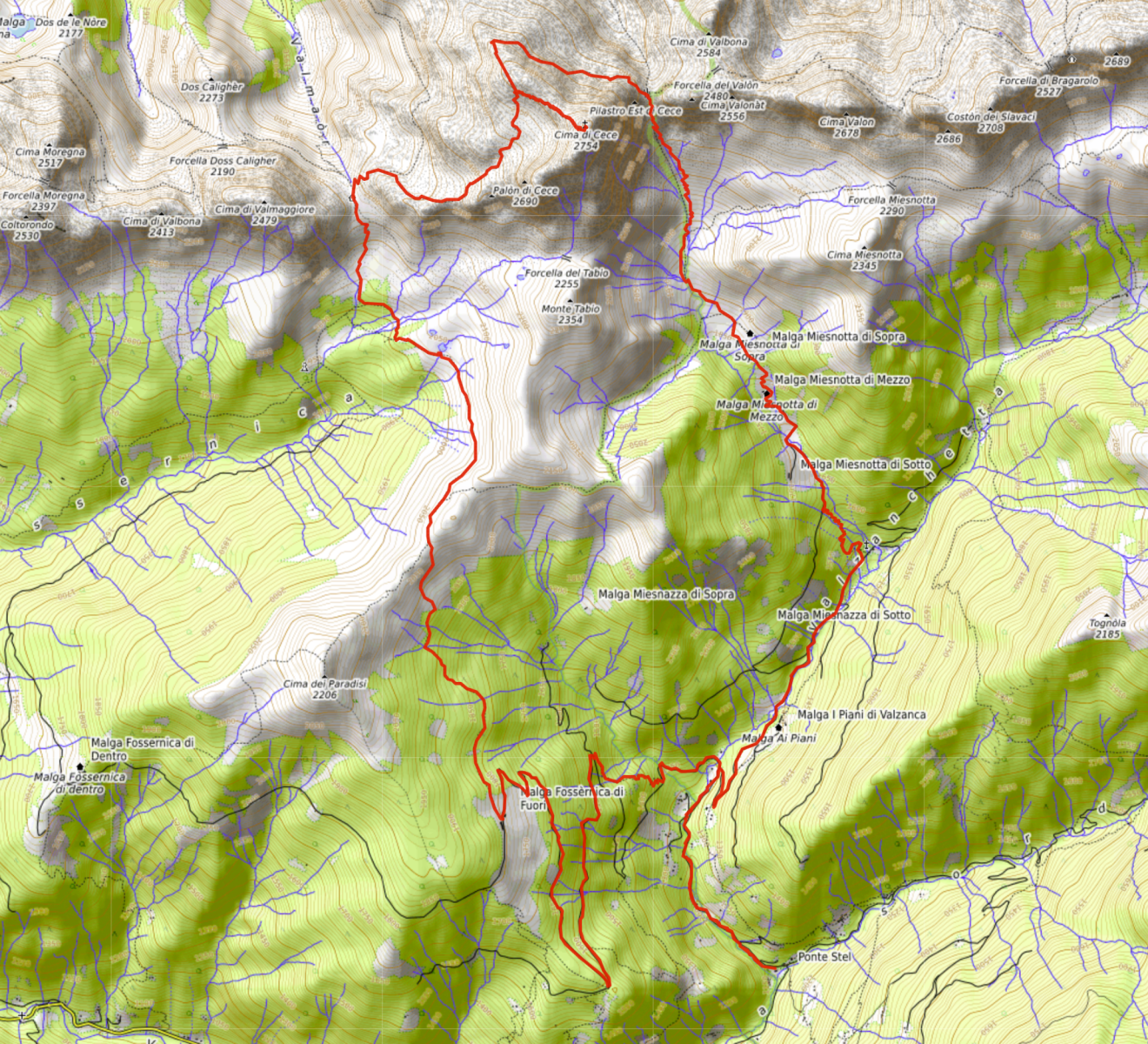
Pont de Stél - Valzanca - Malga Miesnòta di Sopra - Forcella di Cece - Cima di Cece - Forcella Valmaggiore - Laghetti di Coltoróndo - Forcella Paradisi - Malga Fossèrnica di Fuori
gian • 23/07/2023
Details
- Sport
- Hike
- Rating
- Difficulty
- Intermediate
- Duration
- 08:00 hrs
- Length
- 26.5 km
- Vertigo
- A little
- Min. elevation
- 1128 m
- Max. elevation
- 2690 m
- Elevation gain
- 1900 m
- Elevation loss
- 1900 m
- Car park
- View on Gmaps
Terrain
- 35%
- 35%
- 30%
- Forest
- Grass
- Rock
Seasons
- Jan
- Feb
- Mar
- Apr
- May
- Jun
- Jul
- Aug
- Sep
- Oct
- Nov
- Dec
Signposts
Description
Long and beautiful loop itinerary among the unspoiled nature that the Lagorai environment typically offers, which alternates grassy and water rich basins of rare beauty with high-altitude porphyry formations, on which it is also possible to glimpse numerous remains of the Great War. The majority of the tour runs along paths touching rather remote places, with the exception of the highest section of the route, in common with the “Translagorai” (TL) trekking route and usually more crowded. The itinerary leads to the top of Cima di Cece, the highest peak of the entire mountain range of Lagorai, located on the watershed between the Valley of Fiemme (Municipality of Predazzo) and the Valley of Vanoi (Municipality of Canal San Bovo), usually approached from the more classic trail starting at the hut of Malga Valmaggiore (Valley of Fiemme).
To avoid a further increase in mileage, instead of starting directly from the village of Caoria, the loop starts from the bridge / location of Pont de Stél, which can be reached by its own means throughout the whole warm season.
From Pont de Stél (1,128 m asl), the route begins by climbing the comfortable gravel road of the Signpost No. 336 “Sentiero di Cece e di Miesnotta” which, starting alongside the old Venetian Sawmill (Siéga de Valzànca), continues with a regular slope along the bed of the stream of Rio Valzanca. Once arriving at the location of Pian del Zot (1,300 m asl), the road of the Signpost No. 336 continues, with a couple of hairpin bends, toward Malga Miesnòta di Sopra / Forcella di Cece. Past the meadows of Piani di Valzanca, with the hut of Malga ai Piani, the trail continues on a flat stretch immersed in the forest until it reaches the crossroads by the location of Campo Bus (1,468 m asl), where the route continues taking to the left, uphill, the mule track toward Malga Miesnòta di Sopra / Forcella di Cece, always following the Signpost No. 336.
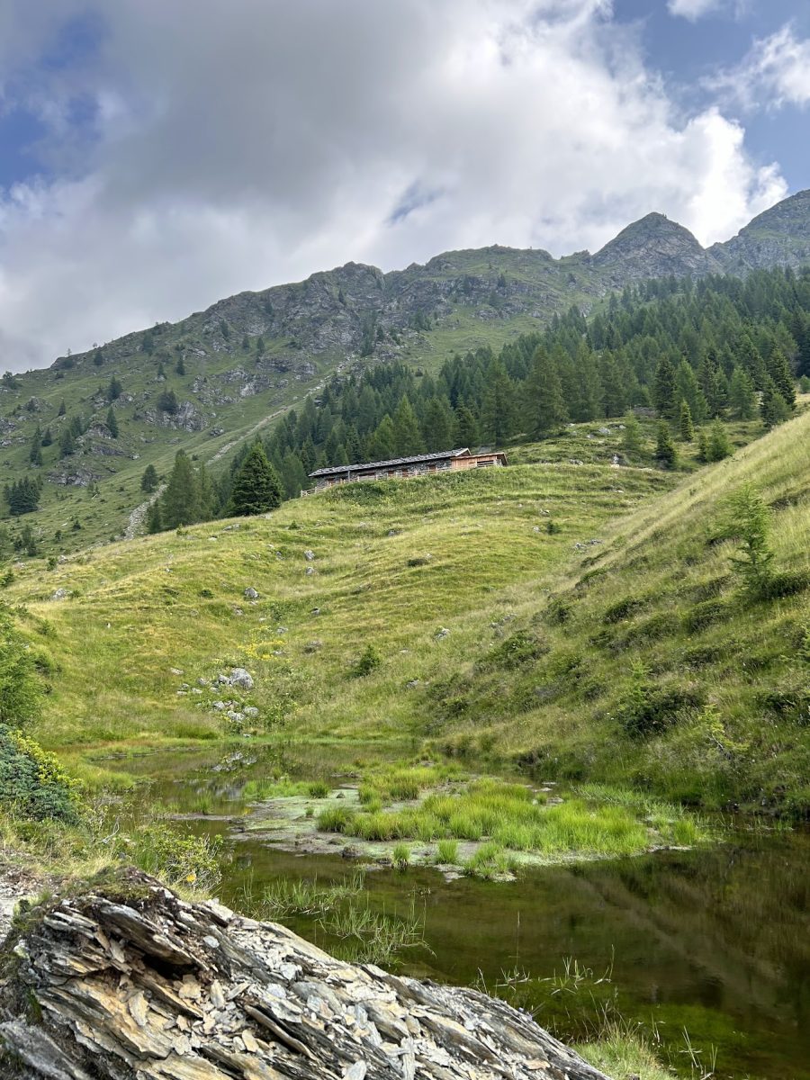
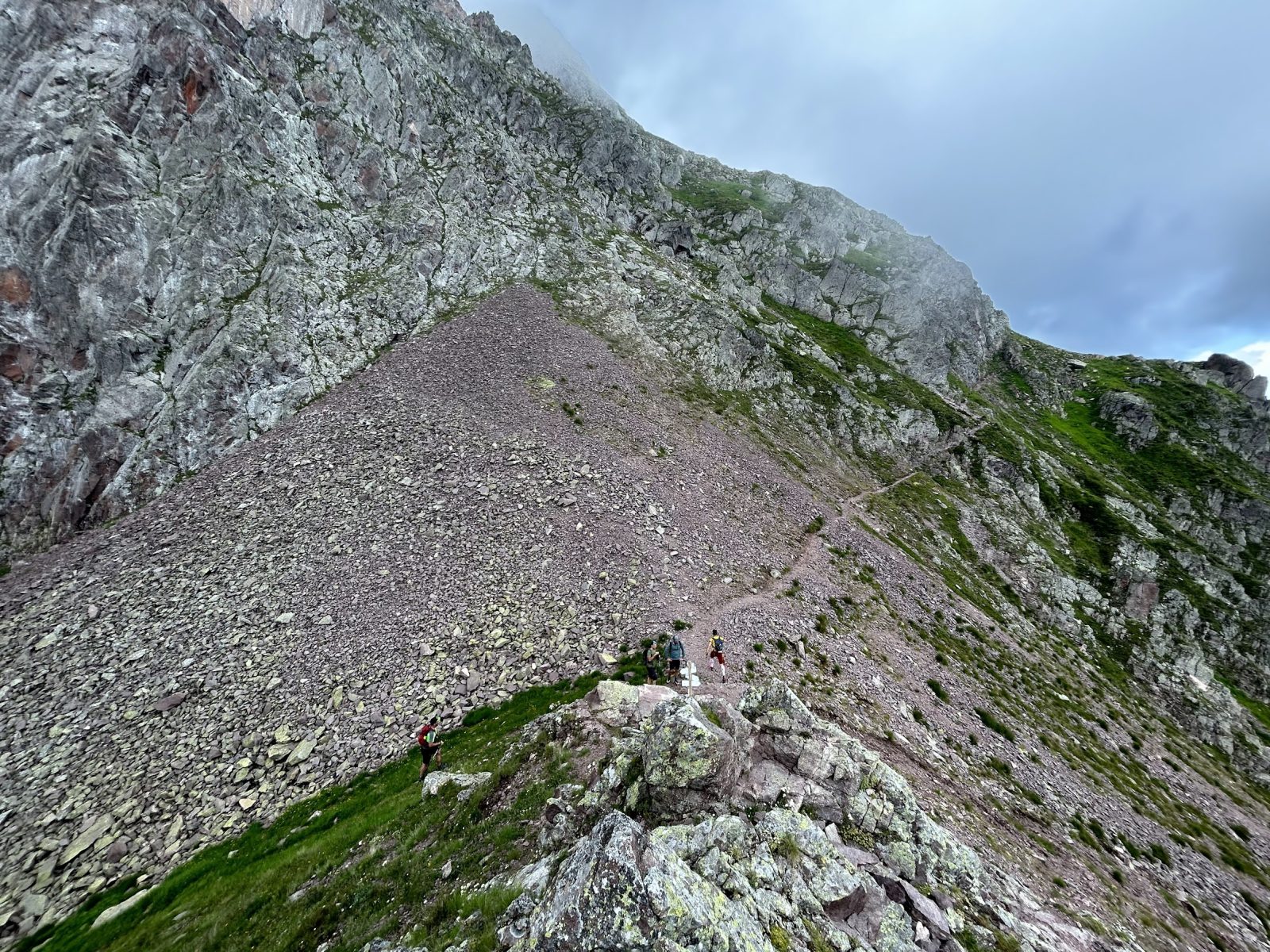
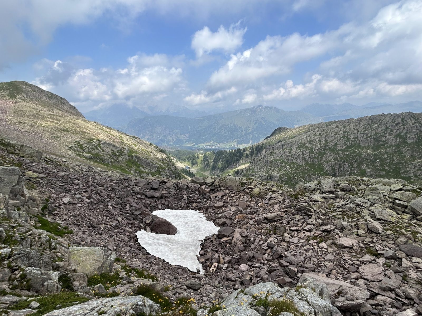
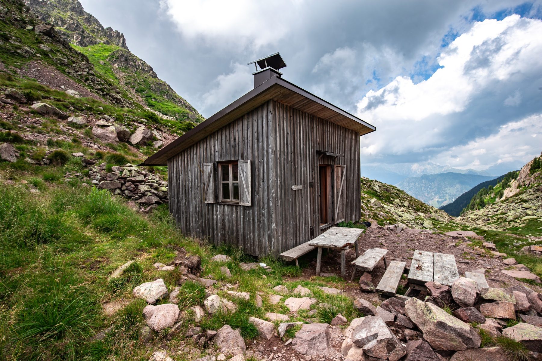
An uphill climb soon leads to rejoining the gravel road, shortly arriving first on the pastures of the hut of Malga Miesnòta di Mezzo / Vesnòta de Mèz and then on those of Malga Miesnòta di Sopra / Vesnòta de Sóra (1,870 m asl), unattended but set up with a bivouac. Situated on an enchanting alpine site at the foot of the peak of Cima di Cece / Cima Cece, the Malga lies in a meadowy basin between the gentle slopes of Monte Tabio, Cima di Cece and Cima Miesnòta, particularly rich in water and animals. The road gets lost on the pastures of the Malga, while the Signpost No. 336 proceeds on a smaller track in the direction of the fork of Forcella di Cece, visible in front to the right of the main peak, ascending the debris gully sunken between the rock walls, on traces that are not very visible on the ground but are always well marked, until it reaches the fork.
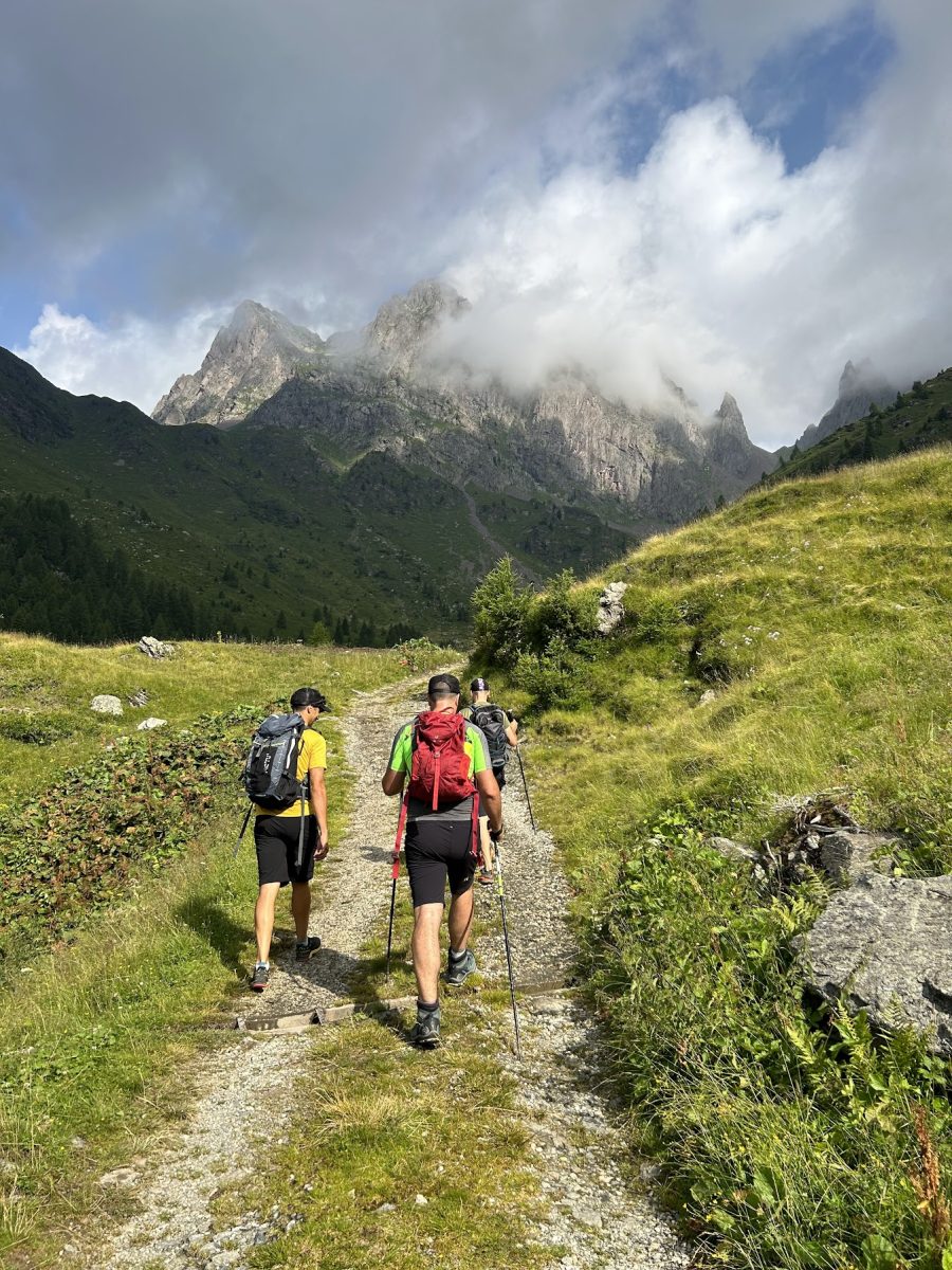
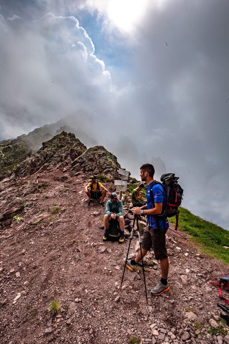
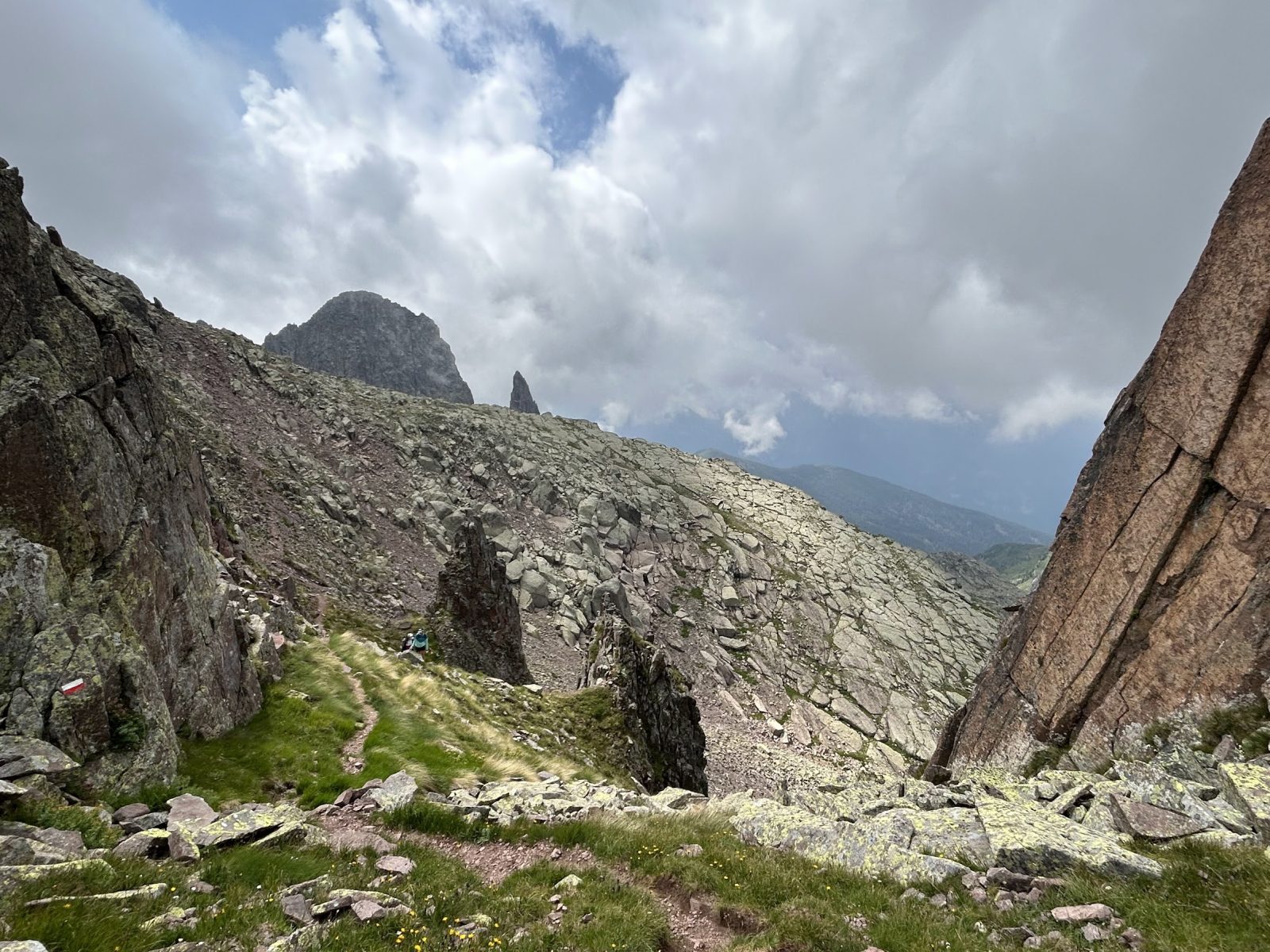
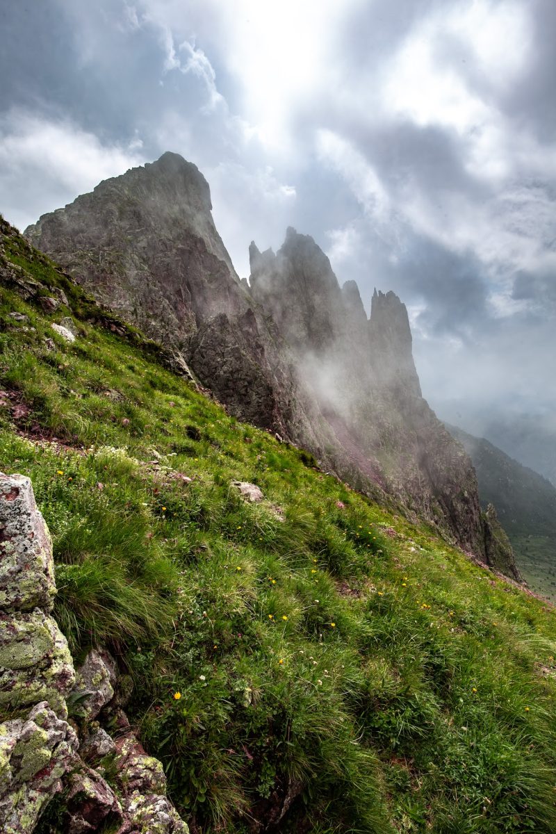
At Forcella di Cece (2,393 m asl) the itinerary continues along the main Signpost No. 349 “Achille Gadler”, part of the “Translagorai” trekking route, towards E, in the direction of Bivacco Paolo e Nicola / Forcella Valmaggiore, on the not very evident track that crosses the detrital slope under the rocks of the northern wall of Cima di Céce, aiming at the ridge connecting the peak of Cima di Céce (SE) with the one of Cima di Sella (NW), with a view downstream to the hamlet of Bellamonte. Once the trail rises to the base of a steep gully, it is recommended to approach the ramp leading to the ridge carefully; from the ridge, the path drops slightly, opening the view in front of it to the Palón di Céce and leading in a few minutes to the detour for the summit.
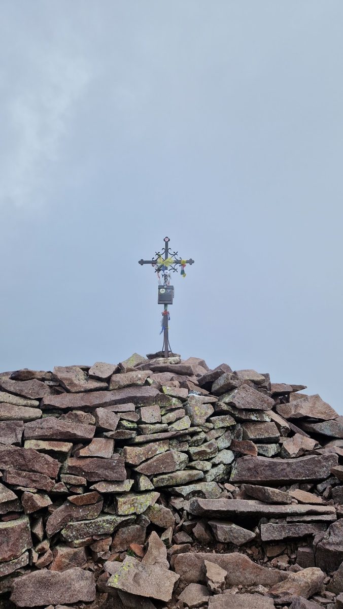
The summit can be reached in about 15 to 20 minutes, on a route that is easier uphill than downhill and requires special attention to the porphyry boulders, which are not always stable. Remnants of ladders from the Great War lead directly to the summit cross, near which numerous imperial remains are visible. From the summit (2,690 m asl) the spectacle is absolute; beyond the gentler slopes to the N are visible the Dolomites of the Valley of Fiemme, Catinaccio / Rosengarten, Sasso Lungo, Marmolada and Pale di San Martino / Pala Group; beyond the steep wall to the S the Valley of Vanoi lies, with the Vette Feltrine and the Massif of Cima d’Asta in the distance, while from E to W the Lagorai chain can be admired in its almost entirety.
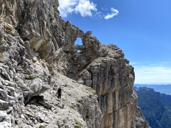
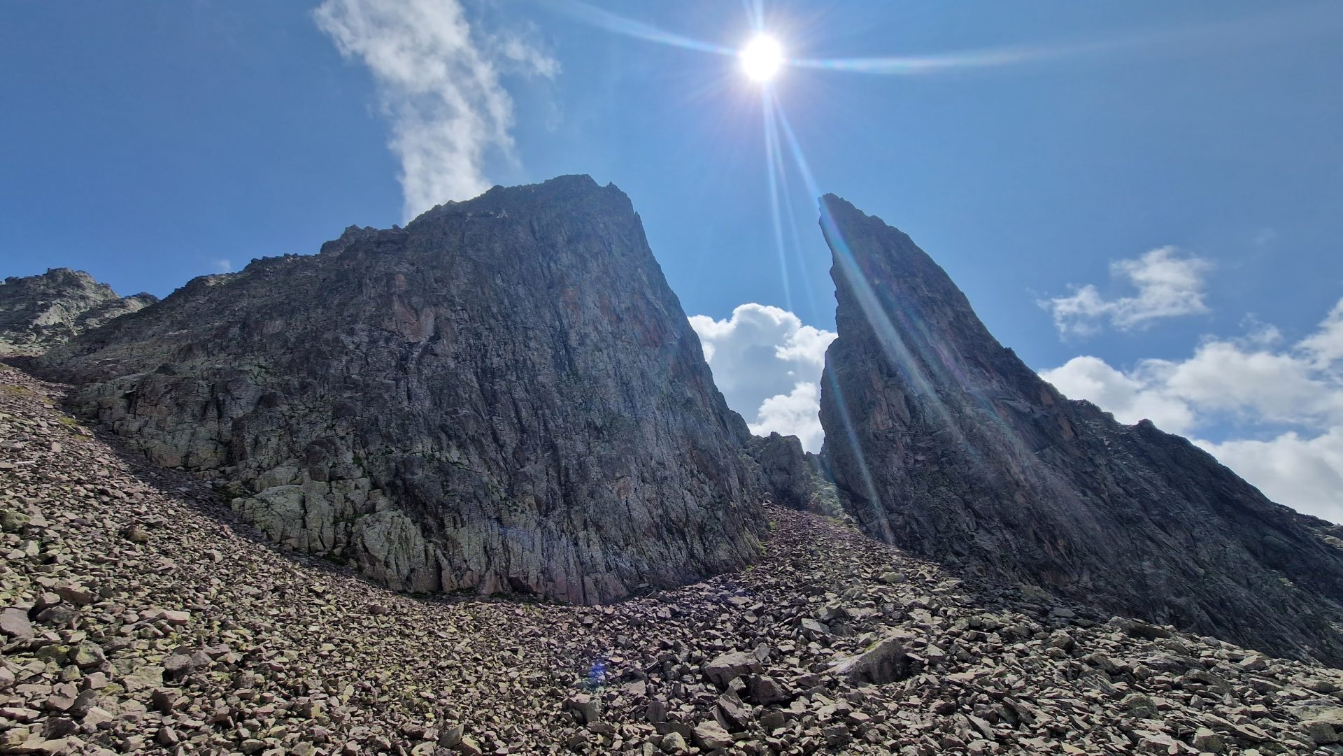
The itinerary continues on Signpost No. 349 “Achille Gadler”, which is clearly visible in the vast rocky basin overlooked by the elegant spire of the Campanile di Céce, bypassing a wide ridge and descending until it reaches the gap of Forcella di Valmaggióre (2,180 m asl), with the bivouac Paolo e Nicola.
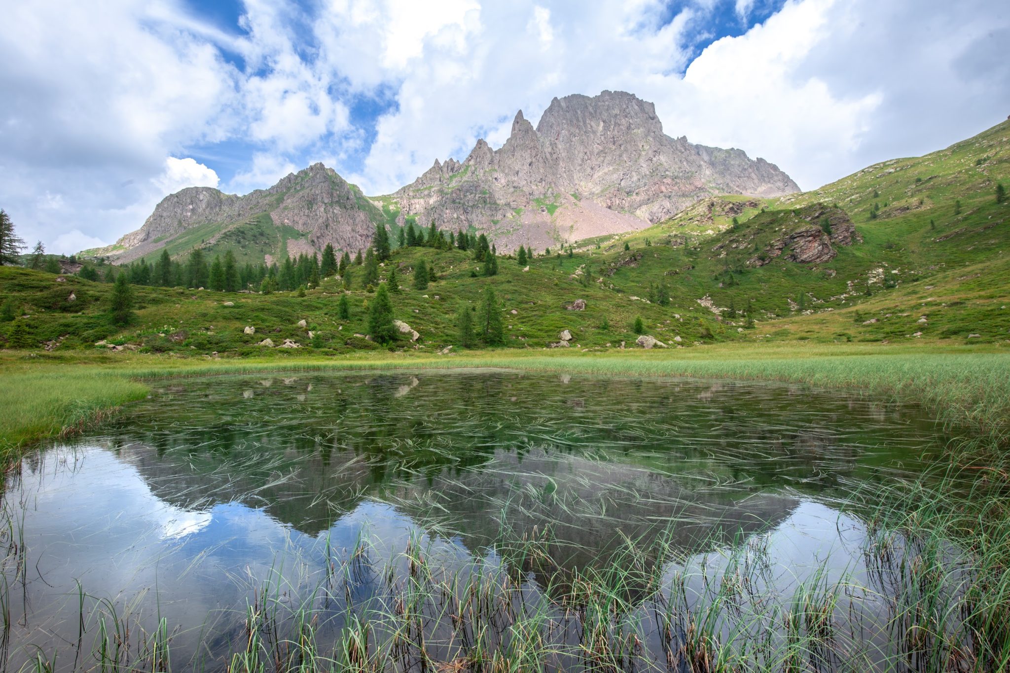
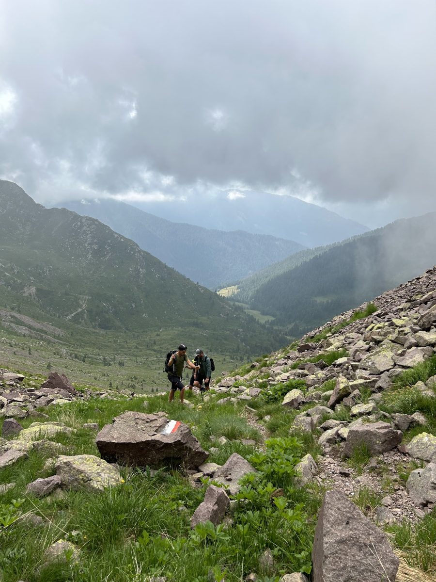
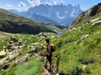
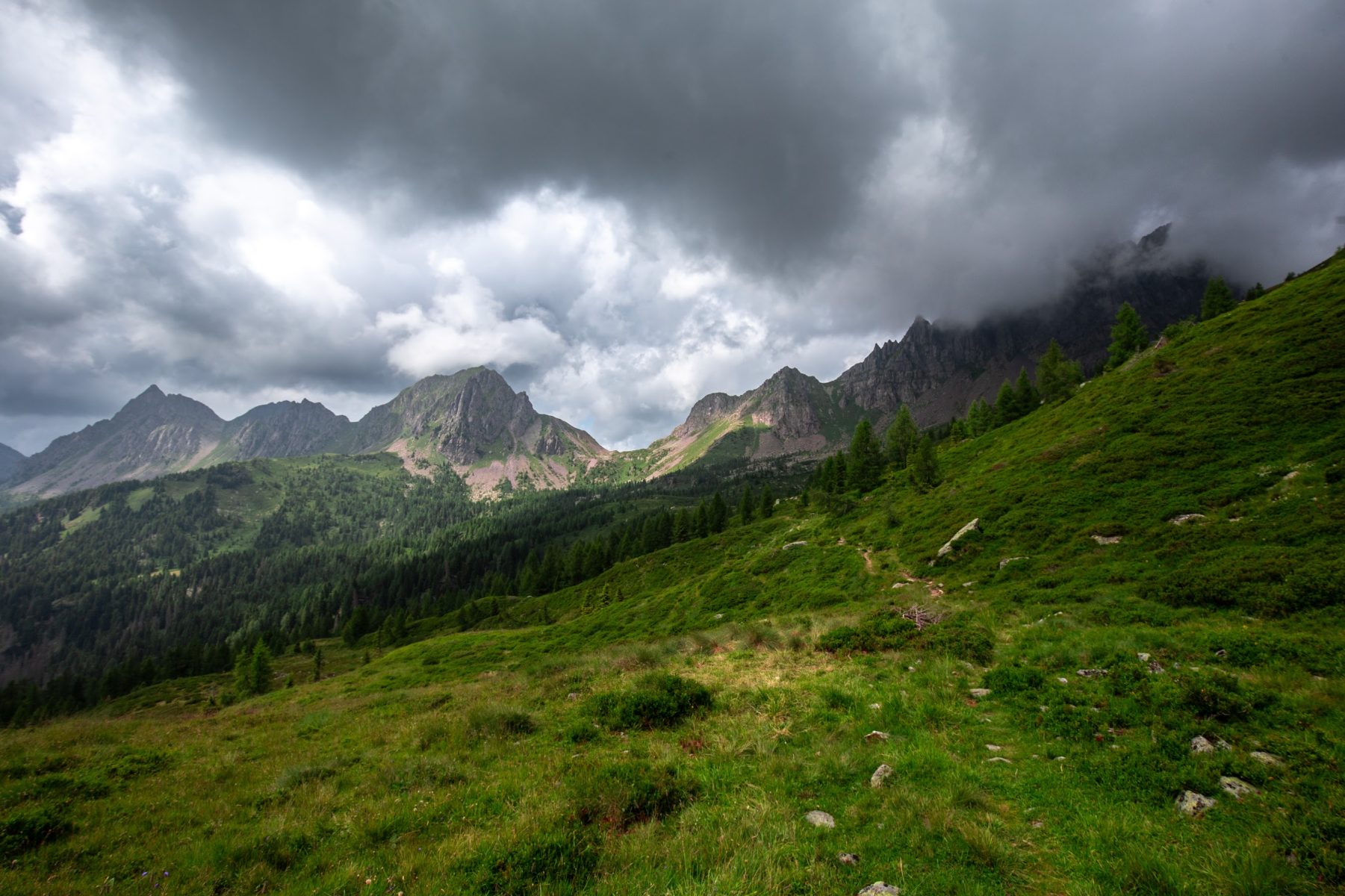
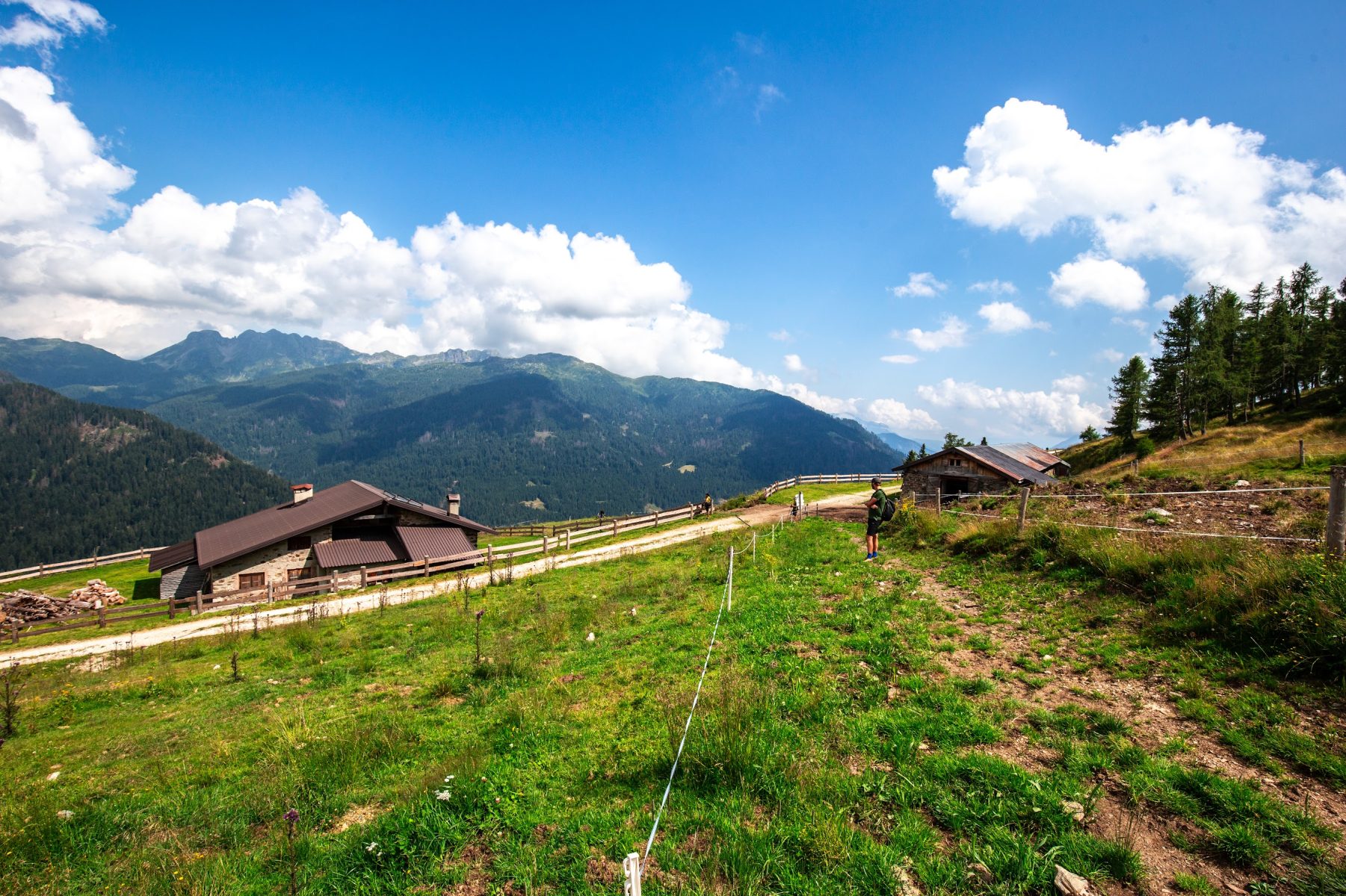
From the gap, the descent begins by initially following the path of the Signpost No. 335 towards Rifugio Refavaie, in a rather steep section that descends into the sparse larch and fir forest until it reaches the junction with the Signpost No. 388, which the route takes to the left toward Forcella Paradisi / Malga Fossèrnica di Fuori, on a slight up and down slope on the ridge that points straight toward the grassy summit of Cima Paradisi. The trail of the Signpost No. 388 proceeds initially through the woods and then comes out on the marshy plateau where the Coltorondo Lakes lie (2,044 m asl); a little paradise, with peaks sprouting to the N just behind the green ridge. The track then continues through pastures and rhododendrons with a wide panorama to the wide saddle of Forcella Paradisi (2,080 m asl), which it crosses to continue downhill – still along the Signpost No. 388 – on a comfortable grassy mule track that crosses a beautiful stretch of forest until it gets to the hut of Malga Fossèrnica di Fuori / Fosèrnega de Fóra (1,804 m asl).
From the Malga, a long return begins; in a little more than 5 km, you will be able to head back to Pont de Stél. Following the access road to the Malga in the direction of Masi di Valzanca / Ponte Stél, the descend proceeds on the tediously flat road, where it is possible to catch a glimpse in the valley – in the distance – of the hamlet near the bridge of Pont de Stél; it is precisely this glimpse, likened to a mirage given the mileage covered up to this point, that can turn the descent into a real test of mental stamina. Fortunately, after walking for kilometers with the feeling of never lowering in altitude, at the fifth hairpin bend it is possible to descend (on the left) along a beautiful path that allows you to cut the road and arrive at the location of Pian del Zot, from which it is sufficient to retrace the very first section of the itinerary and thus head back to Pont de Stél.
Paths
- From the bridge / location named Pont de Stél (1,128 m asl), go up the gravel road of the Signpost No. 336 toward Malga Miesnòta di Sopra / Forcella di Cece [1h 45],
- From Malga Miesnòta di Sopra (1,870 m asl), proceed along the path of the Signpost No. 336 toward Forcella di Cece [2h 45],
- From the fork of Forcella di Cece (2,393 m asl), continue on the trail of the Signpost No. 349 “Achille Gadler” toward E, in the direction of Bivacco Paolo and Nicola / Forcella Valmaggiore [3h 30],
- [VARIANT] Ascend to the summit of Cima di Cece (2,690 m asl) [4h 15],
- Continue on the Signpost No. 349 “Achille Gadler” until you reach Forcella di Valmaggióre / Bivacco Paolo e Nicola [5h 00],
- From the gap of Forcella di Valmaggióre (2,180 m asl), descend along the path of the Signpost No. 335 towards Rifugio Refavaie, then take the path on the left, along the Signpost No. 388, toward Forcella Paradisi / Malga Fossèrnica di Fuori, until getting to Malga Fossèrnica di Fuori (1,804 m asl), after crossing the wide saddle of Forcella Paradisi (2,080 m asl) [6h 30],
- From the hut of Malga Fossèrnica di Fuori (1,804 m asl), descend along the access road to the malga toward Masi di Valzanca / Ponte Stél, cutting the road on the left track that starts at the fifth hairpin bend and leads to the location of Pian del Zot [7h 45],
- From Pian del Zot (1,300 m asl), descend on the gravel road heading back to Pont de Stél [8h 00]. ✓
Best choices


Suggested hikes

- Demanding
Forks at Treviso
Canali Valley,Mis Valley,Pala Group
- Duration: 03:45 hrs
- Length: 6.2 km
- Elev. gain: 1900 m

- Demanding
Val de Stua
Lower Primiero,Vette Feltrine Range
- Duration: 05:30 hrs
- Length: 12.1 km
- Elev. gain: 1900 m


- Demanding
- Best choice
Leslie Stephen
Canali Valley,Pala Group,Upper Primiero
- Duration: 12:00 hrs
- Length: 29.5 km
- Elev. gain: 1900 m