Tour of the Arzon Group
Calaita - Forcella Fólga - Forcella Valsórda - Malga Valsorda Alta - Malga Tognòla - Cima Tognazza - Forcella Scanaiòl
Lagorai,Lower Vanoi,San Martino di Castrozza
aaron • 13/06/2020

Details
- Sport
- Hike
- Rating
- Difficulty
- Intermediate
- Duration
- 08:00 hrs
- Length
- 22.9 km
- Vertigo
- A little
- Min. elevation
- 1584 m
- Max. elevation
- 2235 m
- Elevation gain
- 1450 m
- Elevation loss
- 1450 m
- Car park
- View on Gmaps
Terrain
- 70%
- 30%
- Forest
- Grass
Seasons
- Jan
- Feb
- Mar
- Apr
- May
- Jun
- Jul
- Aug
- Sep
- Oct
- Nov
- Dec
Signposts
Description
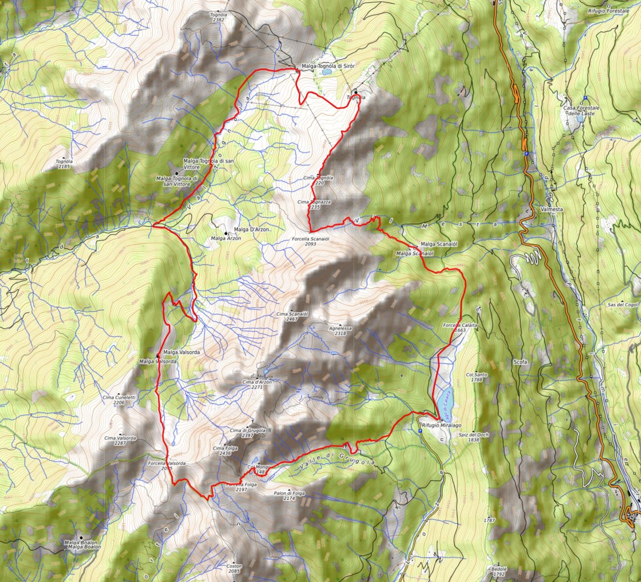
The itinerary goes around the Folga–Arzon–Scanaiòl massif, known also as Group of Cima Arzon. Located in the SE-most part with respect to the Lagorai mountain range, the Group of Cima Arzon – which has in the summit of Cima Folga (2,436 m asl) its highest peak – represents one of the few sectors of the Southern Alps where the oldest crystalline basement of the Central-Southern Alps of metamorphic rock emerges, on which calcareous-dolomitic strata were subsequently deposited. Conventionally, this group is linked and classified together with the (larger) mountain range of Lagorai.
Like all the classics trails within the Lagorai, this is a very long yet beautiful route, among green forest trees, wide open areas, huts, mountain gaps and ridges, presenting spectacular sights both on the porphyria rocks of Lagorai and on the dolomitic ones of Pale di San Martino.
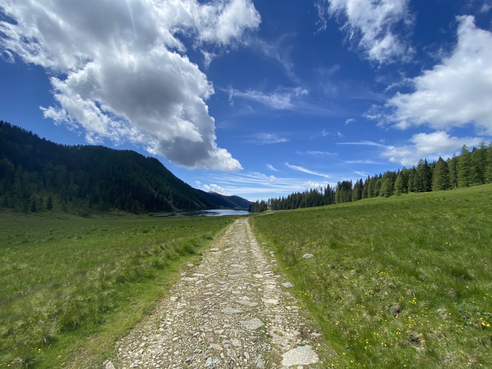
The starting location is by the lake of Calaita (1,621 m asl), which can be easily accessed with your own vehicle. The very first stretch of the hike descends for about 200 m along the main access road to the hut placed beside the lake (i.e. Rifugio Miralago Calaita), for then taking the gravel road on the right, pointing O, towards the hut of Malga Grugola. After crossing the crossroads with the Signpost No. 347, after about 600 meters along the road, the route takes the Signpost No. 358, uphill, still towards Malga Grugola.
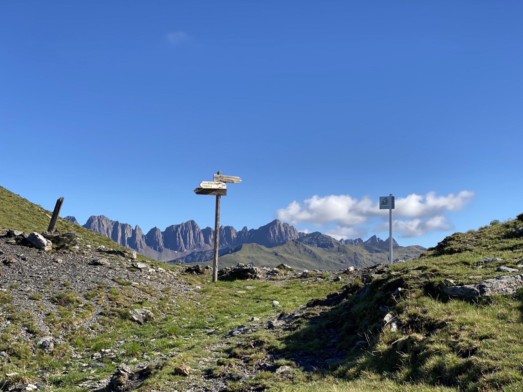
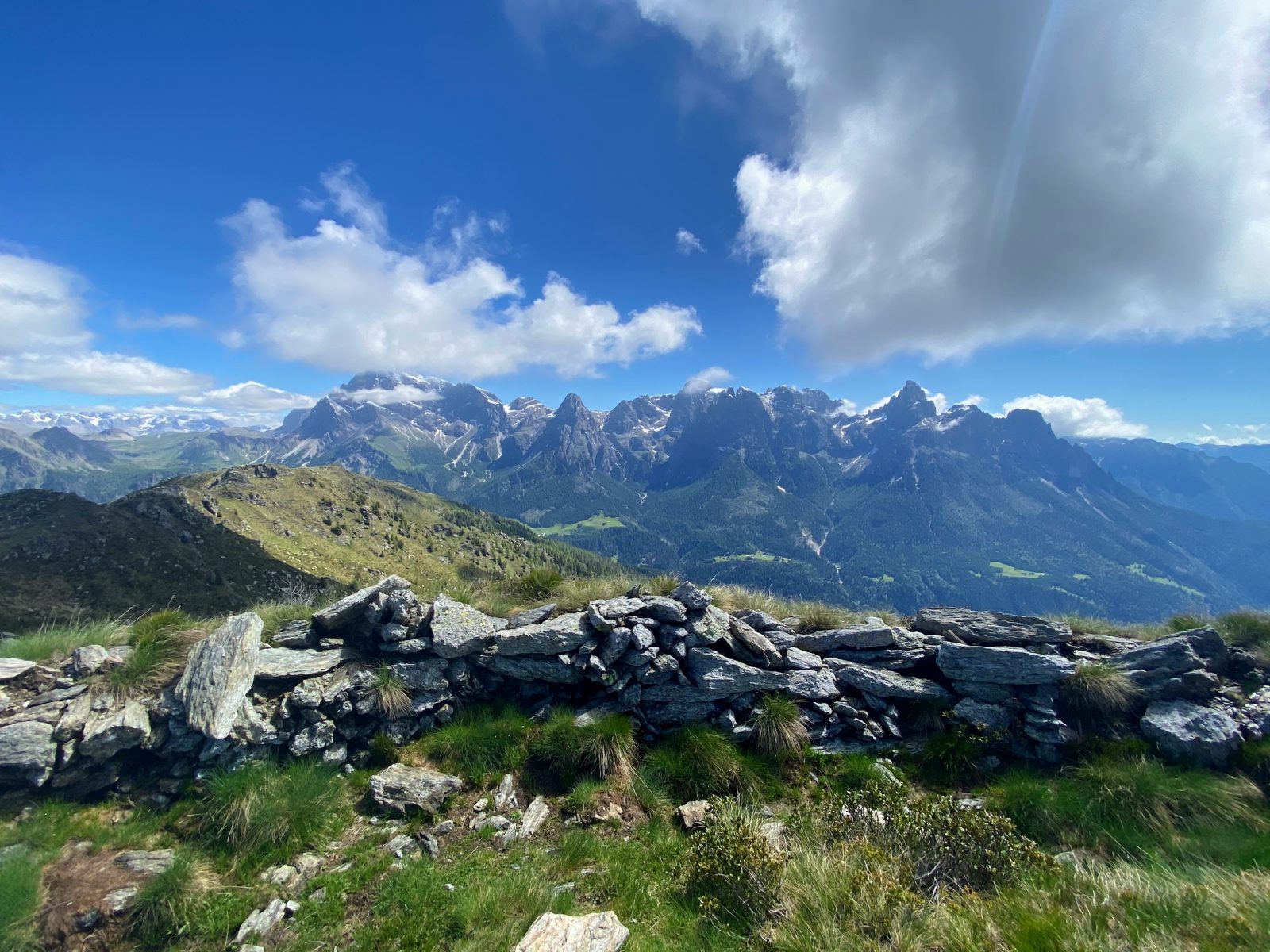
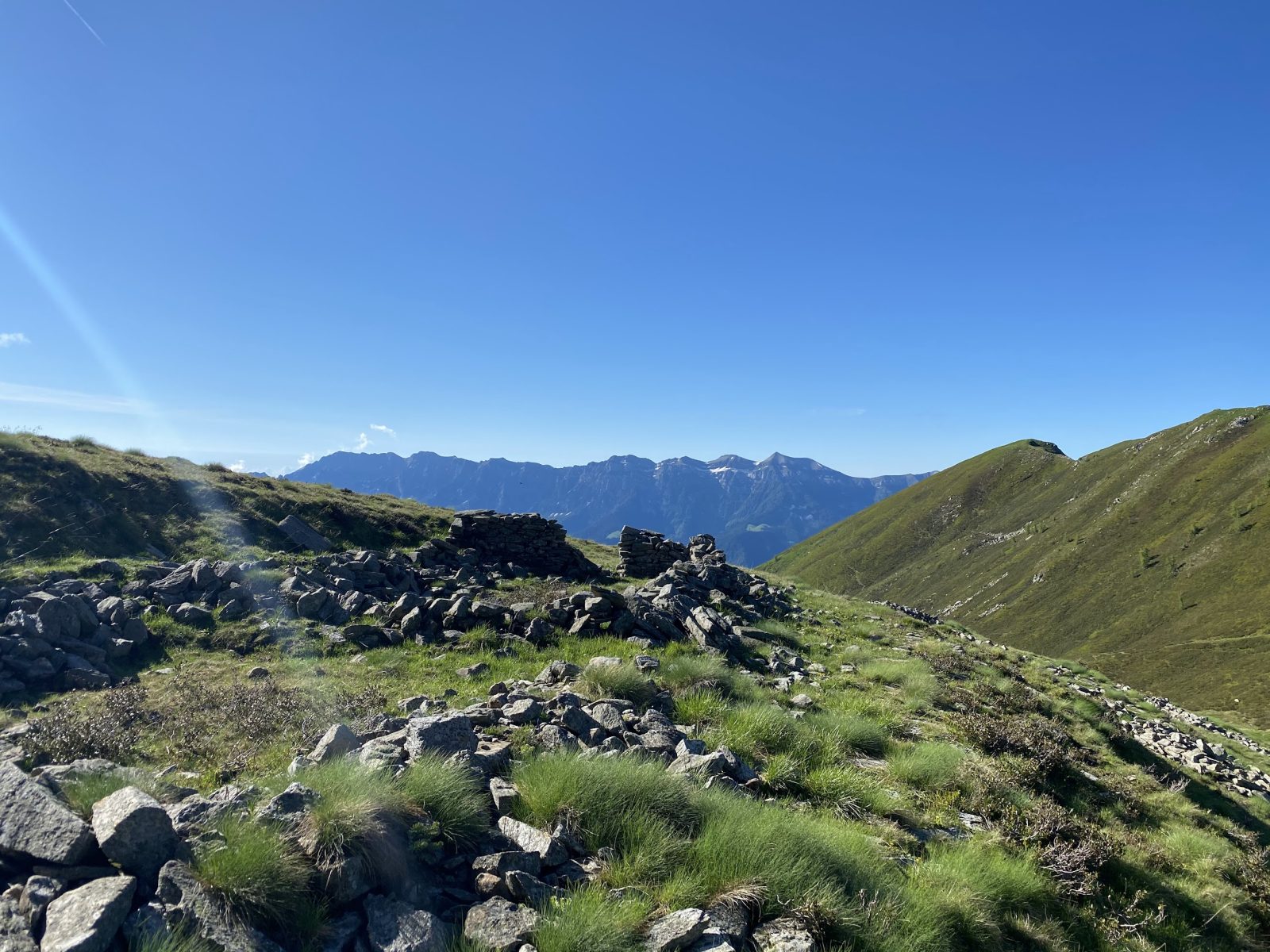
Once arrived at Malga Grugola (1,782 m asl), the track continues, by still following the Signpost No. 358 towards the mountain gap called Forcella Folga. From Forcella Folga (2,197 m asl) – and for all the entire stretch that follows – you can enjoy a beautiful view towards the peak of Cima d’Asta and all the mountain range of Vette Feltrine. From the gap, take the visible Signpost No. 347 to the W which, after a first downhill stretch, leads to another mountain gap called Forcella Valsorda (2,094 m asl), crossing some basins with remains of pastures and huts, including some trenches of the Great War which are clearly visible from Forcella Valsorda. At the gap, a beautiful panorama on the E part of the Lagorai mountain range, with the peaks of Colbricon, Ceremana and Bragarolo that stand out in the distance opens up.
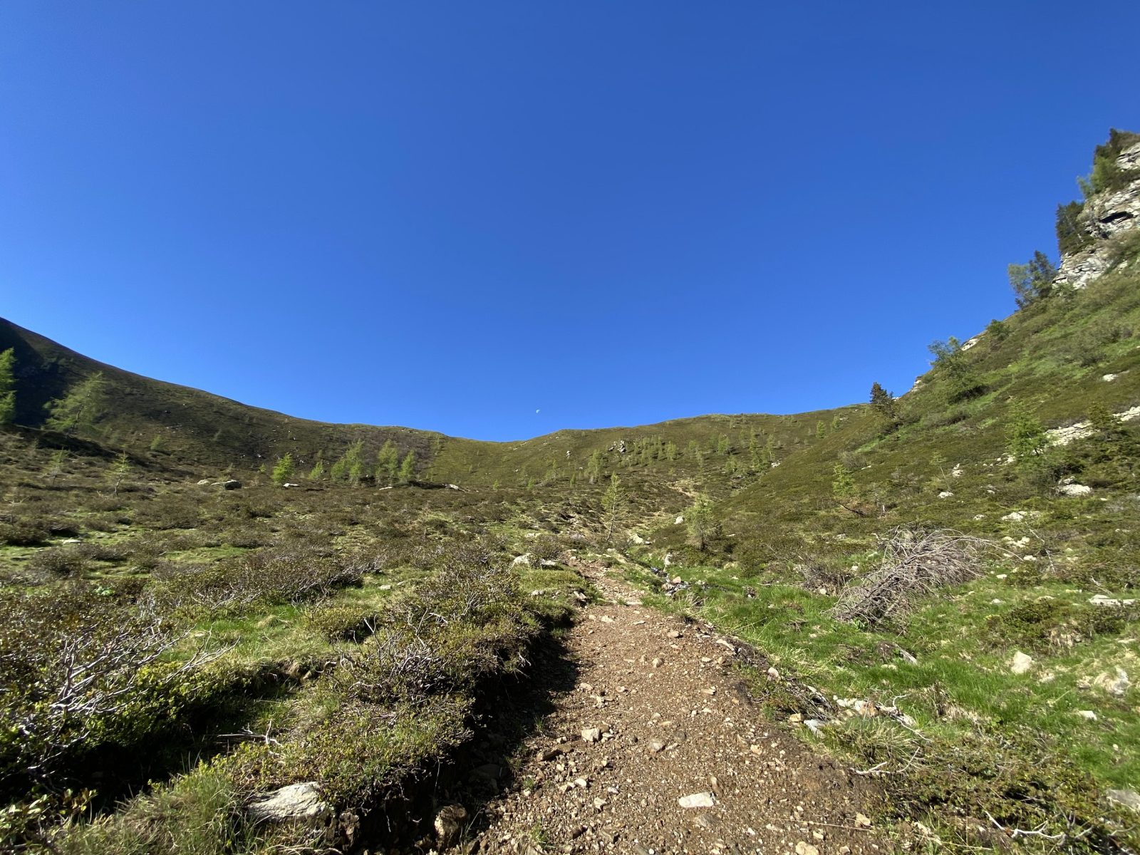
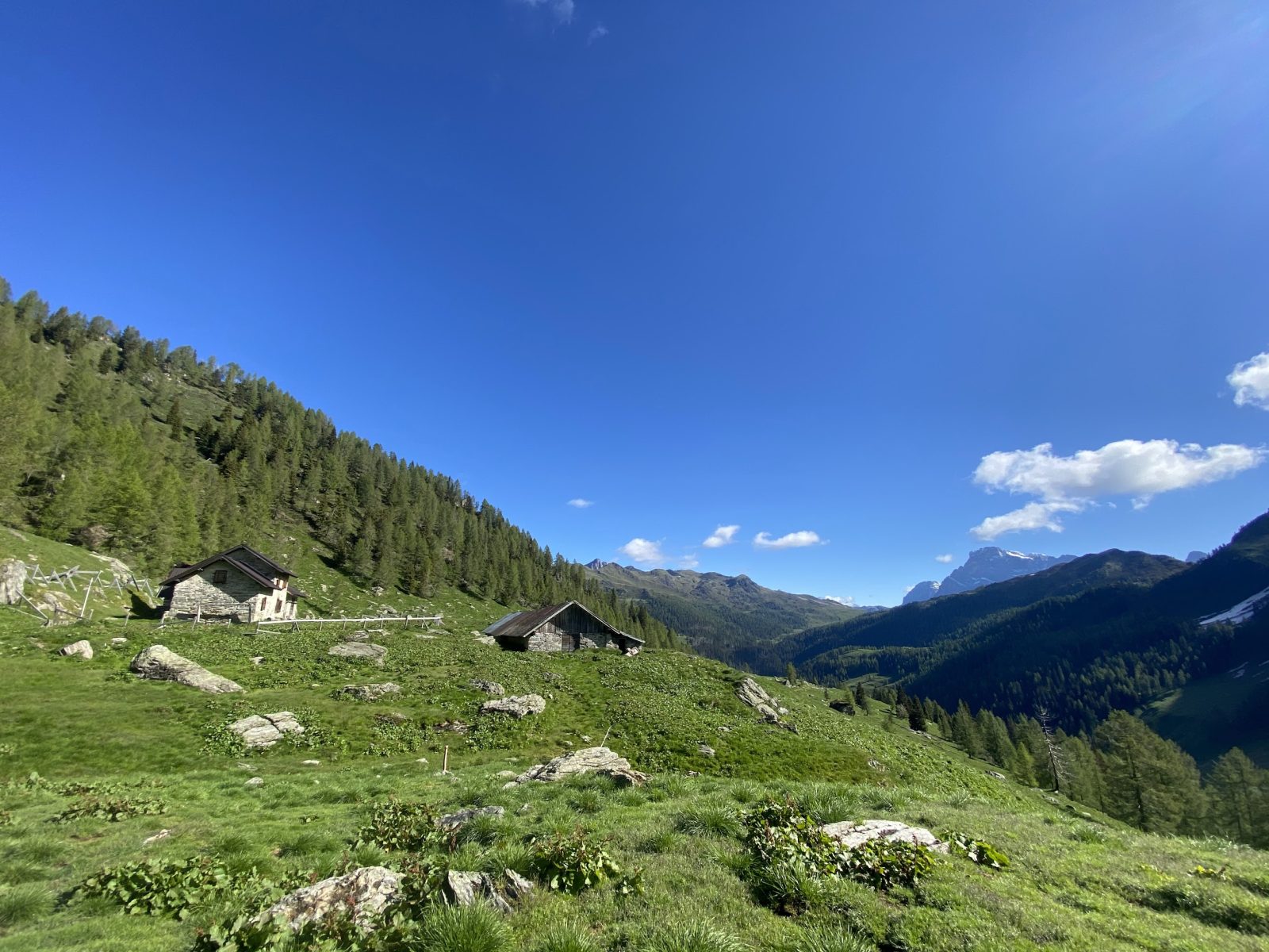
After crossing the gap of Forcella Valsorda, the route starts descending along the Signpost No. 390 towards the hut of Malga Valsorda Alta (1,918 m asl). From the hut, the trail continues downhill on the old access road to the building, clearly visible and marked, which follows the bed of the stream named Rivo Valsordetta. As a side note, during this stretch it is important to keep the riverbed as a reference, since the trail detaches from the road on a couple of instances. Once you reach the stream of Rio Tognola, which flows into the Rivo Valsordetta to shape the Rio Valsorda, near a wooden bridge where the hut of Valsorda stands (1,543 m asl – lowest point of the itinerary), the ascent begins along the SIgnpost No. 352 towards Malga Tognòla di Sirór, which develops on the orographic right of stream of Rio Tognola. After overtaking the crossroads with the path to Malga Tognòla di San Vittore, continue along the Signpost No. 352 with the forest that slowly disappears for the open areas of Alpe Tognola. Once at the base of the Scandola ski lift, the trail goes up the slope a bit, arriving at Malga Tognòla di Sirór (1,990 m asl), with a last flat stretch. Malga Tognòla is located in the heart of the ski lifts and the view that opens onto the dolomites of Pale di San Martino is simply amazing.
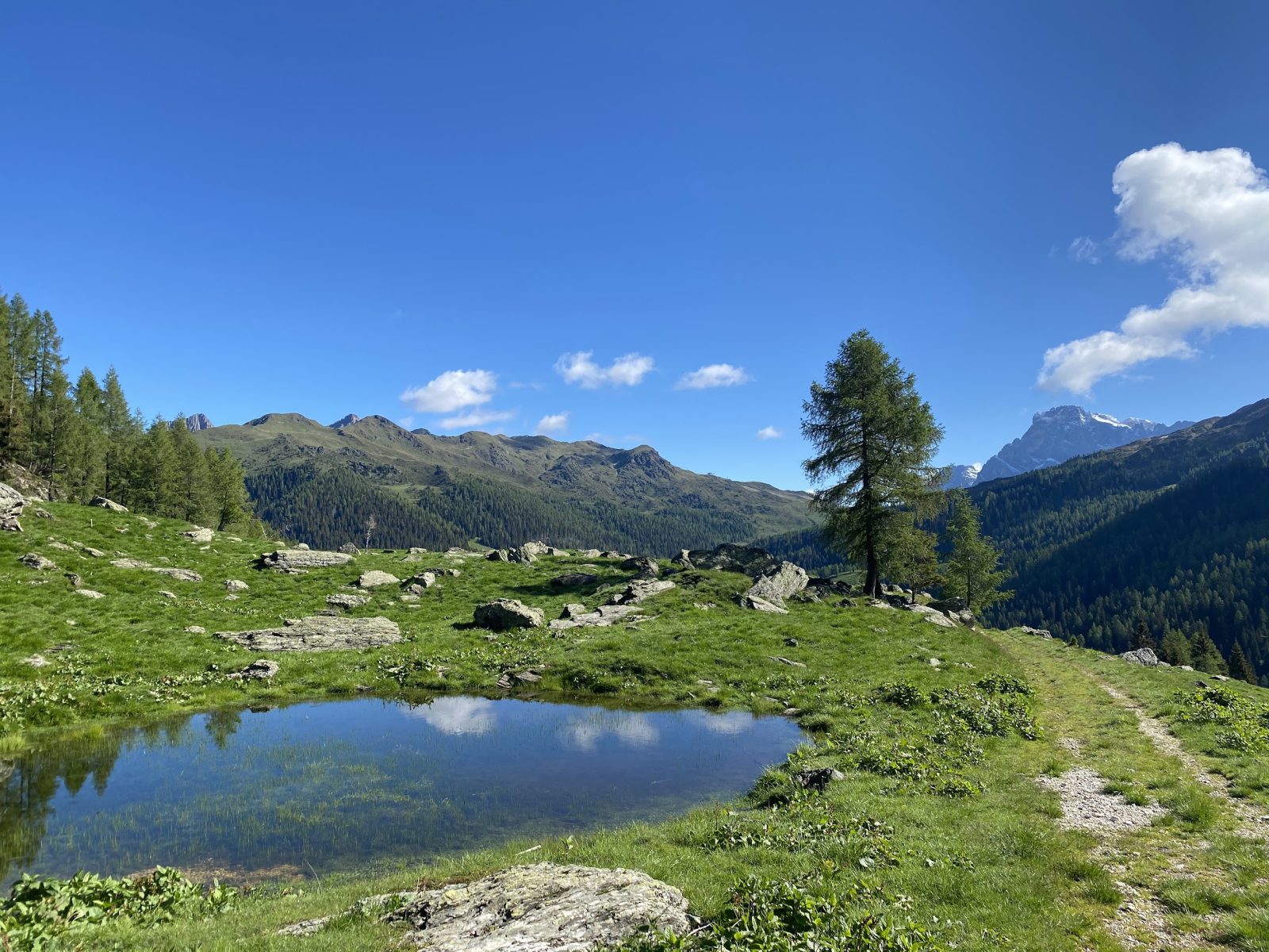
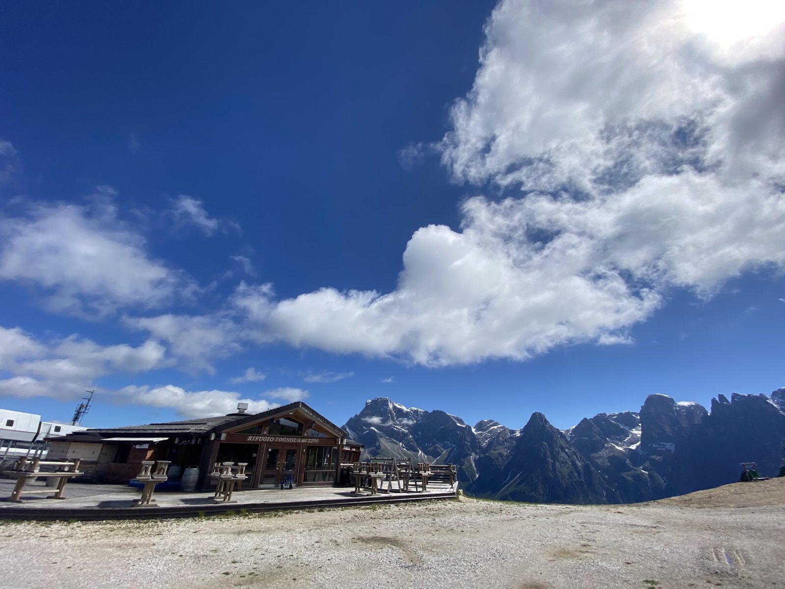
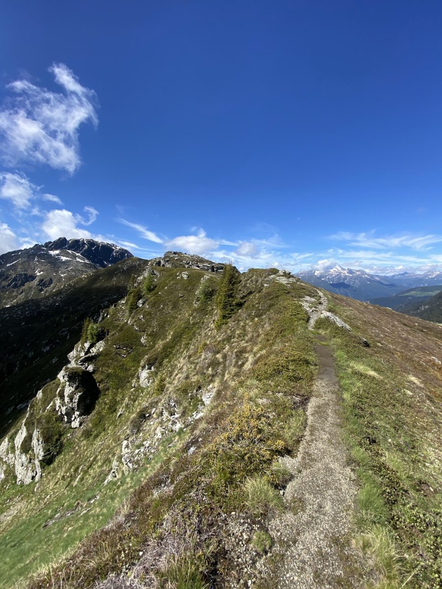
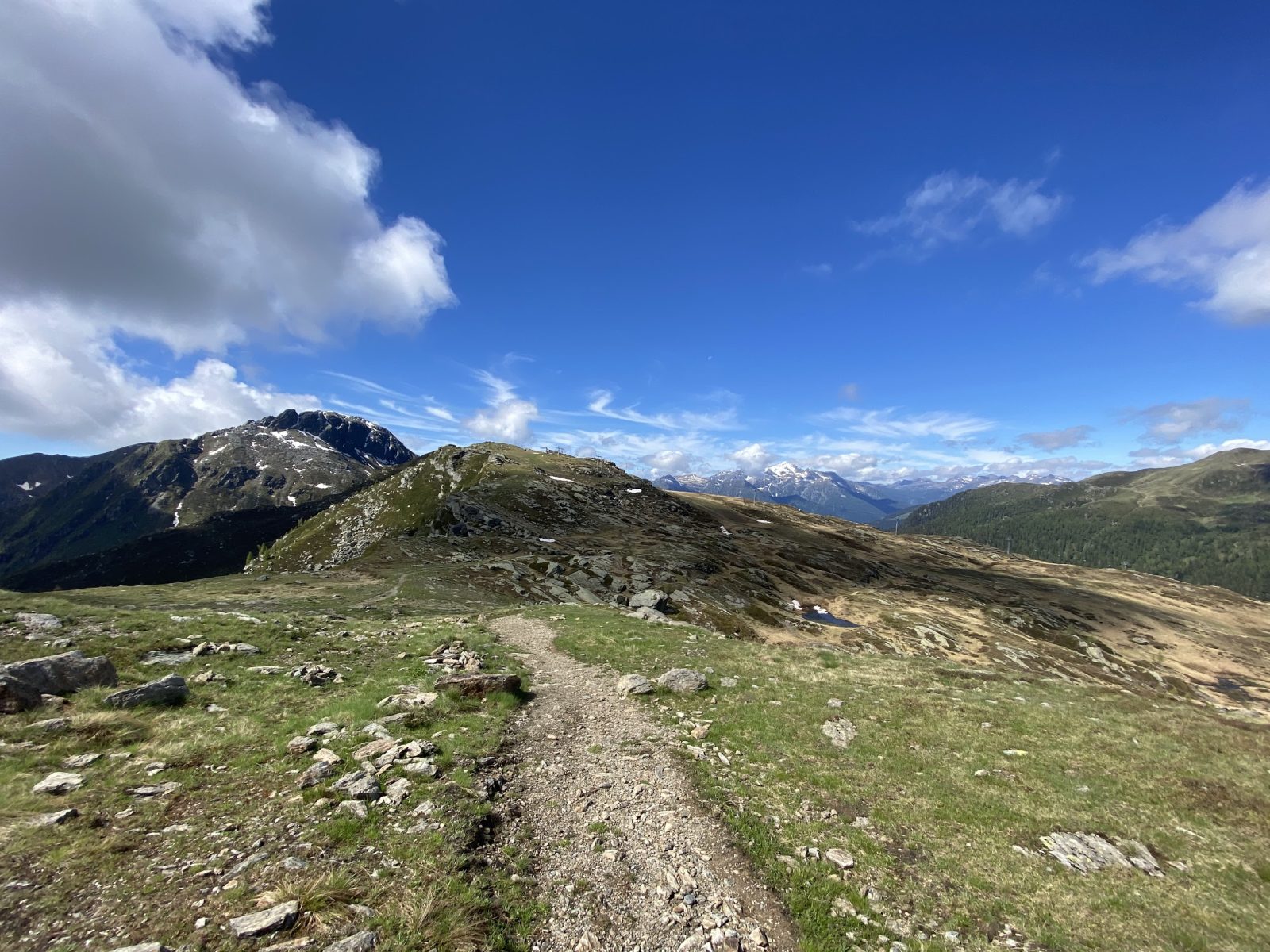
From Malga Tognòla, the route continues by taking the forest road that climbs the meadows towards the hut of Rifugio Tognòla (2,163 m asl), already visible from Malga Tognòla on the ridge to the SE. From Rifugio Tognòla (2,143 m asl) the path continues south along the ridge formed by the peaks of Tognòla and Tognazza, from which you can admire a unique panorama, with the Pale di San Martino to the left, Cima Scanaiòl in front and a good part of the chain of Lagorai and the valley on the right. The path on the ridge to Forcella Scanaiòl is well marked and leads to the gap passing through the summit of Cima Tognazza (2,235 m asl).
From the gap of Forcella Scanaiòl (2,093 m asl), the route returns to Calaita descending to the left, E direction, towards Malga Scanaiòl, which can be reached in about 20 minutes after passing through a very suggestive rough open area, along a path that in 3 km it leads directly to the lake of Calaita (Signpost No. 350), with a very last stretch on the basin from which the beautiful view of the lake opens.
Paths
- From Calaita (1,621 m asl), take the Signpost No. 358 towards Malga Grugola / Forcella Folga, passing by the hut of Malga Grugola (1,782 m asl) [1h 45],
- From Forcella Folga (2,197 m asl), take the Signpost No. 347 towards Forcella Valsorda [2h 15],
- From Forcella Valsorda (2,094 m asl), take the Signpost No. 390 downhill along the Rivo Valsordetta to the Valsorda hut, passing by the hut of Malga Valsorda Alta (1,918 m asl) [3h 45],
- From the Valsorda hut (1,543 m asl), ascend along the Signpost No. 352 towards Malga Tognòla di Sirór [5h 15],
- From Malga Tognòla di Sirór (1,990 m asl), follow the gravel road to the hut of Rifugio Tognòla [5h 45],
- From Rifugio Tognòla (2,163 m asl), continue south along the ridge to the gap of Forcella Scanaiòl, meeting the peak of Cima Tognazza (2,235 m asl) [6h 45],
- From Forcella Scanaiòl (2,093 m asl), descend towards Calaita, passing by Malga Scanaiòl [8h 00]. ✓


Suggested hikes

- Demanding
Forks at Treviso
Canali Valley,Mis Valley,Pala Group
- Duration: 03:45 hrs
- Length: 6.2 km
- Elev. gain: 1450 m

- Demanding
Val de Stua
Lower Primiero,Vette Feltrine Range
- Duration: 05:30 hrs
- Length: 12.1 km
- Elev. gain: 1450 m


- Demanding
- Best choice
Leslie Stephen
Canali Valley,Pala Group,Upper Primiero
- Duration: 12:00 hrs
- Length: 29.5 km
- Elev. gain: 1450 m