Four Via Ferrata
Colverde - Ferrata della Vècia - Ferrata Nico Gusella - Ferrata del Portón - Ferrata del Velo
Pala Group,San Martino di Castrozza
gian • 17/08/2019


Details
- Sport
- Hike
- Rating
- Difficulty
- Demanding
- Duration
- 09:30 hrs
- Length
- 19.0 km
- Vertigo
- Extreme
- Min. elevation
- 1515 m
- Max. elevation
- 2680 m
- Elevation gain
- 1680 m
- Elevation loss
- 1680 m
- Car park
- View on Gmaps
Terrain
- 30%
- 70%
- Forest
- Rock
Seasons
- Jan
- Feb
- Mar
- Apr
- May
- Jun
- Jul
- Aug
- Sep
- Oct
- Nov
- Dec
Signposts
Description
This itinerary develops on a rather unusual route, although it passes through some of the most visited places of the Dolomites of Pale di San Martino. The track is proposed to those who are expert hikers and love the Via Ferrata of the Dolomites. Due to its length (19 km), the four via ferrata – two of which are quite demanding – that it crosses and a total shift of more than 1,500 m, we are strongly suggesting to not so experienced hikers to simply avoid it.
The route, which starts from San Martino di Castrozza, after a first simple section, will lead hikers straight in the middle of some of the most beautiful places and tracks of the range of Pale di San Martino and in general of the Dolomites, forming a loop that develops clockwise around the peak of Cima di Ball (2,802 m asl), named after the famous Irish naturalist, politician and mountaineer John Ball who, in 1869, together with his partner Leslie Stephen, conquered the summit.
In the description of the route, some detours are indicated, which will provide hikers some shortcuts, in the event that the weather conditions are not forgiving or the physical shape does not allow them to complete the route.
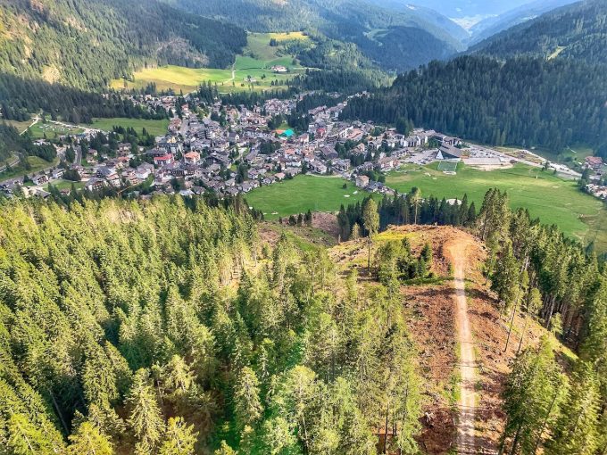
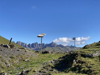
The route starts from the location of Colverde, north of the village of San Martino di Castrozza, where the gondola leading to the peak of Rosetta starts. The first stretch takes place along the comfortable gravel road of Signpost No. 702. After about a kilometer and a half, at the first crossroads, the track continues along the Signpost No. 721, one of the classic routes – in our opinion the most beautiful and technical – accessing the hut of Rifugio Velo della Madonna. Along this stretch, you will pass at the bottom of the magnificent Val di Roda, along a path that is never too steep, between the shade of the forest and the beginning of the rocks, which leads, in about an hour and a half, to the start of the first via ferrata, named “Ferrata della Vècia” (Signpost No. 739B).
Leaving the path that leads to Rifugio Velo della Madonna, helped by the many stirrups present in the via ferrata, you climb the steep wall of what will be the shortest and easiest via ferrata of the day. The “Ferrata della Vècia” will allow you to get to the foot of a long gravelly slope that points straight towards the Portón opening (2,526 m asl), a watershed of a chain that cannot be crossed but that will be found a few hours later towards the end of the hike.
From the mountain gap called Forcella Portón (2,460 m asl) the loop around Cima di Ball begins. Leaving the Signpost No. 739B, continue left, westwards, on the Signpost No. 714 which, after passing on the gap of Forcella delle Féde (2,550 m asl), leads to the gap of Forcella Stephen (2,680 m asl), a scenic pass between the peaks of Cima di Ball and Cima di Val di Roda (2,791 m asl). The last stretch of ascent approaching Forcella Stephen along the upper Val di Roda is one of the riskiest stretches of the route, as there are no protections and you walk on rocks with red marks acting as signposts. The gap offers an excellent sight, on which you can stop for a break, before descending along the gully to the east which, closed between two beautiful walls, leads directly to the gap of Passo di Ball (2,443 m asl), along the “Ferrata Nico Gusella”. The equipped stretch of “Nico Gusella” is not to be considered demanding or exposed, but being approached downhill it turns out to be a little bit technical.
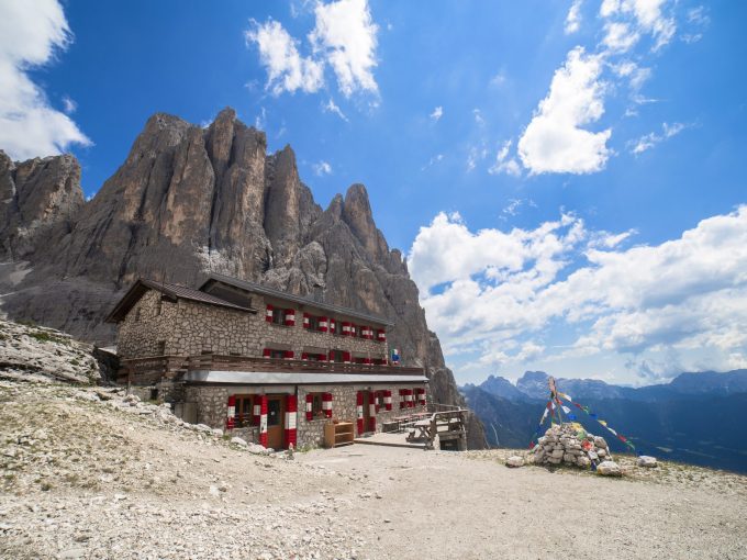
From Passo di Ball, the route continues towards the hut of Rifugio Pradidali on a simple downhill section, which leads to the hut in about 20 minutes. Once at Rifugio Pradidali (2,278 m asl), you will be about halfway along the route and, since the most demanding part is missing, we advise you to evaluate whether to return to the starting point. As an information, by following the Signpost No. 715 to the north (called Sentiero attrezzato del Passo di Ball), it is possible to return to San Martino di Castrozza along the path called Barone Von Lessler, thus shortening the route and avoiding the more technical part of it.
From Rifugio Pradidali, continue along the Signpost No. 739A towards Rifugio Velo della Madonna. Shortly after a stretch of technical path on rock and gravel, which descends on a steep gully overlooking the Val Pradidali, you will reach the attack point of “Ferrata del Portón”, the most demanding stretch of the tour, which begins vertically on the eastern wall of Cima di Ball. The first section of the ferrata is vertical and exposed, at times overhanging, but incredibly panoramic. Once the equipped section is finished, you will feel almost out of this world, closed in a steep and landslide gully that you will have to carefully climb up to get (once again) to the gap of Forcella Portón.
From Forcella Portón (2,460 m asl) there is yet another via ferrata. At this point, the loop around Cima di Ball is over and all that remains is to continue on the Signpost No. 739 and descend along the via ferrata called “Ferrata del Velo”, crossing the base of the magnificent north face of the peak of Cima della Madonna (2,803 m asl).
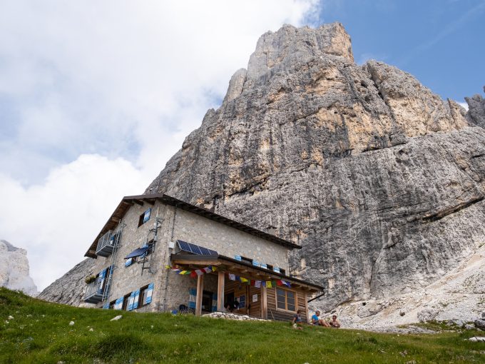
Once at the hut of Rifugio Velo della Madonna, you will only have to get back to San Martino di Castrozza, going down along Signpost No. 713 to the ruins of the hut of Malga Sóra Rónz. From the hut, continue along the Signpost No. 724 towards San Martino di Castrozza, which leads to the location of Còl. After crossing the torrent that descends from Val di Roda, and consequently reached the Rifugio Forestale (1,551 m asl), turn right, towards the north, along a short uphill stretch that will allow you to join the gravel road already traveled at the beginning of the hike: the Signpost No. 721. The road will lead you comfortably back to the starting point, by Colverde.
Paths
- From the departure of the Colverde gondola, in the village San Martino di Castrozza, follow the Signpost No. 702 towards Rifugio Velo della Madonna [0h 20],
- After just over a kilometer and a half, take the Signpost No. 721 towards Rifugio Velo della Madonna, passing through Val di Roda [2h 45],
- Take the via ferrata called “Ferrata della Vècia”, marked as Signpost No. 739B, towards Forcella Portón [3h 15],
- From the gap of Forcella Portón (2,460 m asl), take the path called “Ferrata Nico Gusella”, marked as Signpost No. 714, towards Forcella Stephen, passing by the gap of Forcella delle Féde (2,550 m asl) [4h 15],
- From the gap of Forcella Stephen (2,680 m asl), descend along the via ferrata of the Signpost No. 714. Then, at Passo di Ball (2,451 m asl), take the Signpost No. 715 towards Rifugio Pradidali [4h 45],
- From the hut of Rifugio Pradidali (2,278 m asl), take the via ferrata called “Ferrata del Portón”, marked as Signpost No. 739A, towards Rifugio Velo della Madonna / Forcella Portón [5h 45],
- From the gap of Forcella Portón (2,460 m asl), take the via ferrata called “Ferrata del Velo”, marked as Signpost No. 739, until reaching the Rifugio Velo della Madonna [6h 30],
- From the hut (2,358 m asl), descend along the Signpost No. 713 to the ruins of Malga Sóra Rónz, then continue along the Signpost No. 724 to San Martino di Castrozza / Col [7h 45],
- After crossing Val di Roda, once you reach the hut of Rifugio Forestale (1,551 m asl), take the short uphill stretch to take the Signpost No. 721, which leads you directly to the starting point [9h 30]. ✓
Waypoints


Suggested hikes

- Demanding
Forks at Treviso
Canali Valley,Mis Valley,Pala Group
- Duration: 03:45 hrs
- Length: 6.2 km
- Elev. gain: 1680 m

- Demanding
Val de Stua
Lower Primiero,Vette Feltrine Range
- Duration: 05:30 hrs
- Length: 12.1 km
- Elev. gain: 1680 m


- Demanding
- Best choice
Leslie Stephen
Canali Valley,Pala Group,Upper Primiero
- Duration: 12:00 hrs
- Length: 29.5 km
- Elev. gain: 1680 m