Hiking at Rifugio Velo della Madonna
San Martino di Castrozza - Val di Ròda - Rifugio Velo della Madonna - Lasta Moia - Malga Civertaghe
Pala Group,San Martino di Castrozza
andrej • 20/09/2019


Details
- Sport
- Hike
- Rating
- Difficulty
- Intermediate
- Duration
- 05:30 hrs
- Length
- 13.5 km
- Vertigo
- A little
- Min. elevation
- 1375 m
- Max. elevation
- 2358 m
- Elevation gain
- 1000 m
- Elevation loss
- 1000 m
- Car park
- View on Gmaps
Terrain
- 45%
- 10%
- 40%
- 5%
- Forest
- Grass
- Rock
- Urban
Seasons
- Jan
- Feb
- Mar
- Apr
- May
- Jun
- Jul
- Aug
- Sep
- Oct
- Nov
- Dec
Signposts
Description
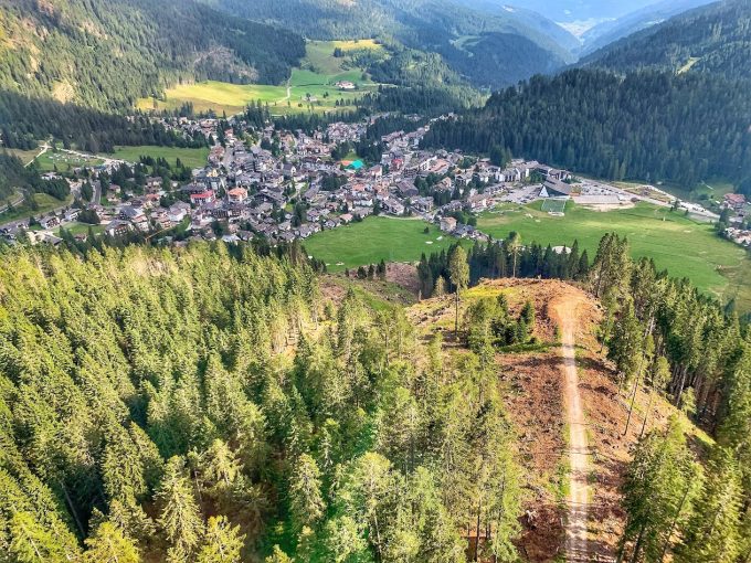
This classic hike to Rifugio Velo della Madonna starts and ends in the center of the village of San Martino di Castrozza, which travels both classic access routes to the hut (Signpost No. 721 and Signpost No. 713 “Lasta Moia”), drawing a loop-like itinerary. The route, presented here in a clockwise direction, can also be approached in a counterclockwise direction, although we think the direction proposed here is better as it tackles the more technical stretch while ascending and returns on the more classic access trail to the Rifugio.
From San Martino di Castrozza (1,487 m asl), the route starts heading towards Maso Col / Fontanelle; before arriving at the hotel of Maso Col, it takes the beautiful Signpost No. 724 “Val di Roda” that climbs up the grassy slope to the left of the paved road toward Col.
The route then climbs towards the meadows of Prati Col where, shortly after an old ruin in the middle of the meadow, it continues by following the signs towards Rifugio Velo della Madonna keeping to the left (to the right would lead directly to Malga Civertaghe), taking a flat section of trail through the woods that enters the valley named Val di Roda.
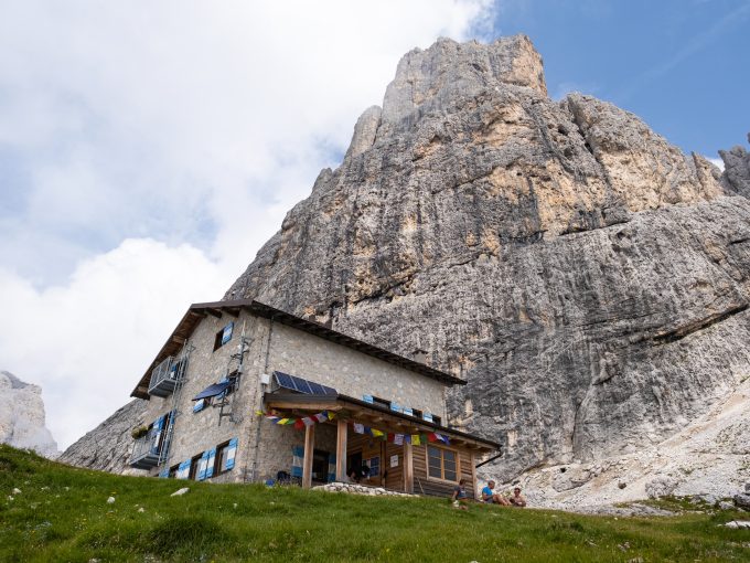
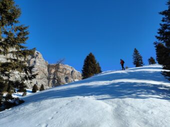
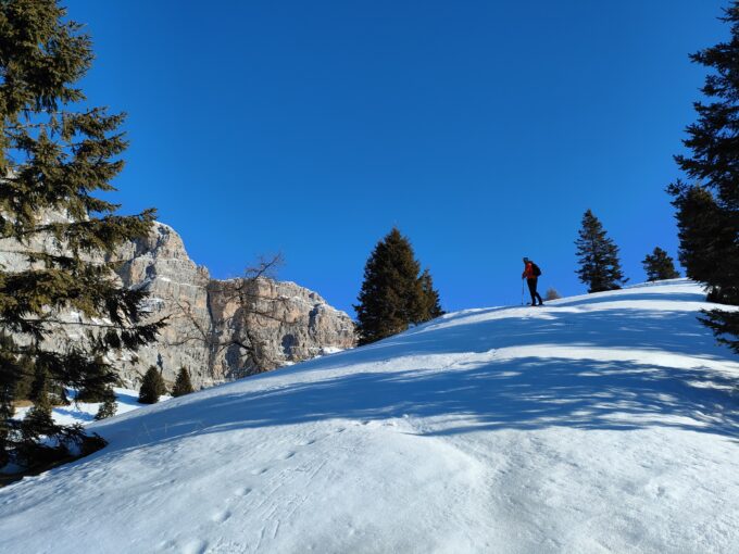
The trail continues along the scenic stretch of path until it reaches the hut of Rifugio Forestale (1,551 m asl), where the route continues on the path of the Signpost No. 721, which, after crossing the stream bed, quickly takes you up to altitude on the orographic left of Val di Roda, below the imposing wall of the the summit of Val di Roda. The trail continues its ascent among scree and mugo trees, then traverses at high altitude, at the edge of the forest, the rocky base of the summit. After passing the crossroads with the Via Ferrata della Vecia (Signpost No. 739B) in the gully called Cadin de Sora Rónz, the route reaches the junction with the path of the Signpost No. 713, which it takes to the left towards Rifugio Velo della Madonna. From the junction, the route soon arrives first at the “Cadinòt” (2,280 m asl) and then at Rifugio Velo della Madonna, overlooked by the peak of Cima della Madonna, with its elegant and famous “Spigolo del Velo”.
Strategically located on a plateau, from the Rifugio (2,358 m asl) it is possible to admire a beautiful panorama of San Martino di Castrozza, the northernmost part of the Lagorai and the nearby peaks of Madonna and Stanga.
The return from the hut follows in its entirety the path of the Signpost No. 713 “Lasta Moia”, downhill, towards Malga Civertaghe. The descent, in its first part, requires special attention on the rocky passage of the oblique and often wet ledge (Lasta Moia), equipped with wire ropes. Once past the passage, the trail descends into the Val de la Vècia forest, arriving first at the start of the Rifugio cable car, near the hut of Malga Sora Rónz and then, after a short stretch on a gravel road, at the hut of Malga Civertaghe (1,373 m asl).
From Malga Civertaghe, the itinerary returns to San Martino di Castrozza following the “Sentiero Forestale Civertaghe” (Signpost No. 23) toward N, which enters the forest of the lower Val di Ròda slightly uphill, toward San Martino di Castrozza. After crossing the stream of Rio Val di Ròda, a last short uphill climb brings you back to the meadows of Prati Còl, where the itinerary retraces backwards, leading directly to the center of San Martino di Castrozza.
Paths
- From San Martino di Castrozza (1,487 m asl), head towards Maso Col / Fontanelle [0h 20],
- From the hotel of Maso Col, ascend along the trail of the Signpost No. 724 toward Col, then proceed to the hut of Rifugio Forestale [1h 00],
- From Rifugio Forestale (1,551 m asl), take the path of the Signpost No. 721 uphill towards Rifugio Velo della Madonna / Via Ferrata della Vecia, up to the junction with the Signpost No. 713 “Lasta Moia,” then follow the Signpost No. 713 towards Rifugio Velo della Madonna [3h 00],
- From Rifugio Velo della Madonna (2,358 m asl), descend along the path of the Signpost No. 713 “Lasta Moia” to Malga Civertaghe [4h 45],
- From the hut of Malga Civertaghe (1,373 m asl), go N along the Signpost No. 23 “Sentiero Forestale Civertaghe” to Prati Còl, then head back to San Martino di Castrozza [5h 30]. ✓
Waypoints
Best choices


Suggested hikes

- Demanding
Forks at Treviso
Canali Valley,Mis Valley,Pala Group
- Duration: 03:45 hrs
- Length: 6.2 km
- Elev. gain: 1000 m

- Demanding
Val de Stua
Lower Primiero,Vette Feltrine Range
- Duration: 05:30 hrs
- Length: 12.1 km
- Elev. gain: 1000 m


- Demanding
- Best choice
Leslie Stephen
Canali Valley,Pala Group,Upper Primiero
- Duration: 12:00 hrs
- Length: 29.5 km
- Elev. gain: 1000 m