Ferrata Dino Buzzati – Camillo Depaoli
Fósne - Monte Cimèrlo - Stanga - Rifugio Velo della Madonna - Camillo Depaoli
aaron • 18/07/2020


Details
- Sport
- Hike
- Rating
- Difficulty
- Intermediate
- Duration
- 05:30 hrs
- Length
- 10.6 km
- Vertigo
- A lot
- Min. elevation
- 1339 m
- Max. elevation
- 2550 m
- Elevation gain
- 1200 m
- Elevation loss
- 1200 m
- Car park
- View on Gmaps
Terrain
- 40%
- 10%
- 50%
- Forest
- Grass
- Rock
Seasons
- Jan
- Feb
- Mar
- Apr
- May
- Jun
- Jul
- Aug
- Sep
- Oct
- Nov
- Dec
Notes
- Ferrata
- Loop
Signposts
Description
Often mistakenly called “le tre Pale” (tr. the three Pala), from the bottom of the Primiero Valley their view impresses many visitors of Fiera di Primiero. In contrast to the very famous Tre Cime di Lavaredo (tr. Lavaredo Three Peaks), which are standing alone, the three peaks that can be seen from the bottom of the valley are simply three of the southernmost peaks of the vast Dolomite block of Pala Group and are – from O to E – the Cima della Madonna, Sass Maór and Monte Cimèrlo. The perspective from the bottom of the valley is biased; in fact, the peaks are placed from N to S and are not connected (between Cimèrlo and Cima della Madonna there is the peak of Stanga). Monte Cimèrlo is the southernmost peak of the three, as well as the lowest. This itinerary leads to the top of Monte Cimèrlo, the only peak of the three that can be reached without any climbing skill, by going up the Via Ferrata Dino Buzzati and then descending along the path of Camillo Depaoli.
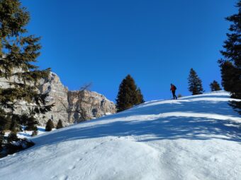
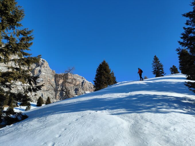
The route starts from the location of Fósne, in the upper Val Canali, where there is also a small parking lot located on the side of the paved road, just before the scenic pastures of Prati Fósne, in the location of Sorapiana. After a few hundred meters slightly uphill on the paved road, you reach the crossroads of Prati Fósne (1,374 m asl), where the route continues on the right, towards the NE, along the path of the Signpost No. 731 which climbs along the edge of the wide meadow towards Cimèrlo / Forcella dei Cistri. The path is clear and well marked; following the signs for the Ferrata Dino Buzzati, the route leaves the Signpost No. 731 to take the steep track of the Signpost No. 747 on the right. This track climbs through the forest called Bosco Cimèrlo, with the vegetation that gradually leaves space to the mountain pine, then becoming increasingly sparse on the edge of the scree that runs through the entire S side of Cimèrlo. The route then leads out of the vegetation and starts featuring countless small spiers.
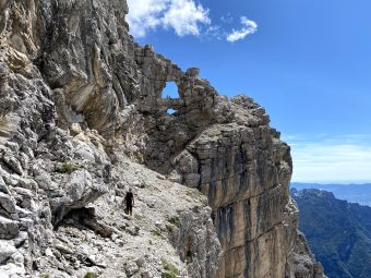
The Via Ferrata Dino Buzzati begins near a saddle, at about 2,100 m of altitude. The first straight section with no excessive slopes is followed by the passage that leads to the small gap of Forcelletta Belvedere, which is followed by a vertical section that leads to a spier. The most spectacular passage of the Dino Buzzati is the safely equipped deviation on the exposed external wall (which replaces the narrow historic passage now in disuse). After this passage, the Via Ferrata ends at the wide shoulder above (2,300 m asl). The route then continues following the track which, going up the sunny meadows of the SE shoulder of Monte Cimèrlo, leads to a gap located on the E of the summit. From here it is also possible to follow a visible track on the ground (not signposted) which, with a detour of about 15 ‘, leads to the summit of Monte Cimèrlo (2,505 m asl).
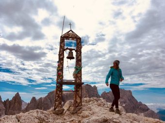
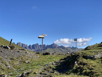
From the gap the itinerary goes down, always along the Signpost No. 747, in a non dangerous section where it is anyhow necessary to be careful. After the descent, you reach the ridge that separates the peaks of Cimèrlo and Stanga. The ridge is extremely panoramic, overlooking the Val Pradidali on the right (side E) and the upper Primiero Valley towards San Martino di Castrozza on the left (side W). After crossing the ridge, once reached the junction with the Signpost No. 742 “Sentiero del Cacciatore” (tr. Path of the Hunter), the route proceeds by ascending the Signpost No. 747 towards Cima Stanga / Rifugio Velo della Madonna. With a final stretch of ascent you reach Cima Stanga (2,550 m asl), where the view over the peaks of Sass Maór and Cima della Madonna in the foreground is simply spectacular.
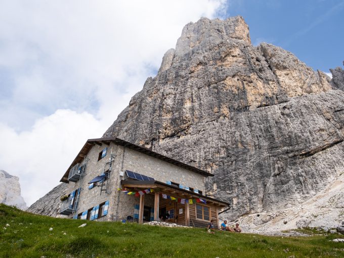
From Cima Stanga, the path proceeds downhill and quickly gets to the hut of Rifugio Velo della Madonna (2,358 m asl), being already visible from the top by looking towards the NW. From the hut, the itinerary continues descending along the Signpost No. 713 “Lasta Moia” to the crossroads of Cadinòt (2,280 m asl). From the crossroads, the route proceeds along the Signpost No. 734A “Camillo Depaoli” towards Col dei Cistri / Fósne / Piereni. The path “Camillo Depaoli”, although with modest difficulty, is equipped in the first part and then it gradually flattens out, taking on a long stretch of descent cutting the SW walls of Monte Cimèrlo. After this long stretch, the itinerary reaches the gap of Forcella Col dei Cistri (1,568 m asl), where it takes the gravel road of the Signpost No. 731 in the location of Prasorìn which descends and rejoins the first stretch of the itinerary, taking you back to the starting point.
Paths
- From the meadows of Prati Fósne (1,374 m asl), in the upper Val Canali, ascend towards the NE along the path of the Signpost No. 731 towards Cimèrlo / Forcella Col dei Cistri, then proceed following the signs pointing to the Via Ferrata Dino Buzzati, on the Signpost No. 747 [1h 00],
- Take the Via Ferrata Dino Buzzati until you reach the gap on the E of the summit [2h 00],
- [DETOUR] From the gap it is possible to follow a track visible on the ground (not signposted) which, with a detour of about 15 ‘, leads to the summit of Monte Cimèrlo (2,505 m asl) [2h 30],
- From the gap, descend following the Signpost No. 747, then proceed on the Signpost No. 742 “Sentiero del Cacciatore” towards Cima Stanga / Rifugio Velo della Madonna [3h 00],
- From the summit of Cima Stanga (2,550 m asl), descend towards the hut of Rifugio Velo della Madonna [3h 25],
- From Rifugio Velo della Madonna (2,358 m asl), follow the Signpost No. 713 “Lasta Moia” to the crossroads of Cadinòt [3h 30],
- From the crossroads of Cadinòt (2,280 m asl), take the Signpost No. 734A “Camillo Depaoli” towards Col dei Cistri / Fósne / Piereni, up to Forcella Col dei Cistri [5h 00],
- From Forcella Col dei Cistri (1,568 m asl), take the gravel road of the Signpost No. 731 and descend retracing the first stretch of the itinerary until heading back to the starting point [5h 30]. ✓
Waypoints


Suggested hikes

- Demanding
Forks at Treviso
Canali Valley,Mis Valley,Pala Group
- Duration: 03:45 hrs
- Length: 6.2 km
- Elev. gain: 1200 m

- Demanding
Val de Stua
Lower Primiero,Vette Feltrine Range
- Duration: 05:30 hrs
- Length: 12.1 km
- Elev. gain: 1200 m


- Demanding
- Best choice
Leslie Stephen
Canali Valley,Pala Group,Upper Primiero
- Duration: 12:00 hrs
- Length: 29.5 km
- Elev. gain: 1200 m