Frontline at Cima Bocche
Malga Valazza - Cima Juribrutto - Cima Bocche - Gronton - Laghi Lusia - Malga Bocche - Malga Juribrutto
gian • 10/07/2020


Details
- Sport
- Hike
- Rating
- Difficulty
- Intermediate
- Duration
- 09:00 hrs
- Length
- 20.0 km
- Vertigo
- Medium
- Min. elevation
- 1912 m
- Max. elevation
- 2745 m
- Elevation gain
- 1450 m
- Elevation loss
- 1450 m
- Car park
- View on Gmaps
Terrain
- 45%
- 35%
- 20%
- Forest
- Grass
- Rock
Seasons
- Jan
- Feb
- Mar
- Apr
- May
- Jun
- Jul
- Aug
- Sep
- Oct
- Nov
- Dec
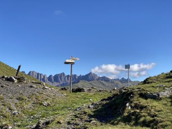
Signposts
Description
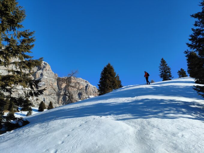
This simply amazing high altitude itinerary was born with the aim of combining history with natural beauty, in a unique combination of its kind. Long but not particularly demanding from a technical point of view, the trek develops around the massif of Cima Bocche, well known above all for the events related to the First World War. The uniqueness of this route is given by the all-round view that constantly follows the hikers, by the lunar landscape characterizing the so-called Lasté of the mountain range of Cima Bocche, by the historical vocation and by a particularly soft terrain, given the altitude.
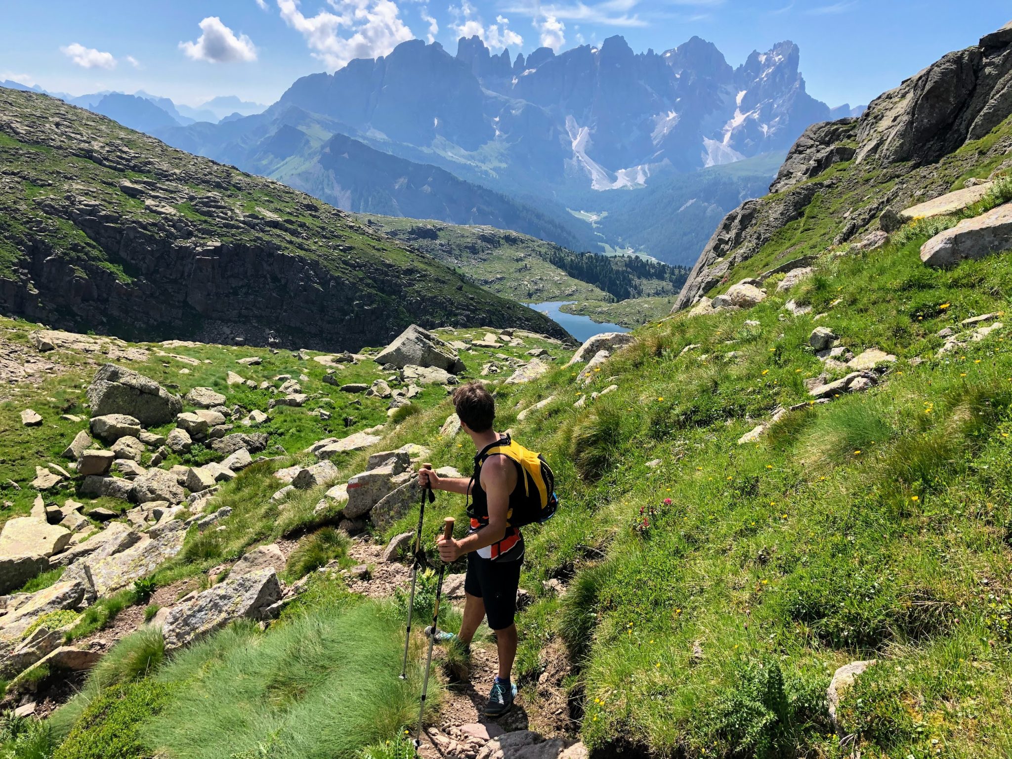
The trail starts in the upper valley of Travignolo, from the hut of Malga Valàzza (1,935 m asl), located near Passo Valles which, given its location, is an excellent starting point. From the hut, climb along the remarkable mule track of the Signpost No. 631 towards Lago di Juribrutto / Gereburt. After leaving the larch forest behind, the mule track begins to climb over the porphyritic bumps of the so-called Lasté of Juribrutto, opening up the sight on one of the most suggestive views of the Dolomites of Pale di San Martino, that was before hidden from the start by the western wall of Cima Valles. That amazing view will last throughout the whole itinerary. The mule track continues uphill, developing on small hairpin bends along the valley of the stream named Ruf de Pradàz, until it reaches a ridge where some remains of the Great War stands. From the ridge, instead of proceeding along the Signpost No. 631 (which leads to the lake of Juribrutto), the trail keeps the eastern side of the Lasté, on a small track leading towards the peak Cima Juribrutto. The small track, not always crystal clear to follow, continues immersed in a lunar environment with vast visibility. Passing through a series of Italian barracks, emplacements and trenches from the Great War, the path directly reaches the peak of Cima Juribrutto.
Located above the pass of San Pellegrino, Cima Juribrutto (2,691 m asl), or Gereburt, offers a 360 degree show on all the surrounding peaks and blocks of the Dolomites, including the Pale di San Martino, the Lagorai, the nearby Cima Bocche, Latemar, Catinaccio, Sassolungo, Sella Group, Marmolada, Tofane, Antelao, Pelmo and Civetta.
From the top of the mountain, the route continues downhill along the Signpost No. 695, which descends fairly close to the western wall of the massif towards the gap of Passo Juribrutto. From the gap, located at 2,384 meters of altitude, the trail starts climbing again towards Cima Bocche / Passo Lusia, along the Signpost No. 628, on a ramp that quickly leads to the top of the wall that leads to the peak of Cima Bocche. With once again the Pale di San Martino and the lake of Juribrutto behind, the panorama reopens completely as soon as you arrive on the plateau with its dense network of trenches preceding the top of the mountain. Just before reaching the summit, on the left you can see the Renato Jellici Bivouac (2,675 m asl). With its 2,745 meters of altitude and its iconic crucified Christ, Cima Bocche, or Cimón de Bóce, offers a spectacular panorama, quite similar to that of its twin brother Juribrutto.
From Cima Bocche, the itinerary faces another short downhill stretch on the Signpost No. 633, along impressive lines of Austrian trenches towards Forcella Bocche. With the arrival at the gap of Forcella Bocche, or Sforcèla de Bóce (2,543 m asl), you leave the territory of the Community of Primiero to enter the Fassa’ one. The section of the more technical route begins from the gap of Forcella Bocche: it is indeed possible to reach the Lusia Lakes by descending into the wide valley along the Signpost No. 633; however, the variant on the Grontón Equipped Path (Signpost No. 634A) is extremely fascinating. The path called Sentiero del Grontón, or Sentiero dei Kaiserjäger, was built by the Austrians during the Great War in order to connect the fortified ridge that, from the Forcella del Cajerin, connects the peak of Cima Grontón. The path was also built to prevent a possible Italian attack from Val dei Laghi (Lusia). To tackle the remarkable stretch of the Grontón path, which draws a flat overhanging line close to the Grontón ridge and leads a few meters from the lakes of Lusia (or Leèghes de Lujia), no ferrata equipment is really required; however, we do not recommend this part of the route to those who suffer from vertigo.
Once you have climbed over the mountain gap of Forcella di Lusia and reached the lake of Lusia (2,332 m asl), which lies on a pleasant flat pasture full of water in front of the Sandro Redolf Bivouac, the long way leading to the starting point begins.
Initially, the trail proceeds in a pleasant downhill stretch towards Malga Bocche, along the Signpost No. 621 which follows the course of the stream called Rif de Castagnèla, emissary of the lake of Lusia which flows towards Paneveggio. Once arrived at the pastures of the hut of Malga Bocche (1,945 m asl), with its famous window on the Pale di San Martino, just before reaching the hut, turn left, heading north, towards Malga Juribrutto / Malga Valàzza / Passo di Valles, on an ancient and wide mule track (Signpost No. 623) that crosses the coast, immersed in a forest made of larches and spruces.
Although very scenic and pleasant to walk, this last stretch on the mule track is particularly long (about 2 hours from Malga Bocche at a good pace); it also has some uphill stretches that leads up to the 2,130 meters of altitude of the location called Galleria Cortivi, for then passing through the one of Val Miniera (2,116 m asl), before resuming the descent and immersing again in the forest above Malga Juribrutto. Once the hut Malga Juribrutto is reached, in order to get back to the starting point, it will be sufficient to cover the very last short stretch uphill towards Malga Valàzza.
Paths
- From the hut of Malga Valazza (1,935 m asl), follow the Signpost No. 631 towards Lago di Juribrutto / Gereburt, until getting onto the ridge on the so called Lasté di Juribrutto [1h 00],
- Leave the Signpost No. 631 and continue the route on the small path that reaches peak of Cima Juribrutto [2h 00],
- From Cima Juribrutto (2,691 m asl), take the Signpost No. 695 downhill towards the mountain gap of Passo Juribrutto; from the gap, take the Signpost No. 628 (Sentiero della Pace, tr. Path of Peace) uphill towards Cima Bocche / Passo Lusia until the top of Cima Bocche [3h 40],
- From Cima Bocche (2,745 m asl), follow the Signpost No. 633 to the gap of Forcella Bocche,
- From the gap (2,543 m asl), take the Signpost No. 634A (Equipped Path of Grontón, Path of the Kaiserjäger), until reaching the gap of Forcella di Lusia and, straight after, the lake of Lusia [5h 15],
- From the lake (2,332 m asl), take the Signpost No. 621 to the hut of Malga Bocche [6h 30],
- From Malga Bocche (1,945 m asl), follow the mule track of the Signpost No. 623 towards Malga Valàzza / Passo Valles, until reaching Malga Valàzza, passing by the location of Val Miniera (2,116 m asl) [9h 00]. ✓
Waypoints


Suggested hikes

- Demanding
Forks at Treviso
Canali Valley,Mis Valley,Pala Group
- Duration: 03:45 hrs
- Length: 6.2 km
- Elev. gain: 1450 m

- Demanding
Val de Stua
Lower Primiero,Vette Feltrine Range
- Duration: 05:30 hrs
- Length: 12.1 km
- Elev. gain: 1450 m


- Demanding
- Best choice
Leslie Stephen
Canali Valley,Pala Group,Upper Primiero
- Duration: 12:00 hrs
- Length: 29.5 km
- Elev. gain: 1450 m